
Keystoned Steel // Field Guide
Wilmot Creek
The brief
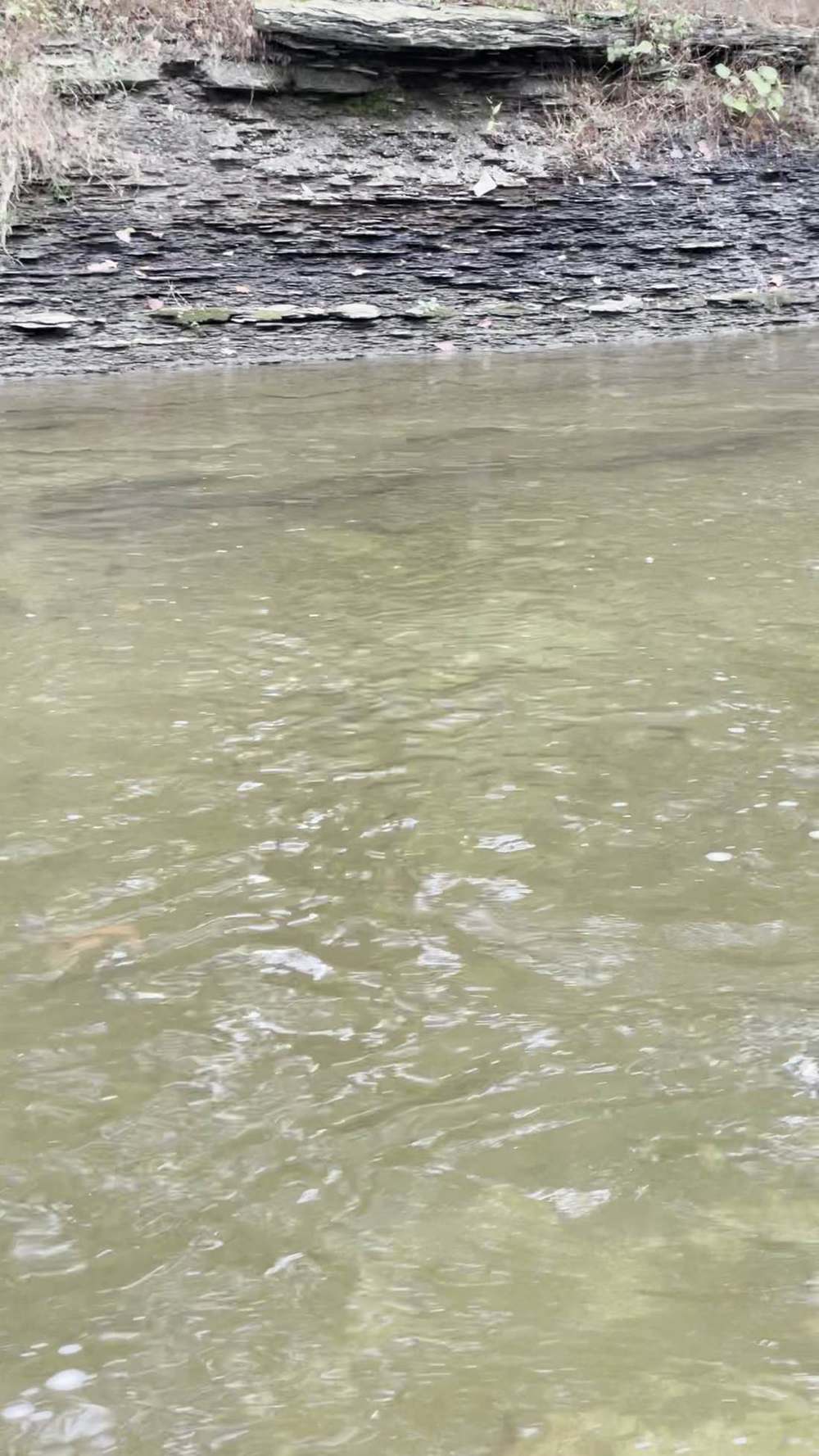
class="v-brief">What this guide covers: Wilmot Creek in Clarington (Newcastle), Durham Region, Fisheries Management Zone 17 — a small, spring-fed, famously private Lake Ontario tributary with two live Water Survey of Canada gauges, a wild-fish reputation out of all proportion to its size, and a name that carries the founding story of fish culture in Canada. Two facts decide every trip: the water is steady, and most of it is not yours to fish.
01 — Section
MOST OF THIS CREEK IS PRIVATE — READ §6 BEFORE YOU PLAN
02 — Section
ANYTHING
Wilmot Creek is famous among Ontario steelheaders as a largely private, posted creek. Most of its length runs through private land, and there is no conservation-area corridor running its length. The verified public water here is short and specific: the Samuel Wilmot Nature Area at the mouth and Thurne Parks Conservation Area north of Newcastle. Everything else is permission-only — in those words.
03 — Section
1. The idea in one paragraph
Wilmot Creek is the north shore's lesson in what springs do for a steelhead creek. While the rain of Nov 10–11 pushed neighbouring creeks up hard, Wilmot's two gauges barely moved — 0.60–0.66 m³/s over 24 hours at Newcastle is the steadiest hydrograph in this whole set of guides. That groundwater stability is why this small creek grows wild fish and why its landowners post it. The public fishery is short, and it fishes best the way the creek runs: low, clear, and quiet. Fish the verified public water, fish it gently, and leave the posted banks alone.
04 — Section
2. How to use this guide
1. Read the box above and §6 first — on Wilmot, access is the trip. 2. Read §3 — two live gauges and the spring-fed steadiness that defines this creek. 3. Read §4: no published go/wait band exists here; §4 prints this guide's method bands, built only from the
verified gauge record and labelled as method. 4. Fish it with §7 and §8, and read §9 first.
05 — The Water★ Intel
3. Live gauges — verified snapshot, Thu Nov 12, 2026
Two gauges, pulled from the federal hydrometric feed on the morning of Nov 12, 2026. All values provisional. Item
Value
---
---
Item
Value
Newcastle — WSC 02HD009
0.662 m³/s (23.4 cfs) at 5:55 AM EST, Nov 12, 2026 (level 3.525 m); past-24h 0.60–0.66 m³/s (21–23 cfs)
Leskard — WSC 02HD021
0.449 m³/s (15.9 cfs) at 5:35 AM EST, Nov 12, 2026 (level 1.16 m); past-24h 0.41–0.47 m³/s (14–17 cfs)
GRCA monitoring station — Wilmot Creek (3rd Concession, Clarington)
The Ganaraska Region Conservation Authority runs its own flood-forecasting station here, measuring water level, rainfall, and water temperature — a monitoring station, not a public discharge series
Clarity on the day
Clear — estimate from the flat, steady hydrograph at both gauges; not a visual reading
Call on the day
GOOD — steady, clear, classic Wilmot: the creek sat out a regional rain event almost without moving
Weather at the creek (Toronto — lakeshore station, weather.com, Nov 12, 2026): showers ending this morning, 45°F at dawn, high 46°F / low 35°F, wind NE 15–18 mph gusting 25. Sunrise 7:07 AM EST, sunset 4:55 PM EST. Regional context: rain on Nov 10–11 lifted creeks across the north shore — the Rouge, to the west, roughly doubled on it — while Wilmot held a 0.60–0.66 m³/s band at Newcastle and 0.41–0.47 at Leskard for a full day.
That is spring-fed baseflow at work. Gauge history: on Oct 27, 2026, Newcastle read 0.592 m³/s (20.9 cfs) and Leskard 0.384 m³/s (13.6 cfs).
Sixteen days and one regional rain later, the creek is up only modestly on both stations — Wilmot's fall operating range is narrow, low, and clear, and today sits inside it.
Sources for this snapshot: ECCC hydrometric real-time feed (api.weather.gc.ca), stations 02HD009 and 02HD021, queried Nov 12, 2026 ~6:15 AM EST. All values provisional. 1 m³/s = 35.3 cfs. GRCA Flood Forecasting & Warning page (grca.on.ca), checked Nov 12, 2026; weather.com, Toronto, Nov 12, 2026.
3A. Recent pushes / fresh runs
Hooked Ontario weekly report, Nov 9–15, 2026
tributary trout are rated conditional — legal extended-season reaches may produce when flows permit, and sanctuaries remain off-limits. The report carries no Wilmot-specific catch report, and this guide invents none.
The gauge story (Nov 10–12, 2026)
rain moved through Nov 10–11 and Wilmot answered with a shrug —
0.60–0.66 m³/s at Newcastle across the whole event, easing and clearing on the cold northeast wind behind it.
06 — The Water
4. Flow bands — go / wait / stay home
No published go/wait band exists for Wilmot Creek — not from the province, the GRCA, or a published shop guide. What follows is this guide's method, built only from the verified gauge record in §3, keyed to the Newcastle gauge (02HD009) — a way to read the gauge, not a promise about the fishing:
- Below ~0.55 m³/s (~19 cfs) — low and gin-clear. The creek at its spookiest: long leaders, small offerings, first and last light.
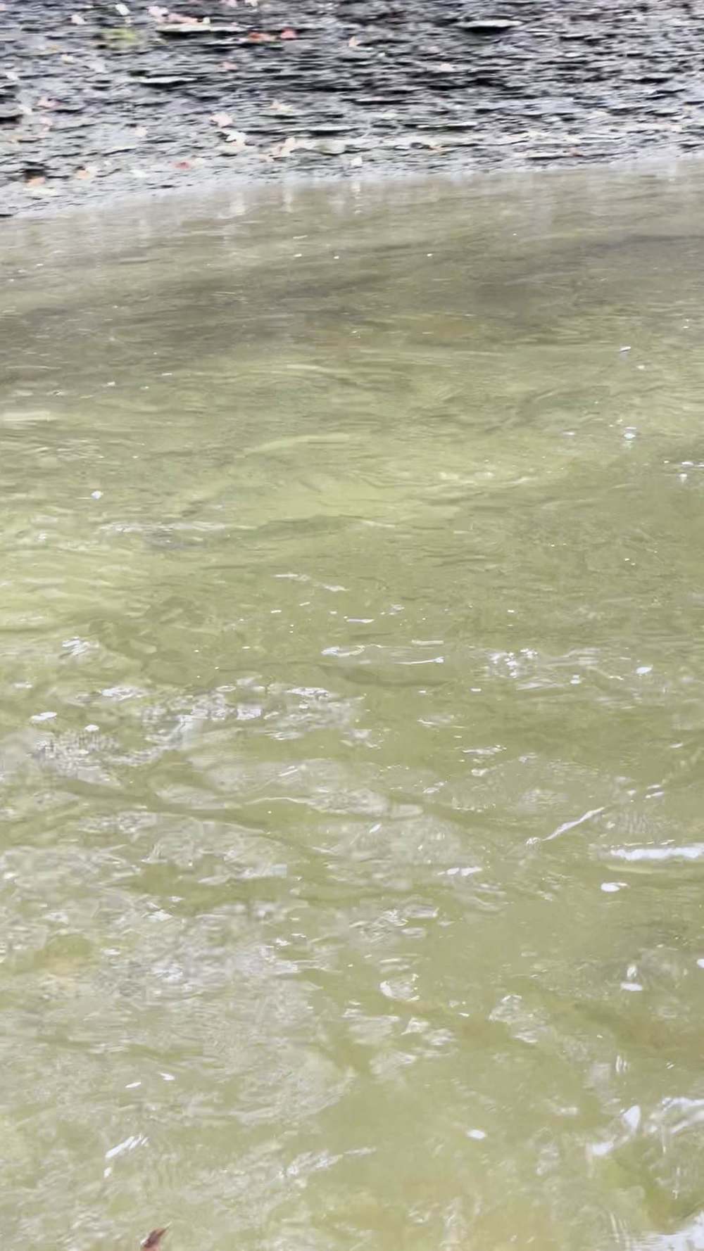
- ~0.55–0.75 m³/s (~19–26 cfs) — the Wilmot window. Both verified fall snapshots (0.592 on Oct 27; 0.662 today) sit in this band. Steady, clear, classic Wilmot — go.
- Above ~0.85 m³/s (~30 cfs) — wait. Well outside the verified fall record; a reading up there means the creek has finally answered a big rain, with colour to match. Wait for the falling side.
Leskard (02HD021) runs roughly two-thirds of the Newcastle figure in both snapshots — if it rises proportionally more, the lower creek follows.
07 — Section
5. The run, the fish, and the rules
The fishery: a small, cold, spring-fed creek with a wild-fish reputation — rainbow trout (steelhead) are the headline run, with Pacific salmon in the fall, brown trout in the mix, and an Atlantic salmon history older than the country fishing it (see Lore). Fish light, and handle wild fish like they matter — here they do.
Seasons — reach by reach (FMZ 17, Durham rules):
- Zone-wide (the baseline, and the rule above Highway 2): rainbow trout open 4th Saturday in
April–September 30, limit S-2, C-1. Above Highway 2 the creek is closed now, until April.
- Between the southerly limit of the CNR right-of-way and Lake Ontario — OPEN ALL YEAR for
Atlantic salmon, brown trout, Pacific salmon, and rainbow trout.
- Between Highway 2 and the CNR right-of-way — EXTENDED FALL SEASON to December 31 for those same species.
- There is no Wilmot-specific sanctuary in the FMZ 17 list. The creek's real restriction is not the season book — it is the land (see §6).
- At the mouth, FMZ 20 rules apply in the lake itself (rainbow and Pacific salmon open all year, rainbow S-2,
C-1) — FMZ 17 rules govern in the creek. Aggregate trout-plus-salmon: S-5, C-2 combined.
Licence (for US buyers): Ontario requires an Outdoors Card plus a fishing licence. The Outdoors Card costs $8.57 CAD plus 13% HST ($9.68 with tax), valid three calendar years. Non-Canadian resident fees (CAD, before HST): 1-day Sport $24.86 (the only licence not requiring an Outdoors Card), 8-day Sport $54.38, 8-day Conservation $31.52, 1-year Sport $83.19, 1-year Conservation $52.71. One-year licences expire December 31 of the licence year; Non-Canadian residents 18 and over need the card and licence — the Canadian-resident 65+ exemption does not apply to them, so non-Canadian residents 65 and over do need the card and licence — but a non-Canadian resident under 18 may fish without a card or licence when accompanied by a licence holder, with kept fish counting against that holder's limits (or may buy their own card and licence). Atlantic salmon are S-0/C-0 — catch and release only. FMZ 17 is in the Southern Bait Management Zone: live or dead baitfish or leeches may not be transported into or out of the zone. Buy online through Ontario's Fish and Wildlife Licensing Service. Sport (S) = full limits; Conservation (C) = reduced.
Verify in the current Ontario Fishing Regulations Summary before you fish — this summary is not the law.
08 — Access
6. Access, pool by pool — area-level only
Area-level only, from official sources — the short public list and the long private truth:
- Samuel Wilmot Nature Area — the mouth (Clarington). Clarington's waterfront page lists it at Toronto
Street at Lake Ontario, Newcastle: 77 hectares with trails, viewing platforms, and two parking areas — at the south end of Cobbledick Road and of Toronto Street. The Great Lakes Waterfront Trail's Clarington page describes the same ground as a great place for fishing and hiking, with trails reaching the shoreline, marsh, and creek. This is the public anchor: the all-year CNR-to-lake reach at the mouth.
- Thurne Parks Conservation Area — the upstream public parcel (GRCA). GRCA's conservation areas page: 18.5 hectares (45.7 acres) north of Newcastle, purchased in 1976, protecting trout spawning habitat, with a one-kilometre section of Wilmot Creek running through it. Fishing is permitted under
FMZ 17. Note GRCA's rule: gates closed mid-October to May, hours dawn to dusk. GRCA conservation areas are free of charge. This is zone-wide-season water — spring water, not a November answer.
- Bond Head Park — a correction, printed plainly. Newcastle's Bond Head Park is a real Clarington lakefront park, but Clarington's own waterfront page places its boat launch on Graham Creek, not Wilmot Creek. It is not Wilmot access.
- Everything else — permission-only. The rest of Wilmot Creek runs through private land. Road crossings are views, not access. To fish private Wilmot water, knock on a door and ask — and take no as gracefully as yes. A fishing licence is not a permit to trespass.
09 — Tactics
7. Flies, tactics, and seasonal playbook
Tackle Small-water gear: a 9–10 ft float rod in a light line rating, or a 6–7 weight fly rod for the open water at the mouth. Wilmot is a presentation problem, not a big-river fight: light leaders, small floats, and shot you can count.
Flies and baits Small and natural: single egg patterns and small soft beads in pale colours, modest roe bags in clear-water netting, and stonefly and caddis nymphs. In gin-clear water, the oversized, bright end of the tackle shop is a liability — downsizing is not a refinement here, it is the method.
How to fish it Slowly, and from downstream. Wilmot fish live in a clear aquarium and watch you arrive. Approach low, keep your shadow off the pool, and make the first drift count. Fish the nature-area water at the mouth when lake fish are staging; fish runs and undercut banks, not just the obvious pools; rest water you have pricked a fish in.
Seasonal playbook
Fall (Sep–Nov)
Pacific salmon early, steelhead behind them; CNR-to-lake open all year, Highway 2–CNR to Dec 31 — but most of that bank is private (§6).
Winter (Dec–Feb)
extended-season lower reaches only, where you have lawful access; spring-fed flow keeps Wilmot open when flashier creeks lock up.
Spring (Apr–May)
the zone-wide opener (4th Saturday in April) brings the whole creek into season, including Thurne Parks — the classic spring steelhead window.
Summer (Jun–Aug)
cold baseflow; the mouth reach stays open, but the migratory game is done until fall.
10 — Section
8. Techniques in depth — fishing Wilmot Creek
The primary rig: a small-water stealth float The Wilmot float rig is a standard trib float rig stripped to its essentials: a small, light float; shot staggered fine and light so the bait leads and ticks only occasionally; a long, light leader — longer and lighter than your Lake Ontario default — because in 0.66 m³/s of gin-clear water the fish can inspect everything you own. Set the depth for the lower third of the water column: drifts here are measured in metres. If the float drags, you are fishing above the fish; if it hangs, you are fishing the rocks. Watch for the shadow that moves before the float does.
Bait selection by clarity
In the normal gin-clear state, fish the smallest end of the box — a single pale soft bead, a small single-egg pattern, a thumbnail roe bag in pale netting. After the rare rise that actually colours Wilmot (§4's wait band), you have a day or less to fish one size up and one shade brighter before the springs clear it again.
Forage notes — Wilmot Creek in mid-November Wilmot is the north shore's spring-fed exception: while the rain of November 10–11 pushed neighbouring creeks up hard, its two gauges barely moved — 0.60–0.66 m³/s over 24 hours at Newcastle — and that groundwater stability is why this small, gin-clear creek grows wild fish. Its fall Pacific salmon egg pulse is spent by mid-November; egg presentations still lead, at the smallest end of the box, for the wild rainbows that headline the run. Fish these notes only on the verified public water — the Samuel Wilmot Nature Area at the mouth and Thurne Parks Conservation Area; most of this creek is private and posted (§6). Shiners are a mouth food only, holding deep off the lake; sculpins and stoneflies are the creek's resident forage, and crayfish are tucked and inactive — the springs keep the water cold and the calendar slow.
| Lead — eggs (roe) | roe bags, beads (6–10 mm) and single eggs, sized to clarity — in the normal gin-clear state, a single pale soft bead, a small single-egg pattern, or a thumbnail bag in pale netting; one size up and one shade brighter only for the day or less after the rare rise that actually colours Wilmot (§8). |
| Secondary — sculpins and stoneflies | a small sculpin pattern or stonefly nymph, fished gently in the public pools — behind eggs. |
| Mouth only — shiners | at the mouth in the nature area, a live shiner on a bobber is a standing go-to, where the zone rules allow live bait. |
Where they hold, by level At low water, fish contract to the deeper pools at the mouth reach and any slot with overhead cover; the runs between fish only at the edges of light. In the Wilmot window (0.55–0.75 m³/s), they spread: pool heads, tailouts, and soft water behind modest structure all hold fish, and walking the public water beats camping on one pool. Above the band, they slide to the banks and bend insides — but the public water is short, so high-water Wilmot is a waiting game.
The secondary method Fly fishing — a single nymph under a small indicator, or a small streamer swung through the mouth-reach runs — is the secondary method, and on bright, clear days over spooky fish it beats the float outright: no float shadow, no shot splash, one quiet presentation.
Seasonal adjustment Winter on Wilmot is a clarity adjustment, not a flow adjustment — the springs hold the flow while the air does its worst. Go smaller again: the tiniest beads and bags, the slowest drifts, midday fishing. Fall spots at fall speed in January are fishing over fish that spooked in November.
11 — Section
9. Safety
The banks are steep, fenced, and slippery. The Nov 12 picture — a NE wind gusting 25 off the lake, temperatures falling toward 35°F — is a hypothermia setup for a wet angler at the mouth: dress for a dunk, not for the forecast high. And confrontations over posted land are the most common way a Wilmot trip goes wrong: if you are not certain you may be there, be somewhere else.
12 — Section
10. What is inside the living edition
Same promise as every Keystoned Steel guide:
- Live Water Survey of Canada gauges at Wilmot Creek near Newcastle (02HD009) and near Leskard (02HD021), plus the GRCA station at the 3rd Concession, Clarington — real readings, stamped with the time the gauge took them; where a gauge is not reporting, the guide says so plainly instead of faking a number.
- Live weather & radar built right into the guide.
- Verified access where it exists — and where access is private, fee-based, or permission-only, the guide says so plainly instead of faking a parking lot.
- Flow windows — the method bands that say go, wait, or stay home, printed with their sources.
- Buy once — updates to the guides you bought are free. A living edition that stays current all season.
Sources (Nov 12, 2026 build)
- ECCC hydrometric real-time feed (api.weather.gc.ca), queried Nov 12, 2026 ~6:15 AM EST (all values provisional): station 02HD009 (near Newcastle) — 0.662 m³/s (23.4 cfs) at 5:55 AM EST, level 3.525 m, past-24h 0.60–0.66 m³/s, Oct 27, 2026: 0.592 m³/s (20.9 cfs); station 02HD021 (near Leskard) — 0.449 m³/s (15.9 cfs) at 5:35 AM EST, level 1.16 m, past-24h 0.41–0.47 m³/s, Oct 27, 2026: 0.384 m³/s (13.6 cfs).
- GRCA, Flood Forecasting & Warning page (grca.on.ca), checked Nov 12, 2026: Wilmot Creek station, 3rd
Concession, Clarington (level, rainfall, temperature).
- GRCA, Conservation Areas page (grca.on.ca), checked Nov 12, 2026: Thurne Parks — 18.5 ha, purchased
1976, one-kilometre section of Wilmot Creek, trout spawning habitat, fishing permitted under FMZ 17; gates closed mid-October to May.
- Municipality of Clarington, Waterfront and Boat Launches (clarington.net), and Great Lakes Waterfront
Trail, Clarington page (waterfronttrail.org), checked Nov 12, 2026: Samuel Wilmot Nature Area — 77 ha, two parking areas, trails to the creek, fishing; Bond Head Park boat launch on Graham Creek.
- Ontario Fishing Regulations Summary, FMZ 17 (ontario.ca), verified Nov 12, 2026: seasons and limits as in
§5; no Wilmot-specific sanctuary listed.
- Ontario licensing fees, verified Nov 12, 2026: Outdoors Card $8.57 CAD + HST; non-resident fees as in §5 (CAD, before HST except as noted).
- Hooked Ontario, Weekly Fishing Report, Nov 9–15, 2026 (hookedontario.ca): tributary trout conditional.
- Ontario Heritage Trust, "The Newcastle Fish Hatchery 1868" plaque (heritagetrust.on.ca), and Dictionary of
Canadian Biography, "Wilmot, Samuel" (biographi.ca), checked Nov 12, 2026: experiments 1866; enlarged 1868 into Ontario's first full-scale hatchery; peak 1876 (1,500,000 eggs); overseer 1868; Superintendent of Fish Culture 1876–1895; hatchery closed 1914.
- Samuel Wilmot Nature Area materials (South Shore Joint Initiative newsletter, Dec 2024): Wilmot Creek named after Samuel Wilmot's father.
- Weather: weather.com, Toronto, Nov 12, 2026 (45°F at dawn, high 46°F, low 35°F, wind NE 15–18 gusting
25; sunrise 7:07 AM, sunset 4:55 PM EST).
Lore, Legends & History
Most creeks are named for a place or a mill. Wilmot Creek is named for a family — and the son made the name mean something far beyond this little valley.
Local tradition, carried in the nature-area histories at the creek's mouth, holds that Wilmot Creek took its name from Robert Wilmot — and the documented record is clear about the son. Samuel Wilmot (born 1822) took over the family farm in 1856 — a farm on Wilmot Creek, in the Dictionary of Canadian Biography's words, "a noted spawning stream for Lake Ontario salmon." By the 1850s those runs were collapsing, here and on every salmon stream on the lake. Wilmot's answer was not a petition. It was a cellar, some spring water, and stubbornness. He hatched salmon eggs in spring water in his cellar in 1865 and 1866, and in 1866 built an experimental hatchery on the creek, succeeding that year in hatching the spawn from four salmon. Four fish. From those four fish came, arguably, the modern idea that a fishery could be rebuilt by hand.
The Dominion of Canada was one year old, and it noticed. The federal government contributed to his expenses in 1867, and on July 1, 1868, Wilmot was appointed a fishery overseer responsible for the Newcastle hatchery — enlarged, in the Ontario Heritage Trust's plaque words, into "Ontario's first full scale fish hatchery, one of the earliest in North America." At peak production in 1876, it hatched 1,500,000 eggs in a year. That same year Wilmot became Canada's first Superintendent of Fish Culture, a post he held until 1895.
It did not save the lake's Atlantic salmon — they were gone from Lake Ontario by the end of the century despite everything Newcastle could hatch, and the hatchery worked on with other species until it closed in 1914. But the pattern Wilmot set — collect the eggs, hatch them by the million, plant the fry, repeat — became the pattern for fish culture on a continent. And the creek? It outlasted the fame. The salmon in it today are Pacific fish and wild rainbows, not the Atlantics Wilmot raised, and the valley filled up with the big private parcels that make modern Wilmot a posted, permission-only creek. There is a fitting symmetry in it: the man who taught Canada that fish could be brought back by hand has his name on a creek that now protects its wild fish the older way — by being hard to get to.
The 77 hectares at the mouth carry his name too, as the Samuel Wilmot Nature Area. Stand there at dawn, in the short public reach, and you are fishing the most historically loaded few hundred metres of creek bank on the north shore.
Night fishing — working the holes after dark First, the law on this water. Ontario night fishing runs under the OMNRF zone rules for this water plus any sanctuary and park or conservation-area hours this guide lists — several creek-mouth sanctuaries and park accesses on this shore close seasonally or keep day-use hours. Where this guide lists a closure or an access schedule, it governs: be out of closed water and out of the access on time, and fish the tactics below only where the night is open. Note the access limit §6 states: Thurne Parks CA is dawn-to-dusk and its gates are closed mid-October to May, and that water is zone-season closed in November in any case — the night water in this guide is the mouth nature area, within its own posted hours.
After dark, the run changes address on Wilmot Creek, ON. Steelhead that held in the riffles and pocket water by day slide into the deepest holes in the reach — the slow, dark water at the head of the pool, along the undercut and the shale ledge, and the tail where the pool shallows into the next riffle — and they feed there with a confidence they never show at noon. On a small creek the night fishery is a handful of holes; learn which ones they are.
Working a hole in the dark is a memory exercise before it is a fishing exercise. Fish the hole in daylight first: learn where it deepens, where the wood and the ledges sit, where you will stand, and where a hooked fish can be landed. At night, work it top to bottom in short steps — a cast or two across the head, down the seam, into the tail — slow, deep and close to the bottom, with long pauses; a steelhead at night does not chase, it intercepts.
Two profiles speak at night: glow — a glow bead, glow egg or chartreuse presentation where a little light helps the fish find it — and dark — a black or black-olive streamer or nymph silhouetted against the night sky. The dark profile works because it reads to a night-feeding fish as a bottom forage fish on the move — big, slow, and tight to the substrate. Light discipline is not optional: a headlamp shone into a hole ends the fishing in it — keep the light on the bank and on your feet, red or dim when you have it, and rest a lit-up hole before fishing it again.
Sound carries the same way. Safety doubles after dark: never wade at night water you have not waded by day, belt cinched and staff in hand, tell someone the reach and the return time — a fall in cold water at night is a survival event, not a soaking. Tonight's night pick — kept live with this guide's bait rotation. The rotation updates the night pick for this water on the same cycle as the day picks, off the forage calendar and the current clarity and flow.
Current-season default: a glow roe bag under a float at the head of the hole; dark second, a black streamer swung at a crawl along the seam.
13 — Posted & Access
Posted Land & Access Trails
Wilmot Creek is the shortest public list in this Ontario pack, and the chapter does not pad it: two verified public doors — a municipal nature area at the mouth and one conservation area north of Newcastle — on a creek whose remaining banks are private parcels, road crossings, and permission water. The conservation authority here is the Ganaraska Region Conservation Authority (GRCA): Wilmot Creek was added to the authority's responsibility in 1962 and its watershed is the western boundary of the GRCA's 935-square-kilometre jurisdiction, running "from Wilmot Creek in Clarington to east of Cobourg" (GRCA, Our History). There is no conservation-area corridor running this creek's length, no easement chain, and no bank-walking right to fall back on — Ontario law gives the angler the named doors below and the occupier's permission everywhere else. Fish the two doors, in the seasons printed below, and treat every other bank as someone else's. Checked November 2026.
The public water — access areas & easements
Mouth to upstream:
Samuel Wilmot Nature Area — the mouth, Newcastle (Municipality of Clarington)
Clarington's Waterfront and Boat Launches page lists the area at "Toronto Street at Lake Ontario, Newcastle": a 77-hectare nature area with trails, viewing platforms, interpretive signs and two parking areas — the west parking lot at the south end of Cobbledick Road, the east parking lot, closer to the lake, at the south end of Toronto Street. The creek reaches Lake Ontario through this ground, and the Great Lakes Waterfront Trail's Clarington page describes the same 77 hectares as Wilmot Creek and "a great place to go birding, fishing and hiking," managed by a committee of volunteers. Clarington's own waterfront page is silent on fishing and on any fee or hours for this site — it names the trails, platforms and parking only — so the fishing attribution rests on the Waterfront Trail page, and any fee or hours are the municipality's to state, not this chapter's. This is the public anchor for the all-year CNR-to-lake reach at the mouth (see Seasonal).
Thurne Parks Conservation Area — north of Newcastle (Ganaraska Region Conservation Authority)
The GRCA's Conservation Areas page: 18.5 hectares (45.7 acres), located north of Newcastle, purchased in 1976, protecting the flood-prone valley lands and preserving trout spawning habitat, with a one-kilometre section of Wilmot Creek running through it (Hunter/Stalker Creek joins the main branch inside the area). The GRCA states the area is used for passive recreation including fishing and views of Wilmot Creek, and that "Fishing is permitted and regulated through the Province of Ontario, which includes the possession of a valid fishing license and respecting provincial catch limits. Anglers must follow provincial fishing practices for Zone 17." GRCA conservation areas generally are available for passive recreation free of charge, with hours from dawn until dusk and gates closed from mid-October to May due to no winter maintenance; no camping or open flame is permitted at any GRCA property (GRCA, Conservation Areas). This is zone-wide-season water — spring and summer water under the staircase below, not an extended-fall door.
Above the run — nothing else verified. No other official source opened for this build names a public fishing access on Wilmot Creek — not the municipality, not the GRCA, not the province. The Orono Crown Lands, through which the creek runs in its upper valley, could not be verified as a fishing access from an official source in this build and is therefore not a stop above; see Posted & private and the Verification log. Treat every bank not named in stops 1–2 as private until a sign or a listing says otherwise.
Posted & private — stay out
Ontario access law — the spine
Ontario has NO purchased-easement chain like New York's PFR and NO statutory bank-walking right like Michigan's MCL 324.73102(3). The public doors are conservation-authority lands, municipal parks, and Crown beds — everything else is permission water. The Fish and Wildlife Conservation Act, 1997 prohibits fishing in contravention of the Trespass to Property Act: fishing on private property requires the occupier's permission (OFAH "Ask a CO," answered by MNRF's Provincial Enforcement Specialist: "generally a person can only fish or hunt on private property with permission from an occupier of that property").
The bed decides, reach by reach
Streambed ownership varies reach by reach on the same river — in the MNRF answer's words, it "can vary significantly, both across the province and even within different stretches of an individual river or stream," and bed ownership may differ from the ownership of the banks beside it. If the bed is Crown, an angler may walk/wade the watercourse regardless of who owns the banks; if the bed is privately owned, wading needs the occupier's permission. Floating on navigable water is a navigation right; stepping onto a private bed is not. The Beds of Navigable Waters Act presumes the bed of a navigable water did NOT pass with a Crown grant absent an express grant — but pre-1911 and express grants can make beds private, so no reach's bed status can be asserted without checking; the MNRF district office is the arbiter, and MNRF directs bed-ownership questions there. No reach of Wilmot Creek's bed ownership was verified for this build, and this chapter asserts Crown-bed wading rights for no reach of this creek. [Bed ownership by reach: UNVERIFIED — see Verification log.]
A licence is not a trespass permit
parking, bank use, and trails are the land manager's rules.
Bond Head Park is not Wilmot access
Bond Head Park, 5 Mill Street South, Newcastle, is a real Clarington lakefront park — but Clarington's own waterfront page places its boat launch "on the Graham Creek just north of the lake," with a small parking area with five trailer spots. It is a Graham Creek door. Do not carry it onto Wilmot Creek.
The Port of Newcastle Marina launch is private
Clarington's waterfront page lists it plainly: "There is a private boat launch at Port of Newcastle Marina." Private ground, named so no one mistakes the marina for a public door.
Orono Crown Lands — a gap, stated as a gap
Wilmot Creek runs through the Orono Crown Lands in the upper valley, and secondary trail sources describe the property — but they conflict on the one fact that matters here (fishing listed among activities in some, "fishing is not permitted here" in another), and no official source naming it as a Wilmot Creek fishing access was opened for this build. It is not printed as a public door. Confirm its fishing status with the land manager before treating any of its creek frontage as fishable.
Everything not named above is permission water
Most of this creek runs through private land. Road crossings are views, not access. To fish private Wilmot water, knock on a door and ask — and take no as gracefully as yes.
Seasonal & changing access
The regulation staircase (FMZ 17, 2026 Ontario Fishing Regulations Summary, ontario.ca). Both the zone-wide baseline and the two Durham additional-opportunity reaches apply to Wilmot Creek. Zone-wide: rainbow trout season fourth Saturday in April to September 30, S-2/C-1; brown trout S-5/C-2; Pacific salmon S-5/C-2; Atlantic salmon S-0/C-0; aggregate trout+salmon S-5/C-2.
Open ALL YEAR: all waters in the Regional Municipality of Durham lying between the southerly limit of the CNR right-of-way and Lake Ontario — for Atlantic salmon, brown trout, Pacific salmon and rainbow trout, zone-wide limits apply. The blanket Durham rule carries Wilmot's lowest reach; Wilmot is not named individually. This is the Samuel Wilmot Nature Area water at the mouth (stop 1).
EXTENDED FALL (fourth Saturday in April to December 31): Durham Region — all waters between Highway 2 and the southerly limit of the CNR right-of-way, same four species, zone-wide limits. Most of this reach's banks are private (see Posted & private) — an open season is not an access right.
Above Highway 2 the creek is zone-wide-season water only — fourth Saturday in April to September 30 for the trout and salmon above. Thurne Parks Conservation Area (stop 2) sits in this water, and the GRCA's own gate season (closed mid-October to May) closes the parcel for much of the closed season in any case.
Sanctuaries: none listed for Wilmot Creek — a checked fact. No Wilmot Creek entry appears in the FMZ 17 fish-sanctuary lists on the FMZ 17 page read for this build (closed-all-year, January–May/November–December, and September 1–October 14 lists all read in full). The creek's real restriction is not the season book — it is the land.
Licence. A Pennsylvania resident is a "non-Canadian resident" in Ontario law. 18+ needs an Outdoors Card ($8.57, valid 3 calendar years) PLUS a fishing licence — 2026 fees (ontario.ca, +13% HST): 1-year Sport $83.19, 8-day Sport $54.38, 1-day Sport $24.86 (the 1-day needs NO Outdoors Card), 1-year Conservation $52.71, 8-day Conservation $31.52. Licences run on the calendar year (expire Dec 31). Under-18 non-Canadian residents may fish under a licensed adult's limits. Carry the Outdoors Card + Licence Summary (the official PDF on a phone is valid; a screenshot is not). FMZ 17 is in the Southern Bait Management Zone: live or dead baitfish or leeches may not be transported into or out of the zone.
Report changes. Conservation-area gates, municipal park terms and sanctuary lists change on agency schedules, not fishing seasons. If a sign, gate or closure on the ground disagrees with this chapter, the sign and the current Ontario Fishing Regulations Summary govern — and tell us, so the living edition can be corrected.
Sources for this section: Ontario Fishing Regulations Summary, Fisheries Management Zone 17 (ontario.ca) — zone-wide seasons and limits; additional fishing opportunities (Durham CNR-to-lake open all year; Durham Highway 2-to-CNR extended fall to December 31); fish sanctuary lists read in full, no Wilmot Creek entry; Southern Bait Management Zone note. Ganaraska Region Conservation Authority, Our History (grca.on.ca) — GRCA jurisdiction from Wilmot Creek in Clarington, 935 km², Wilmot Creek added 1962; Conservation Areas (grca.on.ca) — Thurne Parks Conservation Area (18.5 ha, purchased 1976, one-kilometre section of Wilmot Creek, fishing permitted, Zone 17), and GRCA-wide terms (free of charge, dawn until dusk, gates closed mid-October to May, no camping or open flame). Municipality of Clarington, Waterfront and Boat Launches (clarington.net) — Samuel Wilmot Nature Area (Toronto Street at Lake Ontario, 77 ha, trails, viewing platforms, two parking areas at Cobbledick Road and Toronto Street); Bond Head Park boat launch on Graham Creek; Port of Newcastle Marina private launch; Fishing page (clarington.net) — Clarington tributaries including Wilmot Creek, Zone 17. Great Lakes Waterfront Trail, Clarington (waterfronttrail.org) — Samuel Wilmot Nature Area, 77 hectares, Wilmot Creek, fishing. OFAH, "Ask a CO: are public waterbodies with private access restricted for use?" (ofah.org), answers by David Critchlow, Provincial Enforcement Specialist, MNRF — Fish and Wildlife Conservation Act / Trespass to Property Act permission rule; bed ownership varies by stretch; Crown bed vs. private bed; MNRF district office. Beds of Navigable Waters Act, R.S.O. 1990, c. B.4, s. 1 (ontario.ca). Ontario licence fees and Outdoors Card terms per the verified Nov 18, 2026 licence spine (ontario.ca). Checked November 2026.
The Bottom Line
Wilmot Creek is the north shore's lesson in what springs do for a steelhead creek. While the rain of Nov 10–11 pushed neighbouring creeks up hard, Wilmot's two gauges barely moved — 0.60–0.66 m³/s over 24 hours at Newcastle is the steadiest hydrograph in this…
Legal · Read last
LEGAL DISCLOSURE — Keystoned Steel Guides
What Keystoned Steel warrants. Keystoned Steel warrants only that, as of the edition date stated in this guide, the access, gauge, and regulation information in this guide that is attributed to a cited official source accurately reflects that source as published on that date. If a material error in that information is confirmed, Keystoned Steel will issue a corrected edition to the original buyer at no charge or, if it does not do so within 30 days after confirming the error, refund the price you paid. That is the sole express warranty provided with this guide.
This guide does not warrant or guarantee:
- (a) Stream conditions, water levels, clarity, or weather — conditions change daily and can change after any
reading printed here;
- (b) Fishing success — no representation is made that fish are present, in any number, size, or location, at any
time;
- (c) Access — access status, parking, and public access rights can change, be posted, or be withdrawn at any
time; inclusion of a reach in this guide is not permission to fish it, and is not a representation that access is currently open;
- (d) Third-party data — Gauge readings, including Water Survey of Canada / Environment and Climate Change
Canada data, agency publications, and maps, originate from third-party sources. Keystoned Steel does not control those sources and cannot guarantee their accuracy, completeness, availability, or continued accessibility.
Third-party information may be provisional, delayed, revised, or incorrect. Its inclusion does not constitute an independent guarantee by Keystoned Steel of the underlying data;
- (e) Regulations — seasons, creel and size limits, and special-reach rules change; the regulations summarized
here are a convenience summary only and are not the law.
Your responsibilities. Before you fish: confirm the current regulations in the current Ontario Fishing Regulations Summary (Ontario Ministry of Natural Resources); hold the required licence — in Ontario an Outdoors Card plus a valid fishing licence; verify access is open and lawful for the reach you fish; respect
posted signs and private land — a fishing licence is not a permit to trespass. Wading and stream fishing involve inherent risks, including fast or rising water, slippery rock, and remote terrain; you fish at your own risk and are responsible for your own safety decisions. This safety warning and assumption of risk do not waive or limit any liability, warranty, or remedy that cannot lawfully be waived or limited under applicable law.
Corrections and refunds. If you believe this guide contains a material error, email keystonedsteel@gmail.com or message our Facebook Page with the guide name and the error. Keystoned Steel will review it against the cited sources within 30 days. If the error is confirmed, you will receive a corrected edition or, at Keystoned Steel's election, a refund of the price you paid. That remedy is your sole and exclusive remedy for errors in this guide. Limitation of liability. TO THE FULLEST EXTENT PERMITTED BY APPLICABLE LAW, KEYSTONED STEEL'S TOTAL LIABILITY ARISING OUT OF THIS GUIDE WILL NOT EXCEED THE PRICE YOU PAID FOR IT, AND KEYSTONED STEEL WILL NOT BE LIABLE FOR INDIRECT, INCIDENTAL, OR CONSEQUENTIAL DAMAGES, INCLUDING TRIP COSTS, CITATIONS OR FINES, OR PERSONAL INJURY ARISING FROM YOUR USE OF THIS GUIDE. NOTHING HERE LIMITS LIABILITY FOR GROSS NEGLIGENCE OR WILLFUL MISCONDUCT. License. This guide is licensed to the original buyer for personal use only. It is nontransferable and may not be shared, resold, or redistributed without the prior written consent of Keystoned Steel. Living-edition updates are delivered only to the original buyer's purchase email.
TO THE FULLEST EXTENT PERMITTED BY APPLICABLE LAW, THE WARRANTY SET FORTH ABOVE IS THE SOLE EXPRESS WARRANTY PROVIDED BY KEYSTONED STEEL FOR THIS GUIDE, AND KEYSTONED STEEL DISCLAIMS ALL OTHER WARRANTIES, EXPRESS OR IMPLIED, INCLUDING ANY IMPLIED WARRANTY OF MERCHANTABILITY AND ANY IMPLIED WARRANTY OF FITNESS FOR A PARTICULAR PURPOSE. NOTHING IN THIS DISCLOSURE SHALL EXCLUDE OR LIMIT ANY WARRANTY, RIGHT, OR REMEDY THAT CANNOT LAWFULLY BE EXCLUDED OR LIMITED UNDER APPLICABLE LAW.