
Keystoned Steel // Field Guide
Silver Creek
GAUGE — USGS 04213394
The brief
class="v-brief">Read the gauge note first: Silver Creek has a USGS gauge (04213394, at US Route 20), and it is reporting.
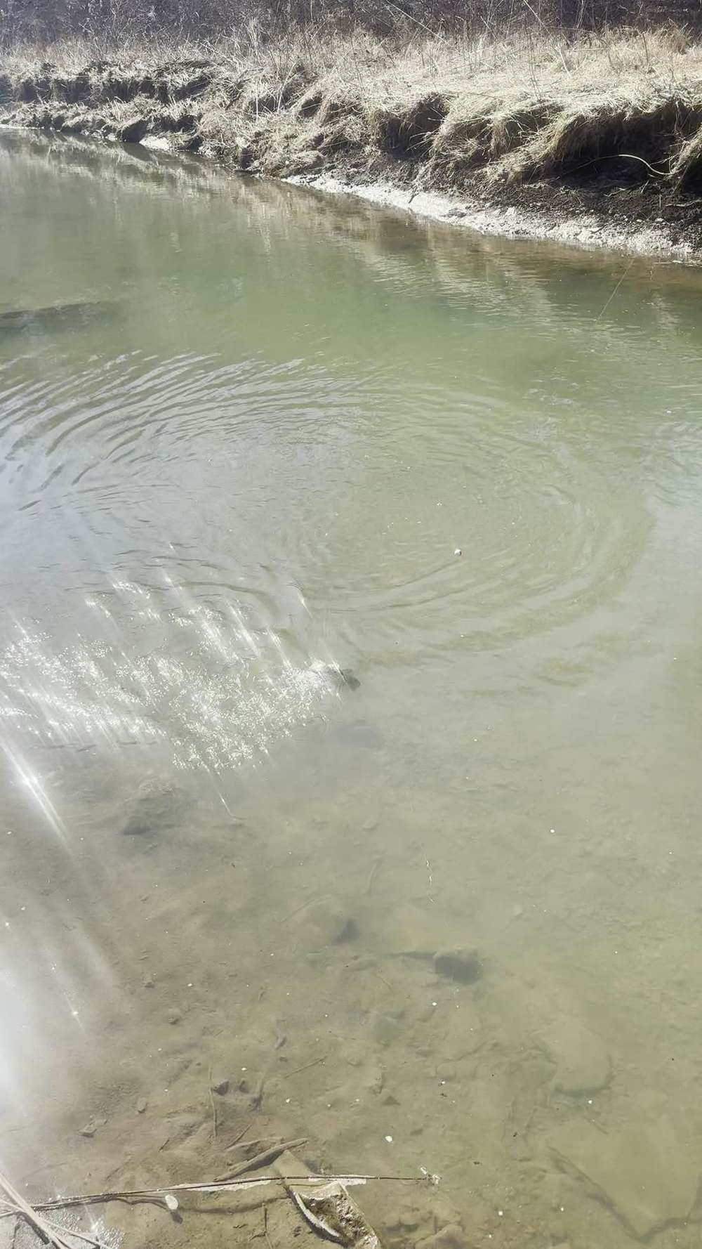
The current verified reading is 3.70 cfs at 12:00 PM EST on Sun Nov 8, 2026 (provisional), gage height 3.77 ft — from the USGS NWIS Instantaneous Values API, queried live at 12:31 PM EST on Nov 8 (the gauge has reported continuously, Oct 29 through Nov 8). Read that plainly: the creek is at a trickle today — too low. An early reading of the USGS webpage suggested no Nov 8 reading could be found and that the gauge might be down — that came from a stale webpage copy, not from the gauge itself. That is the Keystoned rule: nothing stale dressed up as live. What this guide covers: Silver Creek in Chautauqua County, NY — a small Lake Erie tributary steelhead stream, from its mouth in the Village of Silver Creek upstream to the falls near the Hanover Road and King Road intersection, about 7.3 miles of steelhead water. Its major tributary, Walnut Creek, joins near the mouth and is covered briefly in §6 because anglers fish the two together.
01 — Section
1. The idea in one paragraph
Silver Creek is the small-water answer to the Cat. It drains just 23–25 square miles, runs 12.2 mapped river miles, and fishes like a creek half its size: it rises fast after rain, drops fast after it stops, and when the big creeks are muddy, Silver Creek is typically less stained. That is its whole appeal — a short morning session on a creek you can read at a glance, with steelhead that run the same October-to-April season as the rest of Steelhead Alley. The catch is access: NYSDEC lists no Public Fishing Rights on Silver Creek at all. The whole 7.3-mile steelhead reach is "need owner permission." This guide is built around that one fact: Silver Creek is a permission creek on a hair-trigger hydrograph — get the permission, then hit it on the drop, because the window is short.
02 — Section
2. How to use this guide
1. Check the gauge. §3 gives the gauge and its current verified reading — 3.70 cfs at 12:00 PM EST on Nov
8, 2026 (provisional). In the living edition, the gauge cell is live at page load. 2. Use the regional gauges as your backup context. The nearest live water is Cattaraugus Creek at
Gowanda (160 cfs, steady, clear on Nov 8) plus Canadaway Creek (15 cfs) and Chautauqua Creek (20 cfs).
They tell you what the region is doing; Silver Creek's own gauge (§3) tells you what Silver Creek is doing. 3. Do not fish a flow band this guide does not have. No published flow band exists for Silver Creek. §4
explains what is known qualitatively (rises fast, drops fast, fish the drop) — and prints no band. Do not treat a guessed number as a Keystoned band. 4. Sort out permission before you drive. There is no PFR on this creek. Every reach outside the village land
needs the landowner's say-so. See §5 and §6. 5. Fish it short and fast. This is a small creek for short sessions — a morning, not a day. The fish are in the
lower creek and the pools; the falls near Hanover and King Roads stop them.
03 — The Water★ Intel
3. Live gauges — verified snapshot, Sun Nov 8, 2026
The Silver Creek gauge — current verified reading, Sun Nov 8, 2026 Gauge
Current verified reading (Nov 8)
Status on Nov 8
---
---
---
USGS 04213394 — Silver Creek at US Route 20 at Silver Creek, NY — right bank at the bridge on State Highway 20, 0.5 mi upstream from Lake Erie, in Silver Creek, Chautauqua County, NY. Drainage area 25.2 mi². Period of record September 2017 to current year. Gage: water-stage recorder and crest-stage gage; datum 576.85 ft above NAVD of 1988. Funding provided by NYSDEC. Station managed by the NY Water Science Center, Buffalo. Records for Water Years 2017–24 rated poor. Extremes for period of record: maximum discharge 1,480 cfs, Oct 7, 2018 (gage height 7.98 ft); maximum gage height 10.17 ft, Jan 22, 2018 (ice jam); minimum discharge 0.13 cfs, Aug 19, 2022 (gage height 3.69 ft).
3.70 cfs, Nov 8, 2026 12:00 PM EST (USGS NWIS Instantaneous Values API, provisional), gage height 3.77 ft. Nov 8 range so far: 3.70–4.09 cfs — a trickle all Sunday morning. Historical context (labeled as such, not the current flow): the creek has been very low for days — Oct 29 range 2.06–3.32 cfs (including 2.34 cfs on Oct 29, 2026 14:00 EST, gage height 3.73 ft), Oct 30 range 2.34–2.97 cfs (2.65 cfs on Oct 30, 2026 04:00 EST, gage height 3.74 ft), Nov 7 range 3.32–4.09 cfs.
The gauge is operating and reporting. Verified Nov 8, 2026 via the USGS NWIS IV API: continuous 15-minute reporting, Oct 29 through Nov 8 (1,007 points, ~96 per day). The gauge was never down. Use the NWIS API for this gauge — the USGS current-conditions webpage copy can lag (the copy circulating in late October was dated Oct 29, 2026), and third-party pages repeat those stale values.
What today's reading means: for scale, this gauge's Oct 30 daily statistics were: minimum (2025) 3.89 cfs, 25th percentile 9.9 cfs, median 28 cfs, mean 40 cfs, 75th percentile 52 cfs, maximum (2022) 155 cfs. Today's 3.70 cfs sits below the 25th percentile and at roughly an eighth of that date's median — the creek is at a trickle, too low today, and it has been there for days: Oct 29–30 it ran about 2.1–3.3 cfs (the Oct 30 reading of 2.65 cfs was below the previous minimum for that date), and the Nov 6–7 rain barely lifted it (Nov 5 peak ~4.5 cfs; Nov 7–8 back to 3.3–4.1 cfs). That matches the DEC hotline's line for this period — the smaller NY Erie tribs at a trickle, practically void of fish (§3A).
Regional proxy — what the neighborhood was doing on Nov 8 (not a Silver Creek reading):
Nearby gauge (USGS, via Lake Erie Pulse / outfish.in, Nov 8)
Reading
What it tells you
---
---
---
Cattaraugus Creek at Gowanda — USGS 04213500, 9.6 miles away (nearest gauge to Silver Creek, per BirdTrout)
160 cfs, steady, 48.7–48.9°F, Clear 4 FNU — normal for the date 433 cfs; stable 53 hours
The region is low, clear, and stable after days without heavy rain. Silver Creek's own gauge confirms the same story for Silver Creek itself — 3.70 cfs at noon on Nov 8, a measurement, not an inference (see the gauge table above).
Canadaway Creek at Fredonia
15 cfs (normal 37), up 30% in 12h, Clear
Another small Chautauqua County trib, also well below normal.
Nearby gauge (USGS, via Lake Erie Pulse / outfish.in, Nov 8)
Reading
What it tells you
Chautauqua Creek below Westfield
20 cfs (normal 47), down 20% in 12h, Clear
Same story: small Alley creeks running low and clear.
New York statewide
56% of normal across 193 USGS gauges (Snoflo, Nov 7)
The low-water picture is statewide, not local to Silver Creek.
Weather at Silver Creek, NY, Nov 8, 2026 (weather.com, live): cloudy, 50°F (feels like 43°F), humidity 72%, wind SW 19 mph with gusts to 28 mph, pressure falling. High 54°F, low 46°F. Hourly: 11 AM partly cloudy/wind 50°F, noon 52°F, 1 PM mostly cloudy/wind 53°F, 2–3 PM 54°F, rain chance 1% through the afternoon, rising to 20% by 6 PM and showers overnight (10 PM 45% rain, 0.02″; overnight showers continuing into Mon morning). Day total ~0.07″. Sunrise 6:59 AM EST, sunset 5:01 PM EST. Small Craft Advisory on Lake Erie until Mon 4:00 PM EST. Lake Erie Pulse forecast ~0.2″ rain in the next 36 hours at the nearby Cattaraugus gauge. What that weather means for this creek: a dry, windy, cloudy day with rain arriving overnight. On a creek this small, 0.07″ overnight will not blow it out — but the next real rain will lift it fast, and the fishable window after it will be short. If you are planning around Silver Creek, watch the overnight rain and the gauge the morning after, not the forecast alone. Sources for this section: USGS NWIS Instantaneous Values API for site 04213394 (waterservices.usgs.gov, queried live Nov 8, 2026, 12:31 PM EST — latest reading 3.70 cfs at 12:00 PM EST Nov 8, 2026, provisional, gage height 3.77 ft; Nov 8 range 3.70–4.09 cfs; continuous 15-minute record Oct 29–Nov 8); USGS 04213394 station page (location, drainage, period of record, extremes, funding, remarks — waterdata.usgs.gov, crawled Oct 29, 2026); USGS Surface-Water Historical Instantaneous Data (historical context: 2.65 cfs, Oct 30, 2026 04:00 EST; Oct 30 daily stats median 28 cfs); BirdTrout, Silver Creek, New York (published Nov 6, 2026: 12.2 mapped miles, 23 mi² drainage, "No gauge stands in it; the nearest is 9.6 miles away" — BirdTrout's claim conflicts with the USGS gauge record and is treated as an error in this guide; see Sources); Lake Erie Pulse, updated Nov 8, 9:53 AM ET (Cattaraugus 160 / normal 433; Canadaway 15 / normal 37; Chautauqua 20 / normal 47); weather.com Silver Creek NY hourly, Nov 8, 2026.
3A. Recent pushes / fresh runs — Nov 6–8, 2026 Dated, sourced reports only. This section is a dated snapshot — in the app it is replaced by the latest reports at page load. Nothing here claims a run that is not sourced. Silver Creek itself has no fresh-run report in the current reports — what follows is what the dated reports say about Silver Creek's neighbors and the region, and the one line that covers Silver Creek directly.
- NY DEC hotline, Oct 30–Nov 13, 2026 — the line that covers this creek: Cattaraugus was the only viable NY Lake Erie tributary — low and clear, with a limited spread of steelhead. All other NY Lake Erie tribs were at a trickle, practically void of fish. Silver Creek is one of those other NY Erie tribs. Read that plainly: as of this hotline period, there is no sourced report of fish in Silver Creek — do not tell buyers otherwise.
- Nov 6–7 rain refill (USGS gauges, via Lake Erie Pulse / Steelhead Almanac): the Nov 6–7 rain lifted the
Pennsylvania tribs and then eased fast. Walnut Creek, PA (Erie County, PA — not Silver Creek's own Walnut Creek tributary, which joins Silver Creek near its mouth) peaked at ~94.7 cfs on Nov 7, easing to ~16.5–18 cfs by Nov 8, 9:30 AM. Elk Creek and Conneaut Creek (PA) also rose on the rain and
then eased. The refill was a PA event; it did not produce a reported push into the NY tribs.
- BirdTrout, Nov 6, 2026: peak run for Walnut, Elk, and Conneaut (PA); tail-off for Cattaraugus (NY).
The PA creeks were at their best on the back of the rain while the NY side was tailing off.
- Nov 7 Erie, PA angler report (Donny Angler): murky but fishy — fish caught on spoons, eggs and egg sacks working; on Elk Creek, eggs and minnows were effective despite the leaves. A PA report, not a Silver Creek report — included because it is the closest dated on-the-water account to this creek.
- Steelhead Almanac, Nov 8, 2026, 9:00 AM EST assessment: Cattaraugus Good — 160 cfs, stable.
Walnut (PA) Fair — 18 cfs, falling. Elk Fair — ~16 cfs, falling. Twenty Mile Poor — ~28 cfs, falling.
The PA creeks are on the falling limb after the Nov 6–7 refill.
- Honest summary — no confirmed widespread fresh push, and none reported in Silver Creek: the Nov
6 forecast alone did not produce a confirmed widespread fresh push. What the reports show is a localised PA refill on Nov 6–7 that peaked and is now falling, a tailing-off Cat, and NY's smaller Erie tribs — including Silver Creek — at a trickle and practically void of fish. If you fish Silver Creek this weekend, you are fishing low, clear, small water on the hope that a few fish came in with the overnight rain — not on a reported run.
- Next chance — forecast, not fact: the next rain chance, late Sun Nov 8 into Mon Nov 9 (showers overnight, ~0.07″ at Silver Creek), could pull a fresh push into the Ohio and Pennsylvania tribs. That is a forecast, not a fact — and on a creek this small, the window after rain is hours, not days. Check the gauge Monday morning before you drive.
04 — The Water
4. Flow bands — go / wait / stay home
There is no published flow band for Silver Creek. This guide does not invent one.
No source — not NYSDEC, not WNY Fly Fishing's Nov 2, 2026 stream report (which gives bands for Cattaraugus Creek, the Genesee, and Oatka Creek but not Silver Creek), not a fly-shop report — publishes a cfs band for USGS 04213394. What the sources do say, qualitatively, is consistent and usable as guidance (not as a band):
- It rises fast and drops fast. "Smaller tributaries such as Chautauqua Creek, Canadaway Creek, and Silver
Creek respond fast to weather swings. They rise quickly with snowmelt or rain — and they typically drop just as fast. That means timing is everything. Hit them on the drop when flows are falling, clarity improves, and you might find fish stacked in classic runs, tailouts, and deeper bends." (Western New York Steelheaders, via Share the Outdoors.)
- It is typically less stained than the big creeks. "When other streams run muddy, this stream is typically less stained." (Tour Chautauqua.) That makes it a fallback when Cattaraugus is blown out — but a small creek that is less stained is still a small creek: low water makes fish spooky and concentrated in the deeper pools.
- Scale tells you the order of magnitude, not the band. The gauge's own record gives the range: minimum
0.13 cfs (Aug 19, 2022), maximum 1,480 cfs (Oct 7, 2018), October median 28 cfs. A creek whose median October flow is 28 cfs fishes in the single digits to low tens, not in the hundreds — but where inside that range the fishable window sits is exactly what needs a local source.
- The falling limb is the window. The same rule as the rest of the Alley: after a rain the creek rises fast and turns muddy, crests, then drops into shape — flow coming back toward normal, color clearing to a green tint, fresh fish in the system. With no rain it slides to low and clear, when fish are spooky and hold in the deep pools (Lake Erie Pulse status definitions, applied here by analogy — Silver Creek is not one of Lake Erie Pulse's 11 gauged streams). The honest gap in this guide: no fishable flow band for USGS 04213394 exists in any published source, so this guide prints none. A reasonable working picture — guidance, not a published band — is that the creek fishes best in the mid-teens to low-30s cfs on the drop after rain, gets too low and clear in the single digits, and is unfishable well above its October median. Treat that as a starting point; if a published band appears (a local shop such as Canadaway Creek Outfitters, a Chautauqua County guide, or the WNY Fly Fishing report), the living edition will add it with its source.
05 — Section
5. The run, the fish, and the rules
- Strain and timing: Washington-strain steelhead, same as the rest of New York's Lake Erie tributaries.
NYSDEC: from October through April, thousands of steelhead ascend New York's Lake Erie tributaries to spawn; the bulk of the run is mid-October through April, with the first Washington-strain fish arriving from mid-September as creek temperatures fall. Catches peak in November and again in March through early April (I FISH NY Great Lakes guide). Best migration water temperature is 45–58°F (DEC guidance). Silver Creek is one of the nine tributaries New York stocks — about 230,000 Washington-strain yearlings a year across the nine (Cattaraugus, Canadaway, Chautauqua, Eighteenmile, Buffalo, Cayuga, Cazenovia, Silver, Walnut); the DEC Lake Erie tributaries page cites a 142,500-yearling target across 8 major tributaries. The two DEC numbers count different things (recent plants across nine streams vs. the plan target across eight) — check DEC's current stocking list for the year you fish.
- How big is the run here: Silver Creek is a smaller water with a smaller run than Cattaraugus or
Canadaway. No creek-specific catch rate or stocking number for Silver Creek has been published — DEC Region 9 / Lake Erie Fisheries Unit stocking material does not break Silver Creek out — so this guide quotes no Silver Creek stocking number.
Size
Lake Erie steelhead generally average 5–8 pounds; fish up to 10–12 pounds are common (NYSDEC, tributaries generally).
The barrier
steelhead can swim upstream as far as the falls near the intersection of Hanover Road and
King Road, almost five road miles inland. That is the top of the steelhead water. Above the falls, it is not steelhead water.
Regulations — verify before you fish
NYSDEC, Great Lakes and Tributaries Special Regulations (in effect April 1, 2026), confirmed directly with DEC: trout open all year, 12-inch minimum, daily limit 3 per person on most streams; fishing permitted one-half hour before sunrise to one-half hour after sunset (fishing at night is prohibited) in tributary streams. The Lake Erie tributaries rule (open all year, 12-inch minimum, three fish a day in any combination for brown/rainbow/steelhead/coho/Chinook) is the same rule cited for Cattaraugus Creek under the April 1, 2026 regulations. Confirm Silver Creek's current reach-by-reach rules in the current NYSDEC Freshwater Fishing Regulations Guide before you fish — including whether any special-regulation reach applies on Silver Creek. A New York State fishing license is required.
Classification
NYSDEC classifies Silver Creek as Class A (drinking water source) and Class C (fishing), with trout-water designation; the classified cold-water reaches (RM 4.2–0.0, 10.7 miles) are classed cold (BirdTrout summary of NYSDEC classification). That is a water-quality classification, not a fishing regulation.
06 — Access
6. Access, pool by pool — area-level only
No street addresses are given in this guide — area-level access (town, park, bridge area) only, per the Keystoned rule. No parking-lot address is stated here that was not verified in a source.
The mouth — Village of Silver Creek, Lake Erie shoreline
The water
Silver Creek joins Lake Erie in the Village of Silver Creek, NY. The mouth is the entry point: steelhead stage off the mouth in the lake and push in with the first good fall rains. The gauge sits at the US Route 20 bridge, 0.5 mi upstream from Lake Erie — so the gauge describes the lower creek, right where the fish come in.
Access
the Village of Silver Creek holds 217 acres of city land touching the river (BirdTrout public-land summary — one unit of public/open-access land, owner listed as city land). The acreage is the whole unit, not the part beside the water, and this guide does not name a lot or an address for it — before you go, confirm with the Village of Silver Creek which parcel touches the creek, where to park, and whether bank fishing is permitted there.
Pools
the mouth pool and the lower runs up to the Route 20 bridge. Fish near the creek mouth and the lower stream access areas after rain, when fresh fish push in.
Note
the Cattaraugus Creek boat launches (Town of Hanover Launch and Sunset Bay Marina, off Routes 5 and 20, 2 miles west of the Silver Creek thruway interchange) serve the Cattaraugus mouth, not Silver Creek — do not confuse the two.
Lower creek — Village of Silver Creek upstream toward Hanover Road
- The water: several miles of smaller-water steelhead fishing from the mouth upstream. Walnut Creek —
Silver Creek's major tributary — flows into Silver Creek near the mouth, with productive fishing upstream to the falls below Route 39 in Forestville. Walnut Creek's own gauge (USGS 04213401, Walnut Creek at US Route 20 at Silver Creek NY) exists; this guide does not print its readings — pull USGS 04213401 live before you fish the two together.
- Access: NYSDEC's steelhead-streams table lists Silver Creek (mouth to falls near Hanover Rd. and King
Rd. intersection, 7.3 miles) as "Need owner permission" — no Public Fishing Rights, no public access listed. That is the whole reach. Ask the landowner, every time, and respect a no. Your fishing license is not a permit to trespass, and on a creek this small, losing one landowner can close a whole pool.
Pools
the classic runs, tailouts, and deeper bends the Western New York Steelheaders describe — fish stack in them on the drop. At low water they hold in the deepest pools only; cover the water efficiently and do not linger in skinny riffles.
Walnut Creek side note
there is bank access in the village's park for Walnut Creek, and potentially from generous landowners with permission (Best Fishing in America summary). That park access is for Walnut Creek, not for Silver Creek's mainstem — do not present it as Silver Creek access.
Upper creek — Hanover Road and King Road falls (the top of the run)
The water
the falls near the Hanover Road and King Road intersection stop the steelhead, almost five road miles inland from the mouth. That is the upstream end of this guide.
Access
same rule as the rest of the creek — need owner permission. No PFR, no public access listed by
NYSDEC for this reach.
Pools
the plunge pool and the runs immediately below the falls are the natural holding water at the top of the run — fish that have run the whole creek stack there. This guide does not name a public viewing or access point at the Hanover/King Roads area — treat access at the falls as unconfirmed, obey posted signs, and do not invent your own way in.
Note
Wheeler Brook (2.8 mi, confluence at RM 6.3) is the creek's one named tributary upstream. Small tributaries to the major waters also get runs of steelhead, but they are on private land and need landowner permission (NYSDEC).
07 — Tactics
7. Flies, tactics, and seasonal playbook
Tackle and fly categories below are from NYSDEC's "Steelhead Fishing in Lake Erie Tributaries" page and the I FISH NY Guide to Steelhead Fishing in Great Lakes Tributaries, plus the Chautauqua County gear summary — the state's and the region's own advice, applied to a small creek.
Tackle — go lighter than you would on the Cat
| Fly rod | 6–8 weight, 8–11 feet; a 7-weight, 10-foot rod is DEC's all-around Lake Erie tributary rod. On a creek this small, a 6-weight is plenty and a 7-weight is the versatile choice. Fly reels need a smooth adjustable disc drag and capacity for the floating fly line plus at least 100 yards of 20-pound dacron backing. Weight-forward floating line. |
| Spinning | 7–12 foot medium-weight spinning rod, 6–12 lb monofilament with a fluorocarbon leader; a tiny bobber and egg with an octopus hook is the classic Chautauqua County spinning setup. |
| Float / centerpin | effective here too, though the drifts are shorter than on the Cat — the creek is small and the pools are close together. |
| Leaders | 6–12 lb monofilament leaders (about 9 feet), with 4–12 lb fluorocarbon tippets. In the low, clear water Silver Creek spends much of the season in, go to the light end — 4–6 lb fluorocarbon and small flies. |
Flies and baits
| Three fly types (DEC) | egg imitators, nymphs, and wet flies/streamers. |
| Egg patterns | the workhorse — single eggs, sucker spawn, scrambled-egg sacks. In clear water, natural colors (steelhead-orange, peach, pink-pearl), small (6mm), light tippet; in stained water after rain, hot pink, chartreuse, or blacker patterns, hook #8–10 (vs #14–16 in clear). |
| Nymphs | stonefly nymphs and hare's ear are the popular Chautauqua County patterns; dead-drift them just off the bottom at the speed of the current. In winter, dredge the bottom with stoneflies or eggs on long drifts. |
| Streamers | woolly buggers, egg-sucking leeches, zonkers — swing them in stained water and in the deeper slots; on a small creek, keep them small. |
| Natural bait | salmon eggs tied in dime-sized sacks in nylon mesh (blue mesh often effective); earthworms at times. Artificial eggs, small plastic worms, and beads are popular. |
| Spinners/spoons | effective for fresh-run fish in the lower creek, especially right after a rain pushes fish in. |
How to fish it
- Fish the drop, not the rise. Silver Creek rises fast and drops fast. The window is the falling limb: flows falling, clarity improving, fish stacked in runs, tailouts, and deeper bends. If you arrive on the rise, fish the soft edges or wait — the creek will come down quickly.
- Short sessions, cover water. This is a creek for a fast morning session (Steelhead Alley guide: "Fast action after rainfall; great for short morning sessions"). Fish the pools, move on, and do not spend an hour in one riffle.
- Low and clear means spooky. At the late-October flows (2–3 cfs) and in any low-water spell, fish are in the deepest pools only, and they see you coming. Downsize, lengthen the leader, stay low, and fish the deep slow runs, not the skinny water.
- When the big creeks are muddy, try Silver Creek. It is typically less stained than Cattaraugus when other streams run muddy — but "less stained" on a small creek still means you fish the edges and the soft water, and you check the gauge first.
Seasonal playbook
| Fall — now (Oct–Nov, peak) | the main event. Fish stage off the mouth in September and push in with the first good fall rains, usually October; the run builds through November. Catches peak in November. Fish the lower creek and the mouth after rain, and the pools on the drop. |
| Winter (Dec–Feb) | holdover fish in deep slow pools. Slow but rewarding if you can stand the cold. Egg patterns and stoneflies on long drifts. Ice on the edges and low flows are the limiting factors; a mild winter means high flows from rain and snowmelt — and on this creek, high means fast and short-lived. |
| Spring (Mar–Apr, spawning) | catches pick up again in March through early April. Spawning mid-March to late April (tributaries generally). Spring thaw lifts the creek fast — fish the drop, as in fall. |
| Summer | not a steelhead season. NYSDEC classifies the lower reaches as cold trout water, but the steelhead are in the lake; this guide does not cover summer trout fishing on Silver Creek. |
08 — Section
8. Techniques in depth — fishing Silver Creek
Silver Creek's whole technique identity is in one line from §4: when the big creeks run muddy, this one is typically less stained. It is the fallback water — small, fast to rise, fast to drop, and fishable on days the Cat is chocolate. But it is permission water for its entire 7.3-mile steelhead reach, mouth to the falls near Hanover Road and King Road, so every technique below starts with a landowner's yes.
The rig, set for this creek. No published band exists for Silver Creek, and §4 prints a working picture instead, labeled as guidance: best in the mid-teens to low-30s cfs on the drop after rain, too low and clear in the single digits, unfishable well above its October median of 28 cfs. On Nov 8 the Route 20 gauge read 3.70 cfs — deep in the too-low zone. So carry two rigs in your head. At single digits, it is a stealth rig: the lightest float you can cast, or no float at all, shot in one tiny cluster, a single small bead or a #12–14 egg pattern on a long, fine leader.
In the mid-teens to low-30s on the drop, step up to a normal small-creek float rig — tapering shot, dime-size sac, depth set to tick bottom every couple of seconds through the classic runs and deeper bends. Check the drift by keeping drifts short: this creek's pools are short, and the first clean drift is usually the one that gets eaten.
Bait by clarity. Silver Creek's clarity pattern is its selling point: it stains less and clears faster than the big creeks, so you spend more of the season in the in-between — a green tint on the drop rather than true mud or gin-clear. That green window is bead and sac water in standard small-creek sizes and natural-with-a-hint-of-color tones. In the single-digit lows, it goes fully clear and the fish go fully spooky: drop to pale, small, and natural, and approach pools from downstream without wading into them.
Forage notes — Silver Creek in mid-November Silver Creek is a small, fast-clearing, permission-only reach — 7.3 miles from the village mouth to the falls near Hanover Road and King Road — and it spends more of the season in that green in-between tint than the big creeks do. In that water, egg sacs, beads (6–10 mm), and single eggs stay in the lead group year-round, sized to clarity: 6 mm and natural in gin-clear, standard small-creek sacs and beads in the green window on the drop.
The salmon-egg sacs and single eggs §7 already calls the workhorse are the lead here in November, not a leftover from October.
Mouth only for shiners
emerald shiners matter at the village mouth and the mouth pool, not as an up-creek lead on a creek this small. Where legal and with the landowner's permission, a live shiner on a bobber never rotates fully out at mouth water; above the Route 20 bridge, do not build the day around shiners.
Secondary, not lead
sculpin streamers are secondary only, kept small and swung only in stained water and deeper slots. Stonefly nymphs are the year-round secondary anchor, as §7 fishes them just off bottom at current speed.
Off the menu
crayfish are tucked and inactive in mid-November cold water, so they are not a November lead in Silver Creek's runs. Where they hold. Low, in the single digits: the deepest pools only, starting with the mouth pool and the lower runs up to the Route 20 bridge. Prime, on the drop in the teens to low-30s: fish stack in the classic runs, tailouts, and deeper bends, exactly as the Steelheaders passage in §4 describes, all the way up toward the falls. High and rising fast: the soft edges and the slowest bends — but a 25-square-mile creek at flood is a short wait, not a fishing problem, so let it crest and fish the drop.
The secondary method. Indicator nymphing with small pheasant tails and midges beats the float rig at low, clear flows in the upper reach, where pools are small, fish are podded, and a float's splash-down ends the conversation. It is also the quiet way to fish permission water without crowding a landowner's bank.
Seasonal adjustment. Timing is the seasonal adjustment here: Silver Creek's window after rain is measured in hours to a day, not days. In spring especially, rig the night before and fish the first morning of the drop — by the second morning this creek is usually back to low, clear, and difficult.
09 — Section
9. Safety
1. It rises fast. A small creek with a 25-square-mile drainage can go from wadeable to dangerous on one
rainstorm — the gauge's own record runs from 0.13 cfs to 1,480 cfs. Check the gauge before you drive, and watch the sky while you are on it. Do not wade a rising creek, and keep an exit in mind: the banks are private land, and your exit route is part of the permission you asked for. 2. Permission is safety, too. Every reach outside the village land needs the landowner's permission.
Trespassing on a small creek does not just risk a ticket — it risks closing the water for everyone, and on a 7.3-mile creek there is not much water to lose. 3. Cold water kills. The nearby Cattaraugus gauge read 48.7–48.9°F on Nov 8; Silver Creek will be in the
same range. A fall in November water is a real emergency. Waders with a belt, a wading staff, and a fishing partner are not optional extras. 4. Low water is slippery water. At low flows the rocks are exposed, algae-slick, and uneven. Felt or studded
soles, a staff, and slow feet — especially on the shale ledges and the falls area. 5. Night fishing is prohibited in the tributary streams. Fish only from 1/2 hour before sunrise to 1/2 hour
after sunset. Plan your morning session around a 6:59 AM sunrise and a 5:01 PM sunset (Nov 8) — and be off the water and off private land before dark. 6. The gauge can go dark — any gauge can. If 04213394 is ever not reporting when you check it, treat that
as information: do not assume the creek is low, do not assume it is fishable — look at the regional gauges, look at the rain, and if in doubt, drive to the Cat instead, where the gauge is reporting. (For the record, on
Nov 8, 2026 this gauge was reporting fine — 3.70 cfs at noon, verified through the USGS data API; it was the gauge's webpage copy that was stale, not the gauge.)
10 — Section
10. What is inside the living edition
Same promise as every Keystoned guide:
- Live USGS gauge at US Route 20 (04213394) — real readings, stamped with the time the gauge took them; where the gauge is not reporting, the guide says so plainly instead of faking a number.
- Live weather & radar built right into the guide.
- Verified access where it exists — and where access is unverified or permission-only, the guide says so plainly instead of faking a parking lot.
- How to read the gauge — no published flow band exists for this creek, so §4 prints none; it gives the qualitative guide instead (rises fast, drops fast, fish the drop) and the gauge's own range.
- Buy once — updates to the guides you bought are free. A living edition that stays current all season.
Sources (Nov 8, 2026 build)
- USGS 04213394 Silver Creek at US Route 20 at Silver Creek NY — station page (location, 25.2 mi² drainage, period of record Sep 2017–current, gage datum 576.85 ft NAVD 1988, NYSDEC funding, extremes: max 1,480 cfs Oct 7, 2018; min 0.13 cfs Aug 19, 2022; records poor WY 2017–24), waterdata.usgs.gov, crawled Oct 29, 2026 (most recent instantaneous value then: 2.34 cfs, Oct 29, 2026 14:00 EST, gage height 3.73 ft).
- USGS Surface-Water Historical Instantaneous Data (waterdata.usgs.gov): instantaneous value 2.65 cfs, Oct
30, 2026 04:00 EST, gage height 3.74 ft (historical context — superseded as the latest reading by the Nov 8 API pull below); Oct 30 daily stats — min (2025) 3.89, 25th 9.9, median 28, mean 40, 75th 52, max (2022) 155 cfs.
- USGS NWIS Instantaneous Values API (waterservices.usgs.gov), site 04213394, queried live Nov 8, 2026,
12:31 PM EST: latest discharge 3.70 cfs at 12:00 PM EST Nov 8, 2026 (provisional), gage height 3.77 ft;
Nov 8 range 3.70–4.09 cfs; continuous 15-minute record Oct 29–Nov 8 (1,007 points) — the gauge was never down.
- BirdTrout, Silver Creek, New York (published Nov 6, 2026): 12.2 mapped river miles, 23 mi² drainage,
NYSDEC Class A / Class C, cold-water reaches RM 4.2–0.0, Village of Silver Creek land 217 acres (city land), Wheeler Brook tributary RM 6.3, HUC 04120101; claim "No gauge stands in it" — contradicted by the USGS record above.
- NYSDEC, Steelhead Streams in Western New York (dec.ny.gov): Silver Creek — mouth to falls near
Hanover Rd. and King Rd. intersection, need owner permission, 7.3 miles (Chautauqua County table);
Walnut Creek — mouth to falls below Route 39 in Forestville, Village of Silver Creek park, other sections need owner permission, 7.7 miles; PFR definition; "need owner permission" rule.
- NYSDEC, Steelhead Fishing in Lake Erie Tributaries (dec.ny.gov): Washington strain, 142,500 yearling target across 8 tributaries, bulk run mid-Oct–Apr, 5–8 lb average (10–12 lb common), tackle (7-wt 10-ft fly rod, 100 yd 20-lb backing, WF floating line; spinning; float/centerpin).
- I FISH NY Guide to Steelhead Fishing in Great Lakes Tributaries (DEC): catches peak November and
March–early April; fly types (egg imitators, nymphs, wet flies/streamers); salmon eggs in dime-sized sacks, blue mesh; drift and float techniques.
- Tour Chautauqua, Lake Erie Tributaries in Chautauqua County, NY: Silver Creek joins Lake Erie in the
Village of Silver Creek, several miles of smaller-water fishing from the mouth to the Hanover and King Road crossing; typically less stained when other streams run muddy; Walnut Creek joins near the mouth; gear (9–10 ft fly rods, 6–12 lb leaders, 4–12 lb fluorocarbon tippets; salmon egg patterns, woolly buggers, egg-sucking leeches, zonkers, stoneflies, hare's ear); regulations (trout open all year, 12-inch minimum, 3/day; 1/2 hour before sunrise to 1/2 hour after sunset, night fishing prohibited).
- Best Fishing in America, Fishing Near Buffalo and Western New York: Silver Creek steelhead to the falls near Hanover and King Roads, almost five road miles inland; designated public access hard to come by, ask property owners; bank access in the village's park for Walnut Creek.
- Western New York Steelheaders, via Share the Outdoors: smaller tributaries (Chautauqua, Canadaway,
Silver Creek) rise and drop fast; hit them on the drop, fish stacked in runs, tailouts, deeper bends.
- Lake Erie Pulse, updated Nov 8, 9:53 AM ET: Cattaraugus 160 / normal 433 steady 49°F Clear 4 FNU;
Canadaway 15 / normal 37; Chautauqua 20 / normal 47; status definitions (low & clear / in shape / falling limb).
- outfish.in, Cattaraugus Creek Fishing Report, Nov 8, 2026: Cattaraugus 160.0 cfs, 48.9°F, updated 9:15
AM; regional run timing and turbidity context.
- WNY Fly Fishing, Stream Report 11/2/2026: bands given for Cattaraugus, Genesee, and Oatka — none for
Silver Creek (absence noted in §4).
- Snoflo New York flow report, Nov 7, 2026: NY rivers 56% of normal across 193 USGS gauges.
- Weather: weather.com, Silver Creek NY hourly, Nov 8, 2026 (50°F, feels 43°F, wind SW 19 mph gusts 28 mph, pressure falling; high 54°F, low 46°F; showers overnight, 0.07″; sunrise 6:59 AM, sunset 5:01 PM;
Small Craft Advisory until Mon 4:00 PM EST).
- Recent pushes / fresh runs (§3A) — NY DEC hotline, Oct 30–Nov 13, 2026: Cattaraugus only viable NY
Erie trib, low/clear, limited steelhead spread; all other NY Erie tribs at a trickle, practically void of fish;
Eighteenmile / Oak Orchard (Lake Ontario) plentiful browns/kings, some steelhead/coho. Nov 6–7 rain refill: Walnut Creek, PA peaked ~94.7 cfs Nov 7, easing to ~16.5–18 cfs Nov 8, 9:30 AM; Elk/Conneaut also rose then eased (USGS gauges via Lake Erie Pulse / Steelhead Almanac). BirdTrout, Nov 6, 2026: peak run Walnut/Elk/Conneaut (PA), tail-off Cattaraugus (NY). Nov 7 Erie, PA angler report (Donny Angler): murky/fishy, fish on spoons, eggs/sacks working; Elk eggs/minnows effective despite leaves. Steelhead Almanac, Nov 8, 2026 9:00 AM EST: Cattaraugus Good 160 cfs stable, Walnut (PA) Fair 18 falling, Elk Fair ~16 falling, Twenty Mile Poor ~28 falling. Next rain chance late Sun Nov 8 into Mon Nov 9 — forecast only.
- Keystoned context: Pennsylvania Outflows & Tailwaters guide (format model); Erie Trenches & Tributaries
Pack $99.99.
Lore, Legends & History Silver Creek the village and Silver Creek the water grew up together, and the village took the creek's name — or, by one local telling, they both took it from the same sight. A Silver Creek history published for the village's centennial says the creek got its name from the Indigenous people who crossed it coming from the reservation, and who were struck by the silvery reflections of the sky in its water. That is how the local history tells it, and it is told here the same way: as the village's own account of its name. In Seneca, the village's name is recorded as Tgaenödë́hda:'.
Settlement came early and came for mill seats. David Dickinson contracted for the land the village now occupies on August 1, 1803, agreeing to build a sawmill by April 1804 and a gristmill by April 1805.
Dickinson, Abel Cleveland, and John E. Howard, all from Berkshire County, Massachusetts, built log houses and settled with their families about 1804 — Howard's on the south bank of the creek, near where Howard Street crosses it now. By July 24, 1804, a writing executed by Dickinson and Cleveland already called the place Silver Creek. They finished a sawmill, added a mortar for grinding corn, and Howard kept an inn for westbound travelers on the lake road. When war with Britain loomed, Dickinson and Cleveland left, and for a time Howard was the only settler left in the place, then still also known as Fayette.
The village's early landmarks were timber and water. In 1822 a famous black walnut tree, about ten feet through, was blown over in a storm — a giant remembered in the county histories long after it fell. Silver Creek incorporated in 1848, consolidating the settlements of Fayette and Silver Creek Harbour, and for a time it was an important Lake Erie port, until the railroads took the shipping trade away. Shipbuilding began on the creek as early as 1826, and the schooner Victory is remembered as the first lake vessel built at Silver Creek and floated out of its creek. The rail age left its own monument: a skew arch railroad bridge, built on an angle, one of only a few of its kind in the country. Industry followed the water and then outgrew it. In 1856 the Eureka shop opened, and Silver Creek became known around the world as a center of the grain-cleaning machine trade — the Eureka, Monitor, and Excelsior works turned out machines the milling world bought, and the S. Howes Company carried that business forward.
The gorge itself resisted building: the creek runs in a trench sixty to ninety feet deep through much of its course, and local mill histories note there were only two mills on Silver Creek itself by 1900, one at Smith Mills and one above the high bridge. The last layer is grapes. In the 1890s Silver Creek businessmen began planting vineyards on the roads around the village — Charles Horton first, on Middle Road — and the experiment took. Today the village marks that heritage every third weekend of September with its Festival of Grapes, honoring the Concord grape country this whole lakeshore became. No documented ghost or haunted-bridge lore for this creek turned up in the sources consulted, so this section leaves it out rather than inventing one. Silver Creek's story is a working one — sawmill, port, grain machines, and grapes — and it needs no dressing up.
Night fishing — working the holes after dark First, the law on this water. This guide's own rules chapter states it, and it governs everything below: "5. Night fishing is prohibited in the tributary streams. Fish only from 1/2 hour before sunrise to 1/2 hour after sunset.
Plan your morning session around a 6:59 AM sunrise and a 5:01 PM sunset (Nov 8) — and be off the water and off private land before dark." Fish the night only where and when that leaves it open. Read that rule in its seasonal frame: it is this creek's statement of the Great Lakes tributary seasonal rule, Sep 1–Mar 31.
Read that plainly before anything below: from September 1 through March 31 there is NO legal after-dark fishing on the tributary reach this guide covers — the legal day ends 1/2 hour after sunset. Everything below therefore belongs to two places: the open months (April through August), and the lake shore and open mouth water outside the tributary reach, where night fishing stays legal. In season, the night game on this creek is the first and last legal light — fish the §7/§8 program hard at dawn and dusk — not the dark itself.
After dark, the run changes address on Silver Creek, NY. Steelhead that held in the riffles and pocket water by day slide into the deepest holes in the reach — the slow, dark water at the head of the pool, along the undercut
and the shale ledge, and the tail where the pool shallows into the next riffle — and they feed there with a confidence they never show at noon. On a small creek the night fishery is a handful of holes; learn which ones they are. Working a hole in the dark is a memory exercise before it is a fishing exercise. Fish the hole in daylight first: learn where it deepens, where the wood and the ledges sit, where you will stand, and where a hooked fish can be landed. At night, work it top to bottom in short steps — a cast or two across the head, down the seam, into the tail — slow, deep and close to the bottom, with long pauses; a steelhead at night does not chase, it intercepts.
Two profiles speak at night: glow — a glow bead, glow egg or chartreuse presentation where a little light helps the fish find it — and dark — a black or black-olive streamer or nymph silhouetted against the night sky. The dark profile works because it reads to a night-feeding fish as a bottom forage fish on the move — big, slow, and tight to the substrate. Light discipline is not optional: a headlamp shone into a hole ends the fishing in it — keep the light on the bank and on your feet, red or dim when you have it, and rest a lit-up hole before fishing it again.
Sound carries the same way. Safety doubles after dark: never wade at night water you have not waded by day, belt cinched and staff in hand, tell someone the reach and the return time — a fall in cold water at night is a survival event, not a soaking. Tonight's night pick — kept live with this guide's bait rotation. The rotation updates the night pick for this water on the same cycle as the day picks, off the forage calendar and the current clarity and flow.
Current-season default: where night fishing is open: a glow spawn sac under a float at the head of the hole; dark second, a black streamer swung at a crawl along the seam. On the lake shore and open mouth water, a glow spoon or stickbait covers the dark water below the reach.
11 — Posted & Access
Posted Land & Access Trails
Silver Creek is the honest test of this set: a creek DEC stocks with a real steelhead run and gives almost no public ground. DEC's steelhead table lists 7.3 miles of water, from the Lake Erie mouth up to the falls near the Hanover Road / King Road crossing — and for access it prints three words: "need owner permission." There are no public fishing rights easements on Silver Creek, no DEC access site, and no park on its banks in DEC's listing. DEC's own Lake Erie tributaries page groups it plainly: Silver Creek receives good runs of steelhead, "however, public access is limited on these streams." Every legal door on this creek is a landowner saying yes. Checked November 2026.
The public water — access areas & easements
There is no DEC-listed public water on Silver Creek. Mouth to upstream, the record is:
The mouth and lower creek
private banks. No easement, no park, no DEC parcel. The US Route 20 bridge, where the USGS gauge sits about a half-mile above the mouth, is a measurement point, not an access point.
The village reach
the park access DEC lists in this village is on Walnut Creek, Silver Creek's tributary, which joins near the mouth (see the Walnut Creek chapter of this set). It is not access to Silver Creek itself, and DEC's boat launches at the Cattaraugus mouth in Irving and Hanover are not Silver Creek access either.
The middle and upper creek to the Hanover Road / King Road falls
DEC's table: permission required for the entire section. The falls, about five road miles inland, are the top of the run and the top of DEC's listed section — a boundary, not a door.
Posted & private — stay out
The whole creek is permission water
That is not this guide's caution; it is DEC's printed access type for all 7.3 miles. Fish it only where a landowner has said yes, and treat every unsigned bank as private too — New York does not require a posted sign to make trespass trespass.
Do not borrow access from the neighboring systems
Walnut Creek's village park, the Cattaraugus launches, and the lake shore at the mouth are separate places with separate rules. None of them licenses a step onto Silver Creek's banks.
A gauge is not a door
The Route 20 bridge gauge reads the creek; it does not open it.
Seasonal & changing access
Open all year for trout and salmon under the Lake Erie tributary rules: 12-inch minimum, 3 per day in any combination — on the water you have permission to fish.
Night rule: September 1 through March 31, the reach from the bridge closest to the mouth upstream to the first impassable barrier — the falls near Hanover Road and King Road — fishes daylight-only (one-half hour before sunrise to one-half hour after sunset), hook gap no more than ½ inch, hooks free-swinging. Night fishing is prohibited on that reach in that window.
Access here changes at the speed of a handshake. Because every reach is permission-based, access on Silver Creek can open or close with a change of ownership or a single bad encounter. The standing rule for permission water applies: ask first, leave no trace, and expect last year's yes to need renewing.
Sources for this section: NYSDEC, "Steelhead Streams in Western New York" (Region 9 table); NYSDEC, "Steelhead Fishing in Lake Erie Tributaries"; NYSDEC, "Great Lakes and Tributaries Special Regulations" (dec.ny.gov). Checked November 2026.
The Bottom Line
Silver Creek is the small-water answer to the Cat. It drains just 23–25 square miles, runs 12.2 mapped river miles, and fishes like a creek half its size: it rises fast after rain, drops fast after it stops, and when the big creeks are muddy, Silver Creek is…
Legal · Read last
LEGAL DISCLOSURE — Keystoned Steel Guides
What Keystoned Steel warrants. Keystoned Steel warrants only that, as of the edition date stated in this guide, the access, gauge, and regulation information in this guide that is attributed to a cited official source accurately reflects that source as published on that date. If a material error in that information is confirmed, Keystoned Steel will issue a corrected edition to the original buyer at no charge or, if it does not do so within 30 days after confirming the error, refund the price you paid. That is the sole express warranty provided with this guide.
This guide does not warrant or guarantee:
- (a) Stream conditions, water levels, clarity, or weather — conditions change daily and can change after any
reading printed here;
- (b) Fishing success — no representation is made that fish are present, in any number, size, or location, at any
time;
- (c) Access — access status, parking, and Public Fishing Rights can change, be posted, or be withdrawn at any
time; inclusion of a reach in this guide is not permission to fish it, and is not a representation that access is currently open;
- (d) Third-party data — Gauge readings, including USGS data, agency publications, and maps, originate from
third-party sources. Keystoned Steel does not control those sources and cannot guarantee their accuracy, completeness, availability, or continued accessibility. Third-party information may be provisional, delayed, revised, or incorrect. Its inclusion does not constitute an independent guarantee by Keystoned Steel of the underlying data;
- (e) Regulations — seasons, creel and size limits, and special-reach rules change; the regulations summarized
here are a convenience summary only and are not the law.
Your responsibilities. Before you fish: confirm the current regulations in the current NYSDEC Freshwater Fishing Regulations Guide; hold the required license; verify access is open and lawful for the reach you fish; respect posted signs and private land — a fishing license is not a permit to trespass. Wading and stream fishing involve inherent risks, including fast or rising water, slippery rock, and remote terrain; you fish at your own risk and are responsible for your own safety decisions. This safety warning and assumption of risk do not waive or limit any liability, warranty, or remedy that cannot lawfully be waived or limited under applicable law.
Corrections and refunds. If you believe this guide contains a material error, email keystonedsteel@gmail.com or message our Facebook Page with the guide name and the error. Keystoned Steel will review it against the cited sources within 30 days. If the error is confirmed, you will receive a corrected edition or, at Keystoned Steel's election, a refund of the price you paid. That remedy is your sole and exclusive remedy for errors in this guide. Limitation of liability. TO THE FULLEST EXTENT PERMITTED BY APPLICABLE LAW, KEYSTONED STEEL'S TOTAL LIABILITY ARISING OUT OF THIS GUIDE WILL NOT EXCEED THE PRICE YOU PAID FOR IT, AND KEYSTONED STEEL WILL NOT BE LIABLE FOR INDIRECT, INCIDENTAL, OR CONSEQUENTIAL DAMAGES, INCLUDING TRIP COSTS, CITATIONS OR FINES, OR PERSONAL INJURY ARISING FROM YOUR USE OF THIS GUIDE. NOTHING HERE LIMITS LIABILITY FOR GROSS NEGLIGENCE OR WILLFUL MISCONDUCT. License. This guide is licensed to the original buyer for personal use only. It is nontransferable and may not be shared, resold, or redistributed without the prior written consent of Keystoned Steel. Living-edition updates are delivered only to the original buyer's purchase email.
TO THE FULLEST EXTENT PERMITTED BY APPLICABLE LAW, THE WARRANTY SET FORTH ABOVE IS THE SOLE EXPRESS WARRANTY PROVIDED BY KEYSTONED STEEL FOR THIS GUIDE, AND KEYSTONED STEEL DISCLAIMS ALL OTHER WARRANTIES, EXPRESS OR IMPLIED, INCLUDING ANY IMPLIED WARRANTY OF MERCHANTABILITY AND ANY IMPLIED WARRANTY OF FITNESS FOR A PARTICULAR PURPOSE. NOTHING IN THIS DISCLOSURE SHALL EXCLUDE OR LIMIT ANY WARRANTY, RIGHT, OR REMEDY THAT CANNOT LAWFULLY BE EXCLUDED OR LIMITED UNDER APPLICABLE LAW.