
Keystoned Steel // Field Guide
Sandy Creek
GAUGE — USGS 04220223 · Sandy Creek at North Hamlin
The brief
class="v-brief">What this guide covers: the lake-run water of Sandy Creek in Orleans and Monroe counties — the creek that empties into Lake Ontario west of Rochester, at Sandy Harbor near Hamlin Beach State Park, and carries fall runs of coho, brown trout, and Chinook salmon plus steelhead in late fall and early spring. This is the Monroe/Orleans Sandy Creek. It is NOT the Sandy Creek in Jefferson County (the one that runs through Lakeview Wildlife Management Area near Southwick Beach) — that is a different creek with its own PFR map.
01 — Section
SAME NAME, DIFFERENT CREEK — READ THIS FIRST
New York has (at least) two Sandy Creeks that hold salmon and steelhead. This guide is the Orleans/Monroe County one: Hamlin, North Hamlin, Sandy Harbor, west of Rochester. If a flow number or access point does not match the water in front of you, check which Sandy Creek your source is describing.
02 — Section
1. The idea in one paragraph
Sandy Creek is the workhorse of the Rochester shore: not the biggest and not the most famous, but stocked at real scale — DEC's PFR map puts over 100,000 Chinook, 26,000 coho, and 14,650 steelhead into it (DEC's newer 2025 stocking list records a different mix — both records in §5) — and it is one of only two creeks (with Oak Orchard) that NYPA's Fall Fishing program deliberately waters with managed Erie Canal releases from September to December. The creek is medium-sized, wadeable and crossable in most conditions, and it runs a full calendar: coho and Chinook in the fall, steelhead late fall into early spring, and a warmwater fishery below North Hamlin when the lake-run game is off. Read the North Hamlin gauge, fish the PFR water, and let the canal releases do the work.
03 — Section
2. How to use this guide
1. Check the North Hamlin gauge snapshot in §3 — a dead-flat gauge on a medium creek is good news. 2. Read §4: no published band exists for Sandy Creek, and this guide prints none. 3. Fish the PFR segments and the DEC angler parking in §6; the rest of the bank is private. 4. Fish it with §7 — small-to-medium water tactics, and §9 for the canal-release rise.
04 — The Water★ Intel
3. Live gauges — verified snapshot, Wed Nov 11, 2026
Gauge: USGS 04220223, Sandy Creek at North Hamlin, NY. Pulled live Nov 11, 2026, ~2:42 PM EST (USGS NWIS Instantaneous Values API). All values provisional.
Item
Value
---
---
Reading
92.1 cfs at 2:00 PM EST, Nov 11, 2026 (gage height 17.03 ft)
Item
Value
Water temp
10.1 °C (50.2 °F) at 2:00 PM EST
Past-day range
90.4–92.1 cfs — dead flat all day
Clarity on the day
Clear — estimate from the flat hydrograph; not a visual reading
Call on the day
FAIR–GOOD — 92 cfs steady at 50.2 °F is clean fall water on a medium creek; not a fresh push, but very fishable
Weather at the creek (Rochester, NY, weather.com, Nov 11, 2026): mostly cloudy, 52°F, wind NNW 2 mph, pressure falling; high 53°F, low 42°F; showers arrive tonight, rain likely Thu Nov 12 (~0.64 in) — that rain is tomorrow's fresh push on a creek that is already in shape. Sunrise 6:58 AM EST, sunset 4:50 PM EST.
Regional context: the western shore's two headline creeks are having the better fall (DEC hotline Oct 30–Nov 13: Eighteenmile and Oak Orchard plentiful browns and kings). Sandy's steady, cool 92 cfs sits just under that tier: in shape, lightly pressured, and positioned to benefit from Thursday's rain.
Gauge history: a flat 90.4–92.1 cfs across 24 hours with the gage height pinned at 17.02–17.03 ft is as steady as this creek gets — baseflow with canal support, not runoff. That steadiness is why the clarity call is clear: nothing has moved the bed all day. Sources for this snapshot: USGS NWIS Instantaneous Values API, site 04220223, queried Nov 11, 2026 ~2:42 PM EST; weather.com, Rochester NY, Nov 11, 2026.
3A. Recent pushes / fresh runs
- No dated, day-specific run report for Sandy Creek was available for this edition. The dated regional signal stands: NY DEC hotline, Oct 30–Nov 13, 2026 had the western Lake Ontario tribs' browns and kings plentiful on the two big creeks, and Sandy's own gauge (§3) shows the kind of steady, cool water that holds fall fish through a week without a push.
- Canal context: Sandy Creek is one of the two creeks NYPA's Fall Fishing program waters with managed
Erie Canal releases (September–December), so this creek's flow is partly deliberate — a flat gauge here can mean a managed release is holding it, not that the creek is dry.
05 — The Water
4. Flow bands — go / wait / stay home
No published flow band exists for this creek in the sources this series checks, so this guide prints none. The working read from §3 stands on its own: a steady ~92 cfs at 50.2 °F in mid-November is good fall water on this creek. A band will be added to this living edition if a credible published source prints one.
06 — Section
5. The run, the fish, and the rules
The fishery (per NYSDEC's Sandy Creek PFR map): the creek flows through Orleans and Monroe counties, emptying into Lake Ontario west of Rochester. Fall runs of coho salmon, brown trout, and Chinook salmon offer good opportunities; runs of rainbow trout (steelhead) occur in late fall and early spring. Each year DEC stocks over 100,000 Chinook salmon, 26,000 coho salmon, and 14,650 rainbow trout (steelhead) in Sandy Creek. DEC's newer published record differs: the 2025 New York Fish Stocking List (NYSDEC Bureau of Fisheries, "Fish distribution January 1 – December 31, 2025") records, for Sandy Creek (Hamlin), 16,990 steelhead (2,000 + 14,990 in two plantings) and 50,320 landlocked salmon (40,000 +
10,320 in two plantings) stocked in 2025 — and carries no Chinook or coho entry for Sandy Creek (Hamlin) at all. Both records are DEC's and both are printed here: the PFR map's figures are its standing annual numbers; the 2025 list is the newer, year-specific record. The absence of Chinook and coho from the 2025 list is stated as found; by itself it is not proof DEC has stopped stocking them here. Below the Route 19 bridge at North Hamlin downstream to the mouth, there is also a productive warmwater fishery (Town of Hamlin waterfront program). Rules: Lake Ontario tributary regulations apply. Verify the current rules — seasons, size and creel limits, and tributary tackle/hours provisions — in the current NYSDEC Freshwater Fishing Regulations Guide before you fish. The DEC guide is the law; this summary is not.
07 — Access
6. Access, pool by pool — area-level only
Area-level only, from official sources:
- DEC Public Fishing Rights segments — DEC holds a PFR map for Sandy Creek (Orleans/Monroe): permanent easements, usually a 33-foot strip on one or both banks, fishing only. Fish the signed segments.
- DEC angler parking — DEC publishes angler parking areas for this creek's PFR water (the DEC angler-parking list, retrieved Aug 28, 2026). Park at the DEC parking; walk in from there.
- Sandy Harbor / mouth and the NYSDEC boat launch — public water access at the creek's mouth on
Lake Ontario, with a DEC boat launch adjacent to Sandy Creek near the harbor (Town of Hamlin waterfront program) and public parking at Hamlin Beach State Park nearby.
- North Hamlin / Route 19 bridge — the gauge reach; the warmwater fishery runs from this bridge downstream to the mouth, and the lake-run fish pass through it on their way up.
- Everything else is private. DEC's PFR sheet is explicit: fishing may be available on some other private lands with the landowner's permission — ask, or stay out. The creek is small enough that a trespass problem here is everyone's problem. DEC Region 8 Fisheries office: (585) 226-2466 (per the DEC PFR map).
08 — Tactics
7. Flies, tactics, and seasonal playbook
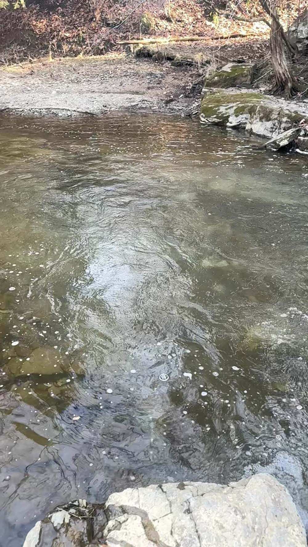
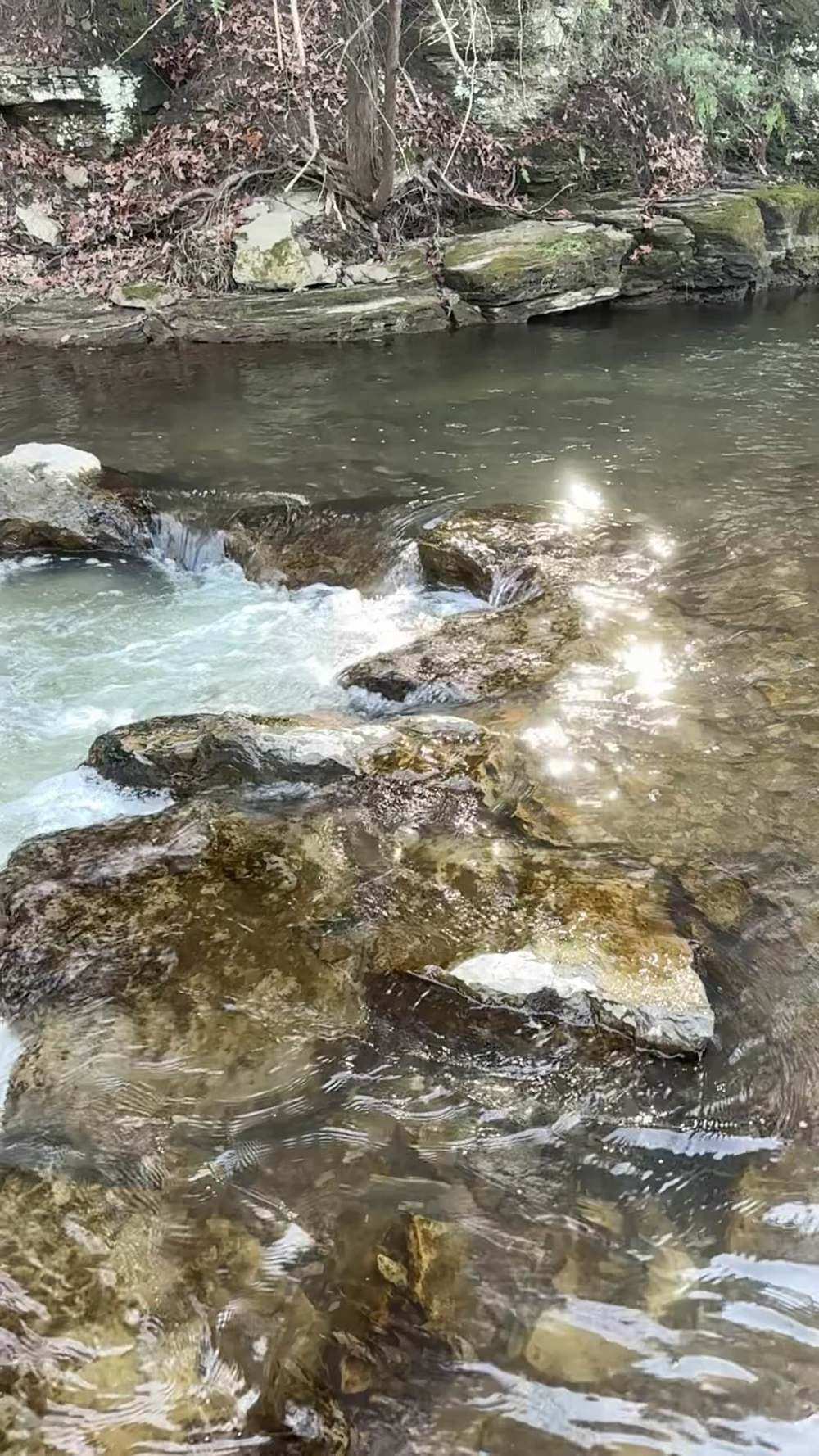
Tackle Medium trib gear: a 9–10 ft 6–7 weight fly rod, a float setup, or light-to-medium spinning gear. The creek is wadeable and crossable in most conditions — small enough that accuracy matters more than power.
Flies and baits Egg patterns and egg sacs for the fall salmon and browns; nymphs and beads for steelhead; small spinners and spoons. On flat, clear water like today's, go lighter and smaller than the gauge would suggest on a bigger creek.
How to fish it Walk the PFR water and fish it thoroughly — the creek's holes are close together, and fish concentrate in the deeper slots and bends. In steady clear water, fish the seams and the tailouts before the fast water. When a canal release or a rain pulse lifts the creek, fish the soft water on the edges and the fresh fish that just came in.
Seasonal playbook
| Fall (Sep–Nov) | coho and Chinook first, browns behind them, steelhead arriving late in the fall. |
| Winter (Dec–Feb) | steelhead in the deeper PFR water; the creek's small size means a hard cold snap can end the season early. |
| Spring (Mar–Apr) | steelhead through the spring run per DEC's late-fall/early-spring timing. |
| Summer | the lake-run game rests; the warmwater fishery below Route 19 (smallmouth bass, northern pike, brown bullhead) carries the creek. |
09 — Section
8. Techniques in depth — fishing Sandy Creek
The primary rig: a light float rig for a creek that runs flat Sandy Creek's signature is steadiness — no published band exists (§4), and the North Hamlin gauge never moved: 90.4 to 92.1 cfs across a full day, clear, at 50.2 °F, on a medium creek small enough to wade and cross in most conditions. The primary rig matches that character: a light float on 6–7 weight tackle, micro-to-small shot staggered down a light leader, and the depth set so the bait runs a few inches off bottom through the slots and bends of the PFR water. Because the holes are close together, the drift discipline is in your feet, not your cast: fish each slot with two or three checked drifts — float at surface speed, bait ticking lightly, no drag — then move. A flat, clear creek punishes the angler who camps.
Bait selection by clarity Clear water is the base state the flat gauge produces, so start small: a single small egg pattern, a soft bead pegged one to two inches above the hook, or a small pale egg sac — §7's instruction, to go lighter and smaller than the gauge suggests on a bigger creek, is this creek's whole bait doctrine. The menu widens on the only two events that color this creek: a canal release or a rain pulse. On stained, rising water, fish a dime-size sac with a floater in it, in brighter netting, through the soft edges — fresh coho and browns on that water are the boldest fish of the week. As it falls and clears, return to small within the day; Sandy clears fast, and yesterday's perfect sac is today's refusal.
Forage notes — Sandy Creek in mid-November Sandy Creek is one of only two creeks in this set deliberately watered by NYPA's Fall Fishing program, with managed Erie Canal releases from September to December — and those releases, as much as rain, move its forage. The fall coho and Chinook egg pulse is spent by mid-November; egg presentations still lead for the steelhead that run late fall into early spring and for the browns that follow the salmon. Below the Route 19 bridge at North Hamlin the creek also carries the warmwater fishery the Town of Hamlin program names — a different forage base in the lower reach. Shiners hold deep off the mouth at Sandy Harbor; crayfish have gone under the rocks.
Lead — eggs
egg sacs, beads (6–10 mm) and single eggs, sized to clarity — a single small egg pattern, a soft bead, or a small pale sac in the clear base state; a dime-size sac with a floater in brighter netting, briefly, on a canal release or rain stain (§8). Sandy clears fast — shrink the presentation as it does.
Secondary — sculpins and stoneflies
small sculpin patterns and stonefly nymphs, in the drift year-round, as the second look in the runs.
Mouth and lower reach only — shiners
at Sandy Harbor and in the lower warmwater reach, a live shiner on a bobber is a standing go-to where legal.
Where they hold, by level
At low, flat water like the build day, fish hold in the deeper slots and bends of the PFR segments and in the seam water and tailouts, with staging fish still down toward the mouth at Sandy Harbor. At prime water — a steady level with a modest lift — coho, browns, and later steelhead push up through the Route 19 bridge reach at North Hamlin and spread through the corridor, and every deeper run is worth its three drifts. At high water, on a release or rain crest, fish sit in the soft insides of bends, the slow margins of the PFR pools, and the harbor water at the mouth — and the falling, clearing side of that crest is the best hour this creek offers all season.
The secondary method Casting small spoons and spinners at the mouth beats the float whenever the creek is at its lowest and clearest and the run is staging rather than running. Fish stacked off Sandy Harbor are in lake mode — chasing, not drifting — and a small spoon counted down and retrieved slow through the staging water takes coho and browns days before they commit to the creek. If they will not come in, go to them.
Seasonal adjustment Time the fall to the canal. Sandy is one of only two creeks the Fall Fishing program deliberately waters with managed Erie Canal releases from September to December, so this creek's best fall fishing follows a release, not a rainstorm: watch the North Hamlin gauge for a managed lift, and fish its falling side with the bigger, brighter menu above. When the program ends in December and the creek falls back to winter baseflow, the adjustment is the winter standard — the deepest PFR water only, small and slow at midday, in a creek a hard cold snap can close early.
10 — Section
9. Safety
A wadeable creek is still a creek: canal releases and rain can lift it without a storm over your head, and the flat gauge in §3 is partly a managed flow. Check the gauge before you wade, and if the water is rising, get out — the soft clay banks here are slippery, and a rising creek in waders is the classic accident. Respect the PFR boundary: unfamiliar private bank is where slips happen.
11 — Section
10. What is inside the living edition
Same promise as every Keystoned Steel guide:
- Live USGS gauge at North Hamlin (04220223) — real readings, stamped with the time the gauge took them; where the gauge is not reporting, the guide says so plainly instead of faking a number.
- Live weather & radar built right into the guide.
- Verified access where it exists — and where access is unverified or permission-only, the guide says so plainly instead of faking a parking lot.
- Flow windows — the exact bands that say go, wait, or stay home where a published band exists; where none exists, the guide says so plainly instead of inventing one.
- Buy once — updates to the guides you bought are free. A living edition that stays current all season.
Sources (Nov 11, 2026 build)
- USGS NWIS Instantaneous Values API (waterservices.usgs.gov), site 04220223 (Sandy Creek at North
Hamlin, NY), queried live Nov 11, 2026 ~2:42 PM EST: latest discharge 92.1 cfs at 2:00 PM EST Nov 11, 2026 (provisional), gage height 17.03 ft, water temperature 10.1 °C; past-day range 90.4–92.1 cfs.
- NYSDEC, Public Fishing Rights Maps: Sandy Creek (DEC PFR map, dec.ny.gov/media/7401): creek flows through Orleans and Monroe counties, emptying into Lake Ontario west of Rochester; fall runs of coho, brown trout, and Chinook salmon; steelhead runs in late fall and early spring; DEC stocks over 100,000 Chinook, 26,000 coho, and 14,650 rainbow trout (steelhead) each year; PFR = permanent easements, usually a 33-ft strip on one or both banks, fishing only; Lake Ontario tributary regulations apply; Region 8 Fisheries office (585) 226-2466.
- Town of Hamlin Local Waterfront Revitalization Program (NY Dept. of State): Sandy Creek habitat from the mouth at Sandy Harbor Beach to the East/West Branch confluence south of Route 104; warmwater fishery from the County Route 19 bridge at North Hamlin downstream to the mouth; NYSDEC boat launch facility adjacent to Sandy Creek; public parking at Hamlin Beach State Park.
- NYPA / NYS Canal Corporation, Access and Conservation Easement (ACE) Program request for expressions of interest (2022): Fall Fishing program — canal flows managed September to December to enhance the fisheries on Oak Orchard Creek and Sandy Creek.
- NY DEC fishing hotline, Oct 30–Nov 13, 2026: western Lake Ontario tribs context (Eighteenmile / Oak
Orchard plentiful browns and kings) — regional context only.
- WNY Fly Fishing, Stream Report 11/2/2026 and Flow Rate Guide (wnyflyfishing.blogspot.com): no published band for Sandy Creek (absence noted in §4).
- NYSDEC, 2025 New York Fish Stocking List ("Fish distribution January 1 – December 31, 2025," Bureau of Fisheries; dec.ny.gov/sites/default/files/2024-07/actualstocking.pdf): Sandy Creek (Hamlin) — 16,990 steelhead (2,000 + 14,990) and 50,320 landlocked salmon (40,000 + 10,320) in 2025; no Chinook or coho entry for Sandy Creek (Hamlin) in the list — differs from the PFR map's figures; both printed in §5, the 2025 list being the newer source.
- Weather: weather.com, Rochester NY, Nov 11, 2026 (52°F, mostly cloudy, wind NNW 2 mph, pressure falling; high 53°F, low 42°F; showers tonight, Thu Nov 12 rain ~0.64 in; sunrise 6:58 AM, sunset 4:50 PM EST).
Lore, Legends & History Nobody ever wrote an epic about Sandy Creek, and this section will not pretend otherwise. What it has instead is a true, well-documented pioneer story — mills, a sickness, and a settlement that nearly died of its own dam — preserved in the old county histories, and worth telling straight.
The name is the plainest kind: a sandy creek, in shore country where the soil turns to sand and gravel coming down toward the lake, as the Monroe County histories note. Settlers reached the mouth early — a Dutchman named Strunk was the first settler there, dead by the time pioneer historian Orsamus Turner visited in 1812 — and Joshua Green put up the town's first sawmill on the creek about 1813.
The creek's real story sits at the Ridge, where the road west from Rochester crossed it. Families settled there from about 1809, Isaac Leach opened the first store in 1815, and in 1817 Henry McCall and Robert Perry built their mills and dammed the creek, backing water over eighteen or twenty acres of heavy standing timber, left standing in the flood. The drowned timber fouled the water, and a terrible sickness went through the settlement.
Turner, writing in 1851, counts twenty-seven deaths in one season out of about a hundred people; the Orleans County history says about a quarter of the inhabitants died. The settlers took the dam down, and the sickness disappeared — an early, hard lesson in what standing dead water does, learned at full price on one small creek.
The creek kept its millers anyway. In Kendall, Osee Webster came in 1819 and built a gristmill remembered as one of the first, if not the first, in Orleans County; his sons raised a stone mill on the site in 1840, and Webster's Mills — later Kendall Mills — grew around it into a hamlet of flour, feed, and saw mills, a tannery, and cooper and carriage shops. Before Webster, Kendall families hauled their grain to Rochester or Clarendon to be ground. After him, they ground it at home, and a place existed.
There is one strange footnote at the mouth: in 1843 a Fourierite community — one of the era's idealistic communal experiments — was organized there under a Dr. Theller. The county history records it in one dry line: "It proved a failure." That is the honest sum of it: a sawmill in 1813, a dam that taught a deadly lesson in 1817, a stone mill in 1840, and a failed utopia. No legends attached themselves to this water that anyone wrote down. But generations ground their grain, buried their neighbours, and learned from both on this creek — and that, in this country, is most of history.
Night fishing — working the holes after dark First, the law on this water. New York's Great Lakes tributary rules close this water to night fishing in season: in the Sep 1–Mar 31 window the tributary reach — from the bridge closest to the mouth up to the first barrier impassable by fish — is open only from 1/2 hour before sunrise to 1/2 hour after sunset. In that window, be off the tributary water by sunset; the tactics below are for the water and the hours where night fishing is open — the lake shore, pier and open mouth water this guide identifies, and the river outside the seasonal window where no other rule closes it. After dark, the run changes address on Sandy Creek, NY. Steelhead that held in the riffles and pocket water by day slide into the deepest holes in the reach — the slow, dark water at the head of the pool, along the undercut and the shale ledge, and the tail where the pool shallows into the next riffle — and they feed there with a confidence they never show at noon. On a small creek the night fishery is a handful of holes; learn which ones they are. Working a hole in the dark is a memory exercise before it is a fishing exercise. Fish the hole in daylight first: learn where it deepens, where the wood and the ledges sit, where you will stand, and where a hooked fish can be landed. At night, work it top to bottom in short steps — a cast or two across the head, down the seam, into the tail — slow, deep and close to the bottom, with long pauses; a steelhead at night does not chase, it intercepts.
Two profiles speak at night: glow — a glow bead, glow egg or chartreuse presentation where a little light helps the fish find it — and dark — a black or black-olive streamer or nymph silhouetted against the night sky. The dark profile works because it reads to a night-feeding fish as a bottom forage fish on the move — big, slow, and tight to the substrate. Light discipline is not optional: a headlamp shone into a hole ends the fishing in it — keep the light on the bank and on your feet, red or dim when you have it, and rest a lit-up hole before fishing it again.
Sound carries the same way. Safety doubles after dark: never wade at night water you have not waded by day, belt cinched and staff in hand, tell someone the reach and the return time — a fall in cold water at night is a survival event, not a soaking. Tonight's night pick — kept live with this guide's bait rotation. The rotation updates the night pick for this water on the same cycle as the day picks, off the forage calendar and the current clarity and flow.
Current-season default: where night fishing is open: a glow spawn sac or glow bead under a float at the head of the hole; dark second, a black streamer swung slow. Off the piers and open shore, glow spoons and stickbaits are the night hardware.
The Bottom Line
Sandy Creek is the workhorse of the Rochester shore: not the biggest and not the most famous, but stocked at real scale — DEC's PFR map puts over 100,000 Chinook, 26,000 coho, and 14,650 steelhead into it (DEC's newer 2025 stocking list records a different…
Legal · Read last
LEGAL DISCLOSURE — Keystoned Steel Guides
What Keystoned Steel warrants. Keystoned Steel warrants only that, as of the edition date stated in this guide, the access, gauge, and regulation information in this guide that is attributed to a cited official source accurately reflects that source as published on that date. If a material error in that information is confirmed, Keystoned Steel will issue a corrected edition to the original buyer at no charge or, if it does not do so within 30 days after confirming the error, refund the price you paid. That is the sole express warranty provided with this guide.
This guide does not warrant or guarantee:
- (a) Stream conditions, water levels, clarity, or weather — conditions change daily and can change after any
reading printed here;
- (b) Fishing success — no representation is made that fish are present, in any number, size, or location, at any
time;
- (c) Access — access status, parking, and Public Fishing Rights can change, be posted, or be withdrawn at any
time; inclusion of a reach in this guide is not permission to fish it, and is not a representation that access is currently open;
- (d) Third-party data — Gauge readings, including USGS data, agency publications, and maps, originate from
third-party sources. Keystoned Steel does not control those sources and cannot guarantee their accuracy, completeness, availability, or continued accessibility. Third-party information may be provisional, delayed, revised, or incorrect. Its inclusion does not constitute an independent guarantee by Keystoned Steel of the underlying data;
- (e) Regulations — seasons, creel and size limits, and special-reach rules change; the regulations summarized
here are a convenience summary only and are not the law.
Your responsibilities. Before you fish: confirm the current regulations in the current NYSDEC Freshwater Fishing Regulations Guide; hold the required license; verify access is open and lawful for the reach you fish; respect posted signs and private land — a fishing license is not a permit to trespass. Wading and stream fishing involve inherent risks, including fast or rising water, slippery rock, and remote terrain; you fish at your own risk and are responsible for your own safety decisions. This safety warning and assumption of risk do not waive or limit any liability, warranty, or remedy that cannot lawfully be waived or limited under applicable law.
Corrections and refunds. If you believe this guide contains a material error, email keystonedsteel@gmail.com or message our Facebook Page with the guide name and the error. Keystoned Steel will review it against the cited sources within 30 days. If the error is confirmed, you will receive a corrected edition or, at Keystoned Steel's election, a refund of the price you paid. That remedy is your sole and exclusive remedy for errors in this guide. Limitation of liability. TO THE FULLEST EXTENT PERMITTED BY APPLICABLE LAW, KEYSTONED STEEL'S TOTAL LIABILITY ARISING OUT OF THIS GUIDE WILL NOT EXCEED THE PRICE YOU PAID FOR IT, AND KEYSTONED STEEL WILL NOT BE LIABLE FOR INDIRECT, INCIDENTAL, OR CONSEQUENTIAL DAMAGES, INCLUDING TRIP COSTS, CITATIONS OR FINES, OR PERSONAL INJURY ARISING FROM YOUR USE OF THIS GUIDE. NOTHING HERE LIMITS LIABILITY FOR GROSS NEGLIGENCE OR WILLFUL MISCONDUCT. License. This guide is licensed to the original buyer for personal use only. It is nontransferable and may not be shared, resold, or redistributed without the prior written consent of Keystoned Steel. Living-edition updates are delivered only to the original buyer's purchase email.
TO THE FULLEST EXTENT PERMITTED BY APPLICABLE LAW, THE WARRANTY SET FORTH ABOVE IS THE SOLE EXPRESS WARRANTY PROVIDED BY KEYSTONED STEEL FOR THIS GUIDE, AND KEYSTONED STEEL DISCLAIMS ALL OTHER WARRANTIES, EXPRESS OR IMPLIED, INCLUDING ANY IMPLIED WARRANTY OF MERCHANTABILITY AND ANY IMPLIED WARRANTY OF FITNESS FOR A PARTICULAR PURPOSE. NOTHING IN THIS DISCLOSURE SHALL EXCLUDE OR LIMIT ANY WARRANTY, RIGHT, OR REMEDY THAT CANNOT LAWFULLY BE EXCLUDED OR LIMITED UNDER APPLICABLE LAW.