
Keystoned Steel // Field Guide
Irondequoit Creek
GAUGE — USGS 04232050
The brief
class="v-brief">What this guide covers: the lake-run water of Irondequoit Creek in Monroe and Ontario counties — the 36-mile creek that empties into Irondequoit Bay and Lake Ontario, fished from the bay mouth up through the parks corridor to the upstream brown-trout water. DEC's own PFR sheet calls it one of the best rainbow trout (steelhead) streams in New York State — and also notes it has only a small amount of Public Fishing Rights.
That combination is the whole story of this creek: great fish, limited legal water, and parks that make it work.
01 — Section
1. The idea in one paragraph
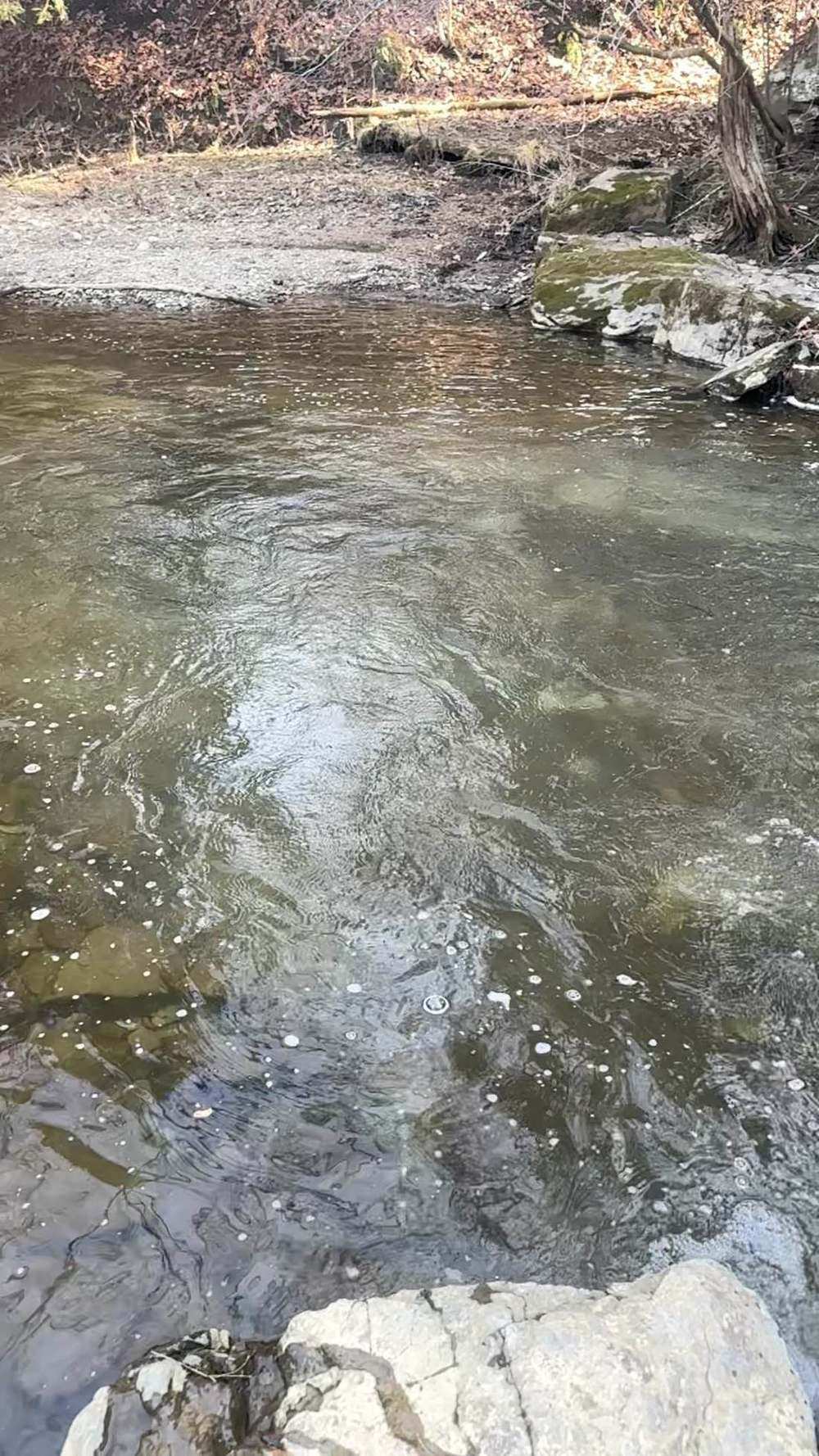
Irondequoit Creek is the urban steelhead stream of the set: a small creek with a big reputation, running through parks and suburbs east of Rochester into Irondequoit Bay. There is no upstream barrier of consequence — lake-run fish can move far — and the creek carries both a fall-spring steelhead run and resident wild browns upstream of Powder Mill Park. The access model is unusual: DEC holds only a little PFR, and the fishery is carried by a string of city, town, and county parks along the corridor. The creek is small and low today — 66.6 cfs and clear — which makes it a finesse game, not a power game. Read the Blossom Road gauge, fish the parks and the PFR, and go light.
02 — Section
2. How to use this guide
1. Check the Blossom Road gauge snapshot in §3 — this creek is small, and low, clear water means small
presentations. 2. Read §4: no published band exists for Irondequoit Creek, and this guide prints none. 3. Plan your access from §6 — the parks are the fishery here, and the PFR is a small part of it. 4. Fish it with §7, and read §9: small urban creek, suburban banks, and a bay at the bottom with different
rules.
03 — The Water★ Intel
3. Live gauges — verified snapshot, Wed Nov 11, 2026
Gauge: USGS 0423205010, Irondequoit Creek above Blossom Road, Rochester, NY. Pulled live Nov 11, 2026, ~2:42 PM EST (USGS NWIS Instantaneous Values API). All values provisional.
Item
Value
---
---
Reading
66.6 cfs at 2:15 PM EST, Nov 11, 2026 (gage height 2.83 ft)
Water temp
9.7 °C (49.5 °F) at 2:15 PM EST
Past-day range
66.6–69.9 cfs — flat and low all day
Clarity on the day
Clear — estimate from the flat hydrograph; not a visual reading
Item
Value
Call on the day
FAIR — low, clear, cold water at 49.5 °F; very fishable for a careful angler, but this is finesse water, not fast fishing
Weather at the creek (Rochester, NY, weather.com, Nov 11, 2026): mostly cloudy, 52°F, wind NNW 2 mph, pressure falling; high 53°F, low 42°F; showers tonight, rain likely Thu Nov 12 (~0.64 in) — a lift of water and a fresh push of fish into a creek that is currently low and clear. Sunrise 6:58 AM EST, sunset 4:50 PM EST.
Regional context: the region's creeks ran steady and cool on Nov 11 (Eighteen Mile 102 cfs, Oak Orchard 372 cfs, Salmon River 272 cfs). Irondequoit's 66.6 cfs is the low end of the set — the smallest gauged flow in the Ontario package, on a creek that fishes small even in good years.
Gauge history: the past-day trace (66.6–69.9 cfs, gage height 2.83–2.87 ft) is baseflow — the creek has not moved. On a creek with no upstream barrier, that means the fish in the system are distributed through the parks corridor, not stacked by a rise. Sources for this snapshot: USGS NWIS Instantaneous Values API, site 0423205010, queried Nov 11, 2026 ~2:42 PM EST; weather.com, Rochester NY, Nov 11, 2026.
3A. Recent pushes / fresh runs
- No dated, day-specific run report for Irondequoit Creek was available for Nov 11, 2026. The creek's own gauge (§3) is the dated signal: low, flat, and cold — a creek waiting on Thursday's rain for its next push.
- Management note (dated, sourced): DEC's 2024 Irondequoit Creek trout survey brief (Nov 25, 2024,
Region 8 Fisheries) records that the State cancelled its brown trout stocking policy for the creek under the DEC Trout Stream Management Plan — brown trout stocking ended in 2026. The steelhead program continues. Note: the PFR sheet's brown-trout figure in §5 comes from a different DEC source and does not match this one — see §5, where both figures are printed with their sources.
04 — The Water
4. Flow bands — go / wait / stay home
No published flow band was found for Irondequoit Creek — not from DEC, and not from the published shop/guide flow guides this series checks (WNY Fly Fishing's Nov 2, 2026 guide covers Cattaraugus Creek, the Genesee at Wellsville, and Oatka Creek only). Re-checked in the verification pass against DEC's Irondequoit Creek pages, the Steelhead Almanac, Snoflo's gauge pages for USGS 0423205010 (percentile/forecast data only, no fishing band), and published Rochester-area steelhead guides — still no published band for this gauge. So this guide prints none. The working read from §3 stands on its own: a flat ~67 cfs at 49.5 °F in mid-November is low, clear, fishable fall water — go light, fish the parks water, and wait for Thursday's rain. A band will only be added when a credible published source prints one.
05 — Section
5. The run, the fish, and the rules
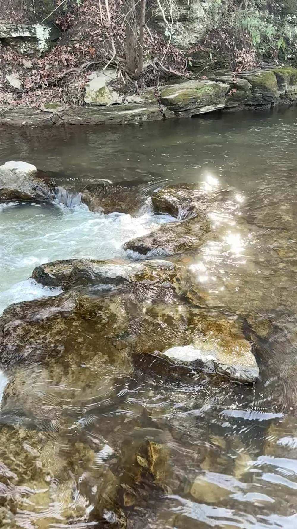
The fishery (per NYSDEC's Irondequoit Creek PFR map): the creek flows through Ontario and Monroe counties, emptying into Irondequoit Bay on Lake Ontario. DEC calls it one of the best rainbow trout (steelhead) streams in New York State. Per the DEC PFR map, DEC stocks 27,500 rainbow trout (steelhead) and 7,600 brown trout each year, including over 1,500 two-year-old fish — and Monroe County stocks brown trout into the portion within Powder Mill Park. Wild brown trout are found upstream of Powder Mill Park. Lake Ontario tributary regulations apply.
Stocking figures — DEC sources, different numbers from different years (read all three): Per DEC's Irondequoit Creek PFR map (DEC's standing public fishery description): 27,500 steelhead and 7,600 brown trout each year, as above. Per DEC's 2024 Irondequoit Creek Trout Survey brief (Region 8, Nov 25, 2024): 18,000 steelhead stocked at Old Penfield Road each spring, and the State's brown trout stocking policy for this creek was cancelled — brown trout stocking ended in 2026. Per DEC's 2025 statewide fish stocking list (the 2025 New York Fish Stocking List, fish distribution January 1–December 31, 2025; the most recent actual-year list on DEC's Fish Stocking page): Irondequoit Creek (Mendon) 18,000 steelhead (5.0 in) — the same steelhead figure as the survey brief — plus brown trout entries for Irondequoit Creek (Brighton, Penfield, Perinton) of 3,190 (9.0 in), 6,270 (9.5 in), and 1,380 (13.5 in) and for Irondequoit Creek (Pittsford) of 880 (9.0 in), 880 (9.5 in), and 380 (13.5 in); those listed brown trout entries add up to 12,980 fish stocked in 2025. Per DEC's Spring 2026 Trout Stocking list for Monroe County (anticipated yearling and older trout for spring 2026 — the most recent DEC stocking list checked for this creek): Irondequoit Creek does not appear at all — no brown trout, and no other yearling or older trout, are listed for the creek. That absence is consistent with the survey brief's cancellation note: the State's brown trout stocking for this creek ended in 2026, after the brown trout recorded in the 2025 list. (The spring list covers yearling and older trout only, so its silence says nothing about steelhead fingerlings; and it does not speak to Monroe County's separate Powder Mill Park brown trout stocking described on the PFR map.) The older DEC sources above conflict with each other, and this guide does not reconcile them — the dated lists are printed so you can see which source is most recent.
Rules: Lake Ontario tributary regulations apply to the creek. Irondequoit Bay itself is exempt from the seasonal tributary rules — Lake Ontario seasons and limits apply in the bay, which is different from the creek sections. Verify the current rules — seasons, size and creel limits, and tributary tackle/hours provisions — in the current NYSDEC Freshwater Fishing Regulations Guide before you fish. The DEC guide is the law; this summary is not.
06 — Access
6. Access, pool by pool — area-level only
Area-level only, from official sources:
- DEC Public Fishing Rights segments — DEC holds only a small amount of PFR on this creek (the PFR sheet's own words). The stocked-trout table lists the PFR water as two stretches: from the NYS Barge Canal to the Powder Mill Park boundary, and from Ellison Park to Legion Eyer Park (8.2 miles of stocked water in DEC's table, PFR plus open-by-owner water). Fish the signed PFR segments.
- The parks corridor — DEC's PFR sheet says it directly: "numerous city, town and county parks offer additional access sites on Irondequoit Creek." The named parks in the corridor are Ellison Park, Powder Mill Park, Tryon Park, Panorama Valley, and Fishers Park — the access that makes this creek work.
Park rules govern each site (hours, parking); read the signs.
- The bay — Irondequoit Bay, where the creek meets Lake Ontario, is fishable from shore or by boat, and is governed by Lake Ontario rules rather than the tributary rules. It is the one place on this creek where the seasonal tributary framework does not apply.
- Everything else is private. Between the parks, the creek runs through suburban backyards and posted land.
Do not leave the parks or the signed PFR to fish a tempting run — the creek's access was built on parks and easements, and both depend on anglers staying where they belong.
DEC Region 8 Fisheries office: (585) 226-2466 (per the DEC PFR map).
07 — Tactics
7. Flies, tactics, and seasonal playbook
Tackle Light trib gear: a 9–10 ft 6–7 weight fly rod, a float setup, or light spinning gear. The creek is small and clear — your presentation should be, too.
Flies and baits Small egg patterns, beads, and nymphs for steelhead; small streamers for the wild browns upstream; spoons and spinners where the water allows. In today's low, clear water, fluorocarbon tippets and small offerings are the rule, not the exception.
How to fish it Fish the parks water slowly and thoroughly — the creek's fish are spread through the corridor, and the good water is in the deeper park pools and runs, not at any one named hole. Keep a low profile: clear, low water and suburban banks mean fish see you before you see them. Fish the bay mouth when the creek is too low to hold fish — the bay is where the lake-run fish stage.
Seasonal playbook
| Fall (Sep–Nov) | steelhead arriving late in the fall; the creek's fall run builds as the water cools. |
| Winter (Dec–Feb) | steelhead in the deeper park water; a small creek fishes well in a mild winter and locks up in a hard one. |
| Spring (Mar–Apr) | steelhead through the spring run; wild browns upstream of Powder Mill Park become the target as the steelhead leave. |
| Summer | resident wild browns upstream of Powder Mill Park; the lake-run fishery rests. |
08 — Section
8. Techniques in depth — fishing Irondequoit Creek
The primary rig: a light float, set for low and clear Everything about this creek argues for going lighter than you want to. There is no published band for it (§4), and the build day was 66.6 cfs, flat, cold at 49.5 °F, and clear — the smallest gauged flow in this set. The primary rig is a small float on a long, light leader: micro-shot staggered fine down the line so the bait drifts ahead naturally, fluorocarbon at the business end, and the depth set to run the bait just off bottom through the deeper park pools. Check every drift. On water this clear, a float that drags, a bait that swings, or a shadow across the pool announces you before the bait arrives. Make short, precise drifts from below the fish, keep your profile behind the bank, and rest a pool after a refusal rather than casting it into submission — pressured fish in the parks corridor remember a bad hour.
Bait selection by clarity Clear is this creek's home state, so the menu starts small: a soft bead pegged one to two inches above a small hook, a single small egg pattern, or a tiny nymph, all in natural tones. The sacs that work on the big creeks are mostly too much here; if you fish a sac at all in clear water, make it small and pale. The menu changes only when the creek does — after a rain lifts and stains it, the one real color event this lowland creek gets, step up briefly to a dime-size sac with a floater and fish it confidently while the stain lasts, because fresh fish moving on that lift are the least shy fish of the season. When the creek drops clear again, go straight back to small.
Forage notes — Irondequoit Creek in mid-November
Irondequoit is a small, clear, urban creek — 66.6 cfs on the build day — with no upstream barrier of consequence, lake-run fish moving far up it, and resident wild browns above Powder Mill Park. There is no big salmon egg pulse to spend here the way the western creeks spend theirs; what egg drift the fall brought is gone by mid-November, and egg presentations still lead for the fall–spring steelhead run, fished at this creek's finesse scale. Shiners belong to Irondequoit Bay and the mouth, holding deep off it — not to the park pools up-creek, where sculpins and stoneflies are the resident forage and crayfish are now dormant under the rocks.
Lead — eggs
egg sacs, beads (6–10 mm) and single eggs, sized to clarity — a soft bead, a single small egg pattern, or a tiny pale sac in natural tones in the creek's clear home state; step up only briefly to a dime-size sac with a floater on the one real colour event, a rain lift (§8).
Secondary — sculpins and stoneflies
a tiny sculpin pattern or stonefly nymph for the park-water fish, and for wild browns above Powder Mill — second to eggs for lake-run fish.
Mouth and bay only — shiners
at the mouth and in the bay, a live shiner on a bobber is a standing go-to where legal.
Where they hold, by level At low water like the build day, with no barrier to stack them, fish are spread thin and hold where depth buys them safety: the deeper pools and runs in the parks corridor — Ellison Park, Powder Mill Park, and the PFR stretches between them — and, at its thinnest, staged down in Irondequoit Bay at the mouth rather than in the creek at all. At prime water, after a modest rain lift greens the creek without blowing it, fish push up through the whole corridor and hold in the seams and tailouts of every park reach. At high, colored water, they hug the soft insides of bends and the slow margins of the park pools, and the bay mouth fishes as creek fish drop back to wait it out.
The secondary method A small streamer, swung or stripped on a fly rod, beats the float on the upper creek — upstream of Powder Mill Park, this is wild brown water as much as steelhead water, and the browns there are hunters, not drift feeders. A slim streamer worked across the deeper bends at dawn or dusk takes browns that have watched beads drift over them all day, and in the low, clear weeks when the lake-run fish have not arrived, it is often the only game worth playing.
Seasonal adjustment Spring changes the target, not just the tackle. As the steelhead finish and drop back toward the bay, shift your effort upstream of Powder Mill Park and fish for the wild browns as residents: smaller streamers and nymphs, slower water, longer leaders, and evening rises instead of morning drifts. The creek's second season is up top, and it fishes like a trout stream, not a tributary.
09 — Section
9. Safety
Small urban creek, suburban banks: the hazards are slippery clay and rock, high banks, and the bay's different water. Do not climb banks you cannot climb back up, and do not wade the bay mouth in a wind — Irondequoit Bay is lake water, not creek water. Park rules are part of safety here: closed hours and closed sections exist, and fishing them is not worth the citation.
10 — Section
10. What is inside the living edition
Same promise as every Keystoned Steel guide:
- Live USGS gauge above Blossom Road (0423205010) — real readings, stamped with the time the gauge took them; where the gauge is not reporting, the guide says so plainly instead of faking a number.
- Live weather & radar built right into the guide.
- Verified access where it exists — and where access is unverified or permission-only, the guide says so plainly instead of faking a parking lot.
- Flow windows — the exact bands that say go, wait, or stay home where a published band exists; where none exists, the guide says so plainly instead of inventing one.
- Buy once — updates to the guides you bought are free. A living edition that stays current all season.
Sources (Nov 11, 2026 build)
- USGS NWIS Instantaneous Values API (waterservices.usgs.gov), site 0423205010 (Irondequoit Creek above Blossom Road, Rochester, NY), queried live Nov 11, 2026 ~2:42 PM EST: latest discharge 66.6 cfs at 2:15 PM EST Nov 11, 2026 (provisional), gage height 2.83 ft, water temperature 9.7 °C; past-day range 66.6–69.9 cfs.
- NYSDEC, Public Fishing Rights Maps: Irondequoit Creek (DEC PFR map, it.dec.ny.gov): 36-mile creek flowing through Ontario and Monroe counties into Irondequoit Bay on Lake Ontario; "one of the best rainbow trout (steelhead) streams in New York State"; small amount of PFR; city, town, and county parks offer additional access; DEC stocks 27,500 rainbow trout (steelhead) and 7,600 brown trout annually, including over 1,500 two-year-old fish; Monroe County stocks brown trout within Powder Mill Park; wild brown trout upstream of Powder Mill Park; Lake Ontario tributary regulations apply; Region 8 Fisheries office (585) 226-2466.
- NYSDEC, Stocked Trout Streams in West Central New York (dec.ny.gov): Irondequoit Creek, Monroe
County — PFR / Open by Owners, NYS Barge Canal to Powder Mill Park boundary and Ellison Park to Legion Eyer Park, 8.2 miles, rainbow and brown trout.
- NYSDEC, Irondequoit Creek Trout Survey, Bureau of Fisheries Technical Brief (Survey #824011, Michael
DiSarno, Region 8 Fisheries, Nov 25, 2024): 18,000 steelhead stocked at Old Penfield Road each spring; brown trout stocking policy cancelled under the DEC Trout Stream Management Plan; wild rainbow and brown trout population; surveys 2021–2022, Ellison County Park to Fishers Park.
- NYSDEC, 2025 New York Fish Stocking List (dec.ny.gov, Fish Stocking page, actual stocking lists updated June 23, 2026; fish distribution January 1–December 31, 2025), Region 8, Monroe County:
Irondequoit Creek (Mendon) 18,000 steelhead, 5.0 in; Irondequoit Creek (Brighton, Penfield, Perinton) brown trout 3,190 at 9.0 in, 6,270 at 9.5 in, 1,380 at 13.5 in; Irondequoit Creek (Pittsford) brown trout 880 at 9.0 in, 880 at 9.5 in, 380 at 13.5 in.
- NYSDEC, Spring Trout Stocking (2026), Spring 2026 Trout Stocking for Monroe County (dec.ny.gov): the county's anticipated yearling-and-older trout list for spring 2026 lists Lake Ontario (Greece, Hamlin, Webster) brown trout and Oatka Creek brown trout only — Irondequoit Creek does not appear, and no brown trout are listed for it.
- NYSDEC, Lake Ontario Atlantic Salmon Fisheries Management Plan 2023–2026 (dec.ny.gov): Irondequoit
Creek identified as a candidate/alternate Atlantic salmon stream; excellent public access and steelhead history; several thousand catchable brown trout stocked for the inland fishery.
- WNY Fly Fishing, Stream Report 11/2/2026 and Flow Rate Guide (wnyflyfishing.blogspot.com): no published band for Irondequoit Creek (absence noted in §4).
- Weather: weather.com, Rochester NY, Nov 11, 2026 (52°F, mostly cloudy, wind NNW 2 mph, pressure falling; high 53°F, low 42°F; showers tonight, Thu Nov 12 rain ~0.64 in; sunrise 6:58 AM, sunset 4:50 PM EST).
Lore, Legends & History Ask ten old books what Irondequoit means and you will get a pocketful of answers, fitting for a name spelled more than fifty different ways. The Seneca form behind it, O-nyiu-da-on-da-gwat, is most often given as "it turns out" or "it goes aside" — the lake turning aside — and the marker at the bay renders it "Where the Lake Turns Aside." Older writers offered "where the waters gasp and die," and plenty of authorities settle for the plain truth: a bay. All the versions point at the same picture — Lake Ontario pushing a long, crooked arm inland, and a creek coming down to meet it. That meeting place, Indian Landing, at the south end of the bay in what is now Ellison Park, was a great crossroads: trails ran from it to the Genesee, to the Finger Lakes, and south toward the Ohio country, and the Seneca used the bay as their port on the lake — the gateway into their country. The French knocked early, and not always politely. René-Robert Cavelier, Sieur de La Salle, is recorded visiting the bay in 1669, coming up it as far as the landing. What came in 1687 was no visit. The Marquis de Denonville, governor of New France, determined to crush Seneca power, sailed across the lake with an army — some sixteen hundred French soldiers and militia and several hundred Indigenous allies by modern accounts, more in the older tellings — and landed on the sandbar at Irondequoit Bay on July 10, 1687. They threw up a small redoubt, left a guard with the boats, and marched inland on the Seneca trails. The Seneca, warned in good time, had moved their families east to safety. An ambush in a ravine near present-day Victor bloodied the French advance but did not stop it, and over the following days Denonville's army burned the four great Seneca towns, including Ganondagan, and destroyed corn in quantities his own letters put above a million bushels — the food of a nation, torched in its fields and storehouses. Then he sailed west and planted a post at Niagara. It is documented history, it happened within sight of this creek's mouth, and its consequence is documented too: the invasion did not break the Seneca. It hardened them, and pushed them closer to the English for a hundred years.
The bay kept its importance after the wars quieted. A French trading post remembered as Fort des Sables — the Fort of the Sands — stood near Sea Breeze in the years after Denonville. And at the head of the bay, where the creek comes in, a whole town rose and vanished: Tryon City, founded in 1797 at the landing by merchants betting that this portage point would become a city. For a while it had stores, taverns, and lake trade. By 1818 it was abandoned, beaten by Rochester's rise on the Genesee a few miles west — a lost city in the truest local sense, its ground now inside a county park, its streets gone back to meadow and trees.
Irondequoit Creek itself worked quietly underneath all this: falling through Penfield, turning mill wheels, feeding the bay. The empires and the land speculators are gone. The bay still turns aside from the lake exactly where the old name says it does, and on a still evening at the landing it is not hard to see why everybody —
Seneca, French, English, and the town builders who bet wrong — wanted this one crooked piece of water.
Night fishing — working the holes after dark First, the law on this water. New York's Great Lakes tributary rules close this water to night fishing in season: in the Sep 1–Mar 31 window the tributary reach — from the bridge closest to the mouth up to the first barrier impassable by fish — is open only from 1/2 hour before sunrise to 1/2 hour after sunset. In that window, be off the tributary water by sunset; the tactics below are for the water and the hours where night fishing is open — the lake shore, pier and open mouth water this guide identifies, and the river outside the seasonal window where no
other rule closes it. After dark, the run changes address on Irondequoit Creek, NY. Steelhead that held in the riffles and pocket water by day slide into the deepest holes in the reach — the slow, dark water at the head of the pool, along the undercut and the shale ledge, and the tail where the pool shallows into the next riffle — and they feed there with a confidence they never show at noon. On a small creek the night fishery is a handful of holes; learn which ones they are. Working a hole in the dark is a memory exercise before it is a fishing exercise. Fish the hole in daylight first: learn where it deepens, where the wood and the ledges sit, where you will stand, and where a hooked fish can be landed. At night, work it top to bottom in short steps — a cast or two across the head, down the seam, into the tail — slow, deep and close to the bottom, with long pauses; a steelhead at night does not chase, it intercepts.
Two profiles speak at night: glow — a glow bead, glow egg or chartreuse presentation where a little light helps the fish find it — and dark — a black or black-olive streamer or nymph silhouetted against the night sky. The dark profile works because it reads to a night-feeding fish as a bottom forage fish on the move — big, slow, and tight to the substrate. Light discipline is not optional: a headlamp shone into a hole ends the fishing in it — keep the light on the bank and on your feet, red or dim when you have it, and rest a lit-up hole before fishing it again.
Sound carries the same way. Safety doubles after dark: never wade at night water you have not waded by day, belt cinched and staff in hand, tell someone the reach and the return time — a fall in cold water at night is a survival event, not a soaking. Tonight's night pick — kept live with this guide's bait rotation. The rotation updates the night pick for this water on the same cycle as the day picks, off the forage calendar and the current clarity and flow.
Current-season default: where night fishing is open: a glow spawn sac or glow bead under a float at the head of the hole; dark second, a black streamer swung slow. Off the piers and open shore, glow spoons and stickbaits are the night hardware.
The Bottom Line
Irondequoit Creek is the urban steelhead stream of the set: a small creek with a big reputation, running through parks and suburbs east of Rochester into Irondequoit Bay. There is no upstream barrier of consequence — lake-run fish can move far — and the creek…
Legal · Read last
LEGAL DISCLOSURE — Keystoned Steel Guides
What Keystoned Steel warrants. Keystoned Steel warrants only that, as of the edition date stated in this guide, the access, gauge, and regulation information in this guide that is attributed to a cited official source accurately reflects that source as published on that date. If a material error in that information is confirmed, Keystoned Steel will issue a corrected edition to the original buyer at no charge or, if it does not do so within 30 days after confirming the error, refund the price you paid. That is the sole express warranty provided with this guide.
This guide does not warrant or guarantee:
- (a) Stream conditions, water levels, clarity, or weather — conditions change daily and can change after any
reading printed here;
- (b) Fishing success — no representation is made that fish are present, in any number, size, or location, at any
time;
- (c) Access — access status, parking, and Public Fishing Rights can change, be posted, or be withdrawn at any
time; inclusion of a reach in this guide is not permission to fish it, and is not a representation that access is currently open;
- (d) Third-party data — Gauge readings, including USGS data, agency publications, and maps, originate from
third-party sources. Keystoned Steel does not control those sources and cannot guarantee their accuracy, completeness, availability, or continued accessibility. Third-party information may be provisional, delayed,
revised, or incorrect. Its inclusion does not constitute an independent guarantee by Keystoned Steel of the underlying data;
- (e) Regulations — seasons, creel and size limits, and special-reach rules change; the regulations summarized
here are a convenience summary only and are not the law.
Your responsibilities. Before you fish: confirm the current regulations in the current NYSDEC Freshwater Fishing Regulations Guide; hold the required license; verify access is open and lawful for the reach you fish; respect posted signs and private land — a fishing license is not a permit to trespass. Wading and stream fishing involve inherent risks, including fast or rising water, slippery rock, and remote terrain; you fish at your own risk and are responsible for your own safety decisions. This safety warning and assumption of risk do not waive or limit any liability, warranty, or remedy that cannot lawfully be waived or limited under applicable law.
Corrections and refunds. If you believe this guide contains a material error, email keystonedsteel@gmail.com or message our Facebook Page with the guide name and the error. Keystoned Steel will review it against the cited sources within 30 days. If the error is confirmed, you will receive a corrected edition or, at Keystoned Steel's election, a refund of the price you paid. That remedy is your sole and exclusive remedy for errors in this guide. Limitation of liability. TO THE FULLEST EXTENT PERMITTED BY APPLICABLE LAW, KEYSTONED STEEL'S TOTAL LIABILITY ARISING OUT OF THIS GUIDE WILL NOT EXCEED THE PRICE YOU PAID FOR IT, AND KEYSTONED STEEL WILL NOT BE LIABLE FOR INDIRECT, INCIDENTAL, OR CONSEQUENTIAL DAMAGES, INCLUDING TRIP COSTS, CITATIONS OR FINES, OR PERSONAL INJURY ARISING FROM YOUR USE OF THIS GUIDE. NOTHING HERE LIMITS LIABILITY FOR GROSS NEGLIGENCE OR WILLFUL MISCONDUCT. License. This guide is licensed to the original buyer for personal use only. It is nontransferable and may not be shared, resold, or redistributed without the prior written consent of Keystoned Steel. Living-edition updates are delivered only to the original buyer's purchase email.
TO THE FULLEST EXTENT PERMITTED BY APPLICABLE LAW, THE WARRANTY SET FORTH ABOVE IS THE SOLE EXPRESS WARRANTY PROVIDED BY KEYSTONED STEEL FOR THIS GUIDE, AND KEYSTONED STEEL DISCLAIMS ALL OTHER WARRANTIES, EXPRESS OR IMPLIED, INCLUDING ANY IMPLIED WARRANTY OF MERCHANTABILITY AND ANY IMPLIED WARRANTY OF FITNESS FOR A PARTICULAR PURPOSE. NOTHING IN THIS DISCLOSURE SHALL EXCLUDE OR LIMIT ANY WARRANTY, RIGHT, OR REMEDY THAT CANNOT LAWFULLY BE EXCLUDED OR LIMITED UNDER APPLICABLE LAW.