
Keystoned Steel // Field Guide
Ganaraska River
The brief
class="v-brief">What this guide covers: the Ganaraska River at Port Hope, Northumberland County, Fisheries Management Zone 17 — the flagship river of this Ontario set: a famous, mostly wild steelhead and salmon river running through a heritage downtown, past a dam and fishway you may watch but never fish, into Lake Ontario. Two facts define the trip: there is no live gauge on this river, and the rule book changes at every bridge.
01 — The Water
NO LIVE GAUGE — AND A YEAR-ROUND SANCTUARY IN THE MIDDLE OF
TOWN The Ganaraska is the one river in this set with NO live discharge gauge: both Water Survey of Canada stations on it are discontinued, and this guide prints no invented reading (§3). And its best-known reach — Highway 401 downstream to the south side of the Jocelyn Street Bridge, through downtown Port Hope, including the Corbett's Dam fishway — is a FISH SANCTUARY, CLOSED ALL YEAR. No fishing there at any time, for any species. The open water is below Jocelyn Street and at the mouth, under the layered rules in §5.
Learn the bridges before you learn the pools.
02 — Section
1. The idea in one paragraph
The Ganaraska — "the Ganny" to everyone who fishes it — is the north shore's town river: wild, naturally reproducing steelhead and salmon running out of Lake Ontario, up a channelled limestone staircase through downtown Port Hope, to a fishway at Corbett's Dam that has been passing fish since 1974. It is also the most rule-bound river in this pack: all-year water at the mouth, an extended-season reach that closes for six weeks every fall, a sanctuary reach that never opens, and a zone-wide river above the highway that sleeps until April.
Add that nobody can pull up a live flow number for it, and this is a river that rewards reading signs, seasons, and water over refreshing a gauge page. Learn the three reaches, respect the sanctuary, and read this river the old way: at the bridge, with your boots on.
03 — Section
2. How to use this guide
1. Read the box above and §5 — on the Ganaraska, the reach rules are the trip; get the bridges wrong and
nothing else matters. 2. Read §3: the no-live-gauge treatment — what was discontinued, what the GRCA monitors instead, and the
last published flow statement. 3. Read §4: no published go/wait band exists; §4 prints this guide's method bands, built on GRCA's base-flow
range. 4. Fish it with §7 and §8, and read §9.
04 — The Water★ Intel
3. Live gauges — verified snapshot, Thu Nov 12, 2026
There is no live discharge gauge on the Ganaraska River. The registry was checked Nov 12, 2026, and what follows is everything that actually exists — two discontinued federal stations, the GRCA's monitoring network, and the most recent published flow statement for the lower river. No reading is invented. Station / source
Status and what it gives you
---
---
WSC 02HD001, Ganaraska River at Port Hope
DISCONTINUED — no live reading exists
WSC 02HD002, Ganaraska River near Dale
DISCONTINUED — no live reading exists
GRCA station — Ganaraska River (Sylvan Glen)
Water level and water temperature (GRCA flood network) — not a public discharge series
GRCA station — Ganaraska River (Osaca)
Water level, water and air temperature monitoring (GRCA) — same limitation
Latest published flow anchor — GRCA, Oct 29, 2026
Normal base flows on the lower river "currently 2 to 3 m³/s" (~71–106 cfs); last major precipitation Oct 16, 2026
Call on the day
NO LIVE READING EXISTS TO PRINT — method water only: the Nov 11–12 rain will have lifted the river off its 2–3 m³/s base; expect rising, colouring water, fishable on the falling side
Weather at the creek (Toronto — lakeshore station, weather.com, Nov 12, 2026): showers ending this morning, 45°F at dawn, high 46°F / low 35°F, wind NE 15–18 mph gusting 25. Sunrise 7:07 AM EST, sunset 4:55 PM EST. Regional context: the gauged creeks either side of Port Hope tell you what kind of event Nov 10–11 was:
Wilmot Creek, west of here, sat out the rain almost flat (0.60–0.66 m³/s over 24 hours at its Newcastle gauge), while flashier north-shore creeks spiked. The Ganaraska, a larger river with a real runoff response, sits between those behaviours. The method call stands: lifted off base, colouring, best on the fall.
Gauge history: the history here is an absence with a paper trail. The federal registry once carried this river at Port Hope (02HD001) and near Dale (02HD002); both are discontinued, and the working monitoring today is the GRCA's flood-forecasting network — level and temperature stations at Sylvan Glen and Osaca. For scale, the river those stations watch over peaked at 421 m³/s through town in the flood of March 1980 (GRCA) — roughly two hundred times the 2–3 m³/s base flow published on Oct 29, 2026. A modest base flow with a violent ceiling, and no gauge on it in 2026.
Sources for this snapshot: ECCC hydrometric station registry (api.weather.gc.ca), stations 02HD001 and 02HD002, checked Nov 12, 2026 — both discontinued. GRCA Flood Forecasting & Warning page (grca.on.ca), checked Nov 12, 2026. GRCA media release, Oct 29, 2026 (base flows 2–3 m³/s). GRCA, Our History page — 1980 flood peak 421 m³/s. Weather: weather.com, Toronto, Nov 12, 2026. 1 m³/s = 35.3 cfs.
3A. Recent pushes / fresh runs
- Hooked Ontario weekly report, Nov 9–15, 2026: tributary trout are rated conditional — legal extended-season reaches may produce when flows permit, and sanctuaries remain off-limits.
- Hooked Ontario monthly report, October 2026 (Ganaraska): the Jocelyn Street–CNR section reopened
Oct 15 for listed trout and salmon after its Sep 1–Oct 14 closure; today it is open.
- GRCA media release, Oct 29, 2026: a beaver dam in a side channel below Jocelyn Street, monitored since
2022, not blocking flow or fish passage in the main branch, with normal base flows of 2–3 m³/s at the time.
- The gauge story (Nov 10–12, 2026): rain Nov 10–11, easing on a cold northeast wind. With no gauge to quote, the read is the calendar and the water itself: steelhead are the November fish, and a lifted, colouring river falling back toward base is the classic Ganaraska steelhead window.
05 — The Water
4. Flow bands — go / wait / stay home
No published go/wait band exists for the Ganaraska River — and on an ungauged river, no honest band can be keyed to a live reading. What follows is this guide's method, built on the one published flow anchor this river has — GRCA's Oct 29, 2026 statement that normal base flows run 2 to 3 m³/s — and labelled throughout as method, not measurement. You apply it by looking at the river.
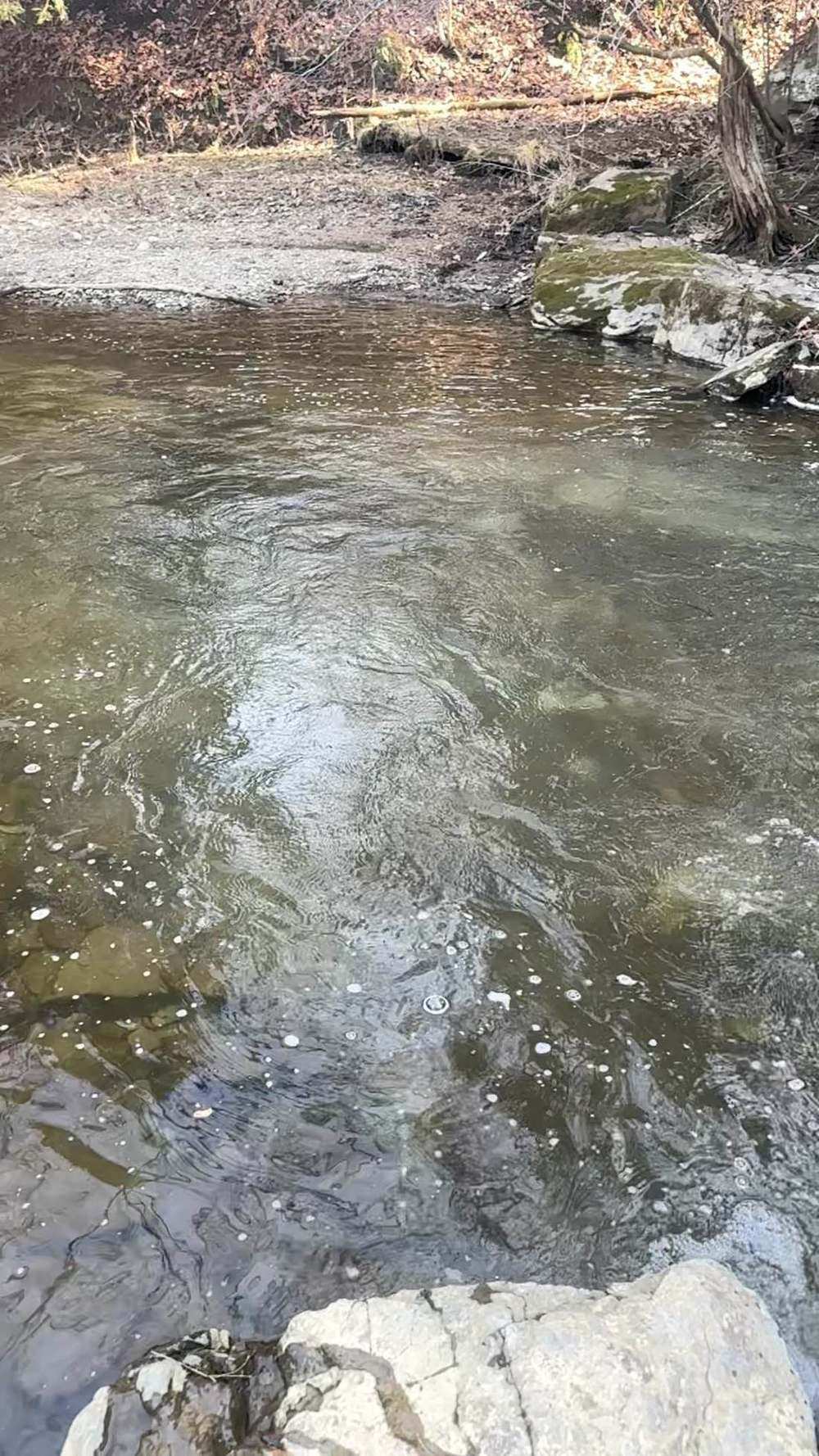
- Below ~2 m³/s — low and clear. The staircase runs thin and gin-clear; fish hold in the deeper step pools and the harbour reach.
- 2–3 m³/s — base flow. The river GRCA described on Oct 29: normal late-fall water, clear to lightly coloured, every open reach in play. Go.
- 3–5 m³/s — rising, with fishable colour. Fresh fish moving; the best steelhead water this method knows — fish it on the falling side.
- Well above ~5 m³/s — town-reach caution. The channel through Port Hope is engineered floodway as much as river (§9): fast, pushy water between walls and ledges is a wading hazard and poor fishing. Wait for the fall. These bands are a reading method, not a forecast: check the GRCA's watershed condition statements before a trip, and let the river itself make the final call.
06 — Section
5. The run, the fish, and the rules
The fishery: the Ganaraska is one of Lake Ontario's best-known migratory trout and salmon rivers, and its modern reputation rests on wild fish — the runs today are driven by natural reproduction: Chinook and coho salmon in the fall, rainbow trout (steelhead) in fall and spring, brown trout and Atlantic salmon in the mix. The Corbett's Dam fishway is the river's counting house: a pool-and-weir ladder, in operation since 1974, passing jumping fish upstream while barring sea lamprey (GRCA). The Municipality of Port Hope describes "Respect the River" as a volunteer initiative dedicated to keeping the Ganaraska River and its surrounding areas clean. No municipal source opened for this build verifies a "signed fishing zones" system; enforcement on the river is MNRF, Port Hope Police, and by-law, separate from the initiative. Seasons — reach by reach (FMZ 17). The bridges are the law:
- Zone-wide (the baseline): rainbow trout open 4th Saturday in April–September 30, limit S-2, C-1.
- Ganaraska River between the southerly limit of the CNR right-of-way and Lake Ontario — OPEN
ALL YEAR for Atlantic salmon, brown trout, Pacific salmon, and rainbow trout. This is the harbour reach.
- Ganaraska River from the south side of the Jocelyn Street Bridge to the southerly limit of the CNR right-of-way — EXTENDED FALL structure: open 4th Saturday in April–August 31 and October 15–December 31; CLOSED September 1–October 14 (fish sanctuary for that period). Today, Nov 12, this reach is OPEN — it reopened Oct 15.
- Ganaraska River, Town of Port Hope, from Highway 401 downstream to the south side of the Jocelyn
Street Bridge — FISH SANCTUARY, CLOSED ALL YEAR. This reach contains the Corbett's Dam fishway.
- Above Highway 401 — zone-wide season (closed now, until April).
- At the mouth, FMZ 20 rules apply in the lake itself (rainbow and Pacific salmon open all year, rainbow S-2,
C-1) — FMZ 17 creek rules govern in the river. Aggregate trout-plus-salmon: S-5, C-2 combined.
Licence (for US buyers): Ontario requires an Outdoors Card plus a fishing licence. The Outdoors Card costs $8.57 CAD plus 13% HST ($9.68 with tax), valid three calendar years. Non-Canadian resident fees (CAD, before HST): 1-day Sport $24.86 (the only licence not requiring an Outdoors Card), 8-day Sport $54.38, 8-day Conservation $31.52, 1-year Sport $83.19, 1-year Conservation $52.71. One-year licences expire December 31 of the licence year; Non-Canadian residents 18 and over need the card and licence — the Canadian-resident 65+ exemption does not apply to them, so non-Canadian residents 65 and over do need the card and licence — but a non-Canadian resident under 18 may fish without a card or licence when accompanied by a licence holder, with kept fish counting against that holder's limits (or may buy their own card and licence). Atlantic salmon are S-0/C-0 — catch and release only. FMZ 17 is in the Southern Bait Management Zone: live or dead baitfish or leeches may not be transported into or out of the zone. Buy online through Ontario's Fish and Wildlife Licensing Service. Sport (S) = full limits; Conservation (C) = reduced.
Verify in the current Ontario Fishing Regulations Summary before you fish — this summary is not the law.
07 — Access
6. Access, pool by pool — area-level only
Area-level only, from official sources — fish the parks and the signed areas:
- The harbour and mouth — the all-year water. The CNR-to-lake reach runs through Port Hope's harbour front: the East Beach and Rotary Park area at the mouth is the town's public waterfront face (Rotary Park, opposite Town Hall — Municipality of Port Hope). This is the always-open water in the town's signed zone system.
- Downtown below Jocelyn Street — the extended-season reach. The open Jocelyn-to-CNR water runs through downtown's riverfront: municipal parks and walkways line the lower river, with trail access at Barrett Street and Jocelyn Street (Municipality of Port Hope) Fish the park frontage; the banks between are a mix of municipal and private.
- Ganaraska Millennium Conservation Area (GRCA). Adjacent to the river at the GRCA offices; fishing is permitted under FMZ 17, on the east side of the river within the area (GRCA). Cautions: GRCA gates are closed mid-October to May, and the Municipality advises the southern access to the Ganaraska Millennium Trail is closed for Highway 401 expansion work until at least 2028.
- Port Hope Conservation Area (GRCA). GRCA: 89.94 acres (36.4 ha) beside the river, acquired in 1964; fishing is permitted under FMZ 17, with fishing trails along the former rail line. Caution: GRCA's spring 2026 note reported this area closed due to Highway 401 expansion work — confirm it is open before planning on it.
- Corbett's Dam and the Ganaraska Fishway — VIEWING ONLY. NO FISHING. The dam and its fishway stand in the year-round fish sanctuary between Highway 401 and Jocelyn Street. This is the best-known spot on the river and it is a spectacle, not a fishing spot: watch steelhead and salmon climb the ladder from the viewing areas, and do not put a line in this water at any time of year. Charges are a recurring local news item — in October 2026 five anglers were charged in a single day for fishing beneath the Jocelyn Street bridge.
- Sylvan Glen Conservation Area (GRCA). GRCA: 2.02 hectares (5 acres) in the valley north of Port Hope, acquired in 1956, the river along its northern boundary; fishing is permitted under FMZ 17. Upstream zone-wide-season water — closed in November.
- Ganaraska Forest (GRCA) — context only. The watershed's headwater forest on the Oak Ridges Moraine — not a fishing access point here.
08 — Tactics
7. Flies, tactics, and seasonal playbook
Tackle Full Great Lakes trib gear with a town-river twist: an 11–13 ft centrepin float outfit is the local instrument on the lower Ganaraska; a 9–10 ft spinning or float rod covers the harbour reach; 7–8 weight fly rods, switch and spey for the swung fly. Wading staff recommended: the town ledges are slick.
Flies and baits Egg patterns, soft beads, and roe bags lead for steelhead and browns; in the fall salmon season, larger egg patterns and skein in the harbour and lower pools. Nymphs — stoneflies, caddis, small mayflies — in the step pools; streamers swung through the wider runs. In clear base-flow water, everything shrinks a size; in coloured falling water (§4's 3–5 band), one size up and one shade brighter.
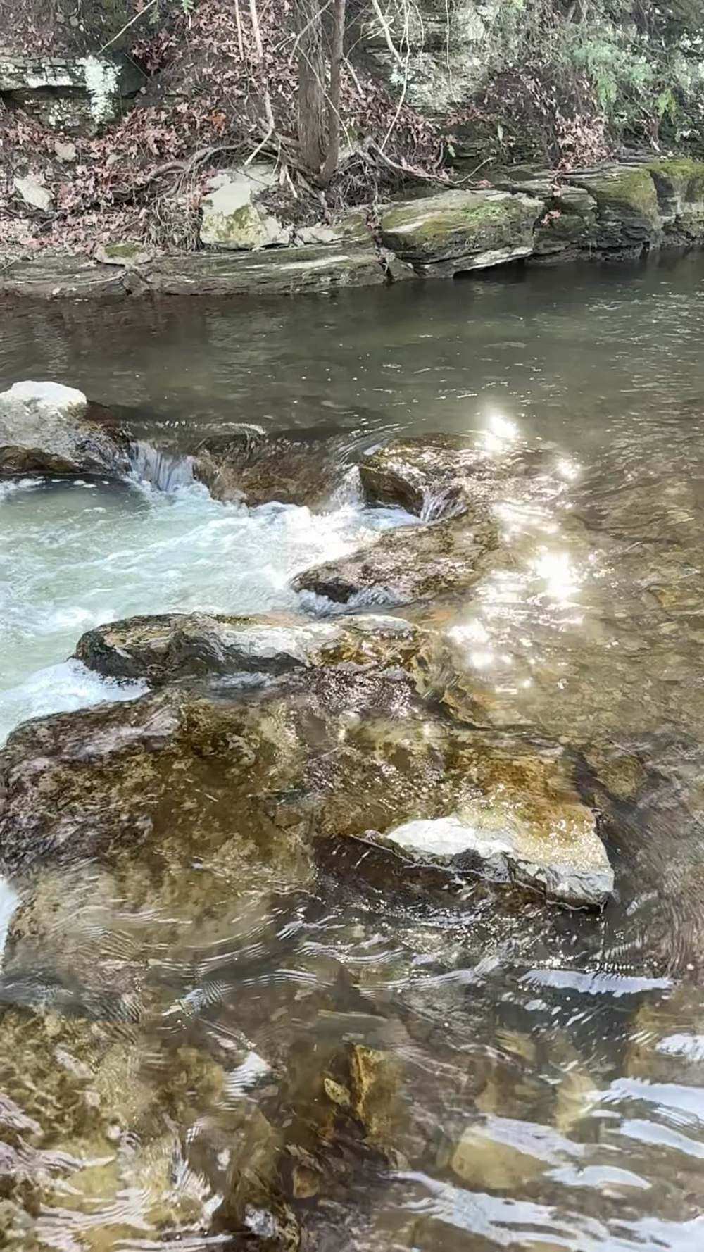
How to fish it Fish the reaches in order of the rules, not the rumours: start at the harbour and the all-year water at first light, work the open downtown reach's step pools and seams through the morning, and let the sanctuary be a viewing stop, never a fishing stop. The town channel fishes like a staircase — short pools separated by limestone ledges — so drifts are short and controlled, and position beats casting distance. The signed, legal water a few pools from the famous spots usually fishes better, and always calmer.
Seasonal playbook
Fall (Sep–Nov)
Chinook and coho from late August through October — remembering the Jocelyn–CNR reach closes Sep 1–Oct 14 and reopens Oct 15; browns and first steelhead behind them; November is steelhead water in the harbour and the reopened downtown reach.
Winter (Dec–Feb)
steelhead in the all-year harbour reach and, to Dec 31, the extended-season reach; cold, clear, quiet — the local centrepin season.
Spring (Mar–May)
the steelhead run proper; the zone-wide opener (4th Saturday in April) opens the river above Highway 401, including Sylvan Glen; the fishway runs full of climbing trout — watch it from the viewing area.
Summer (Jun–Aug)
the migratory game rests; the all-year mouth reach stays open, and the river belongs to the town and the trails.
09 — Section
8. Techniques in depth — fishing the Ganaraska River
The primary rig: a centrepin float rig, set for a staircase The Ganaraska through town is float water by culture and by geometry, and the centrepin is its native instrument. The channelled reach is a staircase of short step pools over limestone ledges: drifts are measured in single metres, and control — not distance — is the whole skill. Rig a small-to-medium float, shot bulked low with a short staggered tail, so the bait drops fast into the pockets and holds its lane; set depth to tick the ledge tops lightly, because a bait above these fish is scenery, and a dragging bait is snagged. The centrepin earns its keep on the mend: in pools this short the drift is over in seconds, and a free-spooling reel lets you stretch it —
feeding line at the pool head, checking it at the tail — without lifting the bait out of the lane. The staircase rewards the methodical.
Bait selection by clarity With no gauge, clarity is your gauge — read it at the bridge before you rig. At clear base flow (the 2–3 m³/s GRCA base), this river's wild steelhead are fully lit and fully suspicious: small soft beads in pale tones, single egg patterns, and thumbnail roe bags in fine netting. In the fishable-colour window on a falling rise, the same fish turn honest: a full dime-size sac with a floater, brighter netting, egg patterns a size larger — fished in the seams and pool tails while the colour lasts. For browns, at the edges of light, a nymph or small streamer swung tight to the ledges can outfish bait outright.
Forage notes — Ganaraska River in mid-November The Ganaraska — the Ganny — is a wild-fish river: its runs are driven by natural reproduction, Chinook and coho in the fall, rainbows in fall and spring, with the Corbett's Dam fishway, passing fish since 1974, as its counting house, up a channelled limestone staircase through downtown Port Hope. That salmon egg pulse is spent by mid-November, and there is no live gauge to tell you so — clarity, read at the bridge, is your gauge.
Egg presentations still lead in the open water. Nothing here is a recommendation for the year-round fish sanctuary — Highway 401 downstream to the south side of the Jocelyn Street Bridge, including the fishway, is closed all year (§5) — or for any reach closed on your date. Shiners hold deep off the harbour mouth; crayfish are tucked into the limestone, inactive.
Lead — eggs (roe)
roe bags, beads (6–10 mm) and single eggs, sized to clarity — small soft beads in pale tones, single egg patterns and thumbnail bags in fine netting at clear base flow (the 2–3 m³/s GRCA base); a full dime-size sac with a floater and brighter netting in the fishable-colour window on a falling rise (§8).
Secondary — sculpins and stoneflies
for browns at the edges of light, a nymph or small sculpin/streamer pattern swung tight to the ledges (§8) — the second look, behind eggs for steelhead.
Harbour and mouth only — shiners
at the mouth and harbour reach — the all-year water below the CNR right-of-way — a live shiner on a bobber is a standing go-to, where the zone rules allow live bait.
Where they hold, by level At low, clear water — below base — the fishery contracts to depth: the harbour reach, the deepest step pools in the staircase, and any slot with overhead cover; the ledges between go empty at midday. At base flow, fish spread through the open reaches: pool heads, tailouts, and seam water along the channelled banks. On a rise into the 3–5 band, fresh fish travel; they pause in the first pools above the harbour and at every ledge that gives them a rest, and the falling side of that rise is this river's prime time. Well above it, fish hold against the walls and in the softest inside water — and that water is floodway first, fishery second (§9).
The secondary method The swung fly. In the wider water of the open reaches, a switch or spey rod swinging a streamer or wet fly across the current covers water the float cannot — long swings through the broader pools, the take coming at the hang-down. It beats the float when steelhead are spread and travelling on a falling river, when fish are chasing rather than sitting, and in the spring run above the highway, where the river opens out beyond the town staircase.
Seasonal adjustment
Winter is a clarity-and-temperature adjustment on the water that stays open: the harbour reach all year, the downtown reach to Dec 31. Slow everything — smaller beads and bags, deeper and slower drifts through the harbour pools, midday fishing. The centrepin's fine control is worth more in January than in any other month here: winter steelhead sit deep and eat close, and they want the offering at walking pace, in the lane, without drag.
10 — Section
9. Safety
The town reach you fish is a flood monument: in March 1980 the Ganaraska peaked at 421 m³/s and put 66 acres of downtown under up to 1.5 m of water; the channel was then widened and deepened for roughly 1,000 m — you are wading in a floodway that fishes. Check GRCA watershed condition statements before a trip, treat a rising, colouring river in the town channel as an order to get out, and never wade the staircase in high water. The ledges are algae-slick limestone in every season; a wading staff and studded boots are equipment, not caution theatre. Mind your backcast around the walkways in the fall crowds, and dress for a dunk in the cold lake wind.
11 — Section
10. What is inside the living edition
Same promise as every Keystoned Steel guide:
- This river has no live discharge gauge — and the guide says so plainly. The living edition works from the GRCA monitoring network and GRCA's published flow statements, stated honestly.
- Live weather & radar built right into the guide.
- Verified access where it exists — and where access is private, fee-based, or permission-only, the guide says so plainly instead of faking a parking lot.
- Flow windows — the method bands that say go, wait, or stay home, printed with their sources.
- Buy once — updates to the guides you bought are free. A living edition that stays current all season.
Sources (Nov 12, 2026 build)
- ECCC hydrometric station registry (api.weather.gc.ca), checked Nov 12, 2026: WSC 02HD001 (at Port
Hope) and WSC 02HD002 (near Dale) both DISCONTINUED — no active WSC discharge gauge on this river.
- GRCA, Flood Forecasting & Warning page (grca.on.ca), checked Nov 12, 2026: Sylvan Glen station — level and temperature; Osaca station — level, water and air temperature.
- GRCA media release, "Beavers on the Lower Ganaraska River," Oct 29, 2026 (grca.on.ca): base flows currently 2 to 3 m³/s; last major precipitation Oct 16; beaver dam in a side channel south of Jocelyn Street, not blocking main flow.
- GRCA, Corbett's Dam & Fishway page (grca.on.ca), checked Nov 12, 2026: dam part of an 1800s distilling/brewing complex; Thomas Molson bought the property in 1851; Dr. Robert Corbett bought the power system in 1889, larger dam 1893; fishway built 1973, operating since 1974 — pool-and-weir, 90 ft × 5 ft, nine pools, ~12 ft lift; GRCA took ownership in 1975.
- GRCA, Conservation Areas page (grca.on.ca), checked Nov 12, 2026, and GRCA fishing season note, April
2026: Millennium CA — fishing permitted under FMZ 17, east side of the river; Port Hope CA — 89.94 acres, fishing permitted, fishway (sanctuary) south of Highway 401, area reported closed in spring 2026 for Highway 401 work; Sylvan Glen CA — 2.02 ha, acquired 1956, fishing permitted; gates closed mid-October to May.
- GRCA, Our History page (grca.on.ca), checked Nov 12, 2026: flood of March 21, 1980 — peak 421 m³/s,
66 acres of downtown flooded to 1.5 m; river widened and deepened over ~1,000 m afterward.
- Municipality of Port Hope, Trails page (porthope.ca) and tourism calendar (calendar.porthope.ca), checked
Nov 12, 2026: Ganaraska Trail starts at the cairn in Rotary Park opposite Town Hall; trail access at Barrett Street and Jocelyn Street; sanctuary and season dates as in §5.
- Ontario Fishing Regulations Summary, FMZ 17 (ontario.ca), verified Nov 12, 2026: reach-by-reach
Ganaraska seasons and limits as in §5.
Ontario licensing fees, verified Nov 12, 2026
Outdoors Card $8.57 CAD + 13% HST; non-Canadian resident fees as in §5.
Northumberland Daily, Oct 19, 2026
five anglers charged Oct 17 with fishing in the sanctuary beneath the
Jocelyn Street bridge.
- Port Hope History (porthopehistory.com), "The Story of a Town," and Ganaraska Hiking Trail Association,
About page (ganaraska-hiking-trail.org), checked Nov 12, 2026: name from Ganaraské, the Cayuga village at the mouth; possible meaning "spawning ground"; Mississauga names Pematascutiang and Cochingomink;
Port Hope in use from 1819; Hope Township named for Colonel Henry Hope.
- Stage 3 Archaeological Assessment, Mason Homes Port Hope (Municipality of Port Hope, 2018): trading post at the mouth from 1778; Peter Smith's log cabin at the mouth; Crown patent granted 1797 to Elias Smith and Jonathan Walton.
- Watershed Magazine, "Respecting the River," checked Nov 12, 2026: 1830s salmon taken by torch and spear; Atlantic salmon extinct in Lake Ontario by 1896; fishway passes ~1,000–2,000 salmon per day at peak.
- Weather: weather.com, Toronto, Nov 12, 2026 (45°F at dawn, high 46°F, low 35°F, wind NE 15–18 mph gusting 25; sunrise 7:07 AM, sunset 4:55 PM EST).
Lore, Legends & History The Ganaraska's name is the first thing about it that nobody can quite settle, and the honest telling keeps the argument in. The name is thought to come from Ganaraské — the Cayuga village that stood at the river's mouth, on the townsite of modern Port Hope. What the word itself means is where the tellings part company. The Ganaraska Hiking Trail Association's history offers that in Iroquois it may mean "spawning ground." A linguistic account making the rounds in recent years renders the Cayuga word as "the place of the great swamp." This guide prints the disagreement rather than a winner: the village is documented, the translations are contested, and a river that has carried three peoples' names for the same water — the Mississauga who followed the Cayuga called the river Pematascutiang and their village Cochingomink, "the beginning of the portage" — has earned its contested etymology honestly. The English layer of the name is a fur trader. By 1778 a trading post stood at the mouth, and Peter Smith — a trader remembered in the local histories for honest dealing — built his log cabin near the mouth; the place took the English name Smith's Creek from him, and kept it through the Loyalist settlement of the 1790s, when Elias Smith and Jonathan Walton received the Crown patent for the townsite in 1797 and laid out the mills and the village plan. After the War of 1812 the village wanted a grander name, tried "Toronto" for a few years, and
settled, in the late 1810s — 1817 in most tellings, 1819 in the town's own story — on Port Hope, after Hope Township, itself named for Colonel Henry Hope, a former lieutenant-governor of Quebec. The harbour name won. The river kept the older one. The dam that defines the modern river has a layered name too. Corbett's Dam began as part of a distilling and brewing complex in the 1800s; Thomas Molson, son of John Molson, bought the property in 1851, dam, brewery, distillery and all. The Corbett in the name is Dr. Robert Corbett, who bought the Port Hope electric light and power system in 1889; the generating plant moved to the dam site and a larger dam was built in 1893.
Power ran until 1912. For the fish, the dam was simply a wall, and for decades the migration was handled the human way: fish were lifted over it by hand. In 1973 conservation groups built the fish ladder, and since 1974 the Ganaraska Fishway has done the lifting — a pool-and-weir ladder, 90 feet long and 5 feet wide, nine pools climbing roughly 12 feet, designed to pass jumping fish and bar the sea lamprey. The GRCA took ownership of the dam in 1975. Everything a modern angler knows about this river — the crowds at the ladder in September, the sanctuary below it — flows from that 1973 decision to give the fish a staircase of their own.
And then there is the water itself, and the night the river took the town. Port Hope had flooded dozens of times before, but on March 21, 1980, rain on frozen ground sent the Ganaraska to a peak of 421 m³/s, and 66 acres of downtown went under water up to 1.5 metres deep, with force enough to knock down building walls. The rebuilding remade the river through town: the channel was widened and deepened for roughly 1,000 metres to carry flood flows through the downtown. The staircase of step pools a steelheader wades today is partly the flood's legacy. Port Hope now marks it the way river towns do: every spring, the Float Your Fanny Down the Ganny race puts homemade rafts on the river that nearly took the town.
Underneath all of it runs the oldest story, the fish. The Ganaraska was an Atlantic salmon river before it was anything else: settlers in the 1830s took salmon by torch and spear, barrels of them in a night, and by 1896 the species was extinct in Lake Ontario — dams, mills, spears, and cleared forests doing together what none could do alone. The salmon in the river today are Pacific fish and the trout are largely wild, but standing at the fishway in September, watching a Chinook climb the ladder, you are watching the river's first story retold with new actors. The name may mean spawning ground after all. The fish, at least, behave as if it does.
Night fishing — working the holes after dark First, the law on this water. Ontario night fishing runs under the OMNRF zone rules for this water plus any sanctuary and park or conservation-area hours this guide lists — several creek-mouth sanctuaries and park accesses on this shore close seasonally or keep day-use hours. Where this guide lists a closure or an access schedule, it governs: be out of closed water and out of the access on time, and fish the tactics below only where the night is open. The year-round sanctuary (Hwy 401 to the south side of the Jocelyn St Bridge, including the fishway) is never night water, and GRCA gates close mid-October to May — confirm which accesses are open before planning a night session. After dark, the run changes address on Ganaraska River, ON. Steelhead that travelled and held in the fast water by day settle into the deep holes — the slow, dark water at the head of the pool, along the ledge and the undercut bank, and the soft seam beside the fast tongue — and they feed there with a confidence they never show at noon. The deep holes are the night fishery: fewer fish moving, more fish eating.
Working a hole in the dark is a memory exercise before it is a fishing exercise. Fish the hole in daylight first: learn where it deepens, where the wood and the ledges sit, where you will stand, and where a hooked fish can be landed. At night, work it top to bottom in short steps — a cast or two across the head, down the seam, into the tail — slow, deep and close to the bottom, with long pauses; a steelhead at night does not chase, it intercepts.
Two profiles speak at night: glow — a glow bead, glow egg or chartreuse presentation where a little light helps the fish find it — and dark — a black or black-olive streamer or nymph silhouetted against the night sky. The dark profile works because it reads to a night-feeding fish as a bottom forage fish on the move — big, slow, and tight to the substrate. Light discipline is not optional: a headlamp shone into a hole ends the fishing in it — keep the light on the bank and on your feet, red or dim when you have it, and rest a lit-up hole before fishing it again.
Sound carries the same way. Safety doubles after dark: never wade at night water you have not waded by day, belt cinched and staff in hand, tell someone the reach and the return time — a fall in cold water at night is a survival event, not a soaking. Tonight's night pick — kept live with this guide's bait rotation. The rotation updates the night pick for this water on the same cycle as the day picks, off the forage calendar and the current clarity and flow.
Current-season default: a glow roe bag under a float at the head of the hole; dark second, a black streamer swung at a crawl along the seam.
12 — Posted & Access
Posted Land & Access Trails
The Ganaraska is the most rule-bound river in this pack and, unusually, one of the better-doored ones: a municipal harbour and riverfront trail system at the mouth, two GRCA conservation areas in the Highway 401 corridor, and one small GRCA valley parcel upstream — five verified public doors, walked below from the lake to Sylvan Glen. But the doors and the seasons do not line up the way an angler expects. The river's most famous water — the downtown Port Hope ladder reach at Corbett's Dam — is a fish sanctuary, closed to fishing all year, and the downtown reach below it closes again every fall from September 1 to October 14. A door tells you whose ground you may stand on; the staircase in Seasonal tells you whether the water in front of it is open at all. Read both before you rig. Checked November 2026.
The public water — access areas & easements
Mouth to upstream:
The harbour and mouth — East Beach / Rotary Park waterfront, Port Hope (Municipality of Port Hope)
The town's public waterfront face for the all-year reach (CNR right-of-way to Lake Ontario — see Seasonal). The Municipality's Trails page places the start of the Ganaraska Trail at the cairn in Rotary Park along the Ganaraska River, opposite the Town Hall; its Waterfront and Beaches page adds that the boat launch is open year-round at no cost to the user and the fish cleaning station is located along Mill Street South, and describes the Ganaraska in Port Hope as offering "some of the most diverse fishing experiences in the Province." East Beach, at Mill Street South and Madison Street, is the lake side of the same waterfront: sandy swimming beach, playground, public washrooms at the nearby Marina building May–October, Waterfront Trail access from the beach; municipal beaches open the first Monday in May and close the first Monday in October, hours 7:00 a.m. to 11:00 p.m. (Municipality of Port Hope, Beaches). The municipal pages opened do not print a separate riverbank fishing rule for this waterfront — the fishing here runs under the FMZ 17 staircase below and the town's posted notices.
Downtown riverfront — Ganaraska Hiking Trail, Barrett Street and Jocelyn Street access points (Municipality of Port Hope)
The Municipality's Trails page: the Ganaraska Hiking Trail's Pine Ridge section "offers an enjoyable walk along the banks of the Ganaraska River to the Port Hope Conservation Area near the Highway 401 underpass," with access points at Barrett Street and Jocelyn Street, features listed as "river access," surface natural/grass/gravel, walkers only; the same page warns the section should be avoided during wet spring high flows. This trail frontage is the public way along the extended-season downtown reach (Jocelyn Street Bridge to the CNR right-of-way — see Seasonal). The banks between the trail and the neighbouring parcels are a mix of municipal and private — the GRCA's own wording for its neighbouring conservation area applies here too: respect neighbouring properties and do not enter private property. Note also the Trails page's standing notice: the southern access point to the Ganaraska Millennium Trail will be closed for highway expansion work until at least 2028.
Ganaraska Millennium Conservation Area (Ganaraska Region Conservation Authority)
The GRCA's Conservation Areas page: the area is adjacent to the Ganaraska River at the GRCA Administrative Offices, with a two-kilometre looped trail around a wetland that was once the Molson Pond, across the river from Port Hope Conservation Area; "Fishing is permitted and regulated through the Province of Ontario, which includes the possession of a valid fishing license and respecting provincial catch limits. Anglers must follow provincial fishing practices for Zone 17"; swimming is not permitted. The GRCA's April 24, 2026 fishing-season release narrows the fishing to one bank: "Fishing can occur on the east side of the Ganaraska River, within the Ganaraska Millennium Conservation Area (CA)." Fish the east side only, and know exactly where you stand relative to the sanctuary boundaries in Seasonal — the year-round sanctuary corridor adjoins this part of the river, and a sanctuary line, not a park boundary, decides whether a cast is legal. GRCA conservation areas generally are free of charge, dawn until dusk, gates closed mid-October to May, no camping or open flame (GRCA, Conservation Areas).
Port Hope Conservation Area (Ganaraska Region Conservation Authority) — CLOSED at the last official check
The GRCA's Conservation Areas page: 89.94 acres (36.4 ha) tucked beside the Ganaraska River, land acquired February 3, 1964; "Greenspaces are found between the parking lot and Ganaraska River, fishing trails extend along the former rail line"; fishing is permitted under provincial licence and Zone 17 limits; swimming and camping are not permitted; "The Ganaraska Fishway (fish sanctuary) is on the south side of Highway 401." That is the standing description — the current status is different: the GRCA's April 24, 2026 release states "Port Hope CA will remain closed due to Highway 401 expansion work," and the Municipality's Trails page separately notes the southern access to the Ganaraska Millennium Trail closed for the same highway work until at least 2028. Do not plan on this door until the GRCA reopens it; it is listed here, with its closure, because it is a real GRCA river parcel whose status will change.
Sylvan Glen Conservation Area (Ganaraska Region Conservation Authority)
The GRCA's Conservation Areas page: located in the Ganaraska River valley, acquired in 1956; "The Ganaraska River flows along the northern boundary of this 2.02 hectares (5 acres) Conservation Area"; used for passive recreation including fishing; fishing is permitted under provincial licence and Zone 17 limits; swimming is not permitted; the annual Float Your Fanny Down the Ganny river race starts from this area. The GRCA's April 24, 2026 release confirms Sylvan Glen "is also available for fishing, while being mindful of property lines." This is upstream, zone-wide-season water — it sleeps under the zone-wide season until the fourth Saturday in April (see Seasonal). Same GRCA-wide terms as stop 3: free of charge, dawn until dusk, gates closed mid-October to May.
Above the run — the Ganaraska Forest is not a fishing door. The GRCA's Ganaraska Forest (about 11,000 acres on the Oak Ridges Moraine headwaters) is the watershed's protective forest, established to stabilize and protect the river's headwaters (GRCA, Forest Resource Management). Its own page lists its recreation as hiking, mountain biking, horseback riding, cross-country skiing, snowshoeing and nature appreciation, with motorized use in the West and East Forests only — fishing is not among the activities the GRCA lists for the Forest — and every visitor requires a Forest Membership or Day Pass, dawn until dusk (GRCA, About the Ganaraska Forest). It is named here so nobody mistakes a Forest pass for a river access: no GRCA source opened for this build names a Ganaraska River fishing access in the Forest. No other named public river access above Sylvan Glen was verified in the sources opened. Treat the upper banks as private until a sign or a listing says otherwise.
Posted & private — stay out
Ontario access law — the spine
Ontario has NO purchased-easement chain like New York's PFR and NO statutory bank-walking right like Michigan's MCL 324.73102(3). The public doors are conservation-authority lands, municipal parks, and Crown beds — everything else is permission water. The Fish and Wildlife Conservation Act, 1997 prohibits fishing in contravention of the Trespass to Property Act: fishing on private property requires the occupier's permission (OFAH "Ask a CO," answered by MNRF's Provincial Enforcement Specialist: "generally a person can only fish or hunt on private property with permission from an occupier of that property").
The bed decides, reach by reach
Streambed ownership varies reach by reach on the same river — in the MNRF answer's words, it "can vary significantly, both across the province and even within different stretches of an individual river or stream," and bed ownership may differ from the ownership of the banks beside it. If the bed is Crown, an angler may walk/wade the watercourse regardless of who owns the banks; if the bed is privately owned, wading needs the occupier's permission. Floating on navigable water is a navigation right; stepping onto a private bed is not. The Beds of Navigable Waters Act presumes the bed of a navigable water did NOT pass with a Crown grant absent an express grant — but pre-1911 and express grants can make beds private, so no reach's bed status can be asserted without checking; the MNRF district office is the arbiter, and MNRF directs bed-ownership questions there. No reach of the Ganaraska's bed ownership was verified for this build, and this chapter asserts Crown-bed wading rights for no reach of this river. [Bed ownership by reach: UNVERIFIED — see Verification log.]
A licence is not a trespass permit
parking, bank use, and trails are the land manager's rules. The Municipality's own sanctuary update adds the town-level version: park only in designated areas, dispose of fish waste at the fish cleaning station or take it home, and carry your licence and produce it on request (Municipality of Port Hope, Fish Sanctuary and Extended Fall Season Update).
Corbett's Dam and the Ganaraska Fishway — VIEWING ONLY. NO FISHING
The dam and its fishway stand inside the year-round fish sanctuary (Highway 401 downstream to the south side of the Jocelyn Street Bridge — see Seasonal). The GRCA's Corbett's Dam & Fishway page: the fishway has operated since 1974, a pool-and-weir ladder 90 feet long and 5 feet wide, nine pools climbing about 12 feet, built to pass jumping fish and bar sea lamprey; the GRCA took ownership of the dam in 1975. Port Hope Tourism's Fish Migration page calls the fishway "the best vantage point for seeing these fish in action" and prints it plainly: "*No fishing allowed in this area." Watch the salmon and steelhead climb from the viewing areas. Do not put a line in this water at any time of year — this is the famous downtown ladder reach, and it is sanctuary, closed all year, however many people are standing there watching fish.
The GRCA says it for its own ground
at Port Hope Conservation Area, "Please respect neighbouring properties and do not enter private property" (GRCA, Conservation Areas). The same rule runs the whole river: downtown, the trail and park frontages in the route list are the public ground; the banks between them are a mix of municipal and private, and a worn path is not a right of way.
Everything not named above is permission water
A stocking record, a race route, or a crowd of watchers at the ladder is not an access listing — where this chapter names a site, a GRCA or municipal source names it first.
Seasonal & changing access
Zone-wide baseline (FMZ 17, 2026 Ontario Fishing Regulations Summary, ontario.ca): rainbow trout season fourth Saturday in April to September 30, S-2/C-1; brown trout S-5/C-2; Pacific salmon S-5/C-2; Atlantic salmon S-0/C-0; aggregate trout+salmon S-5/C-2. Above Highway 401 the Ganaraska is zone-wide water — Sylvan Glen (stop 5) fishes on this season and no other.
Open ALL YEAR (Atlantic salmon, brown trout, Pacific salmon, rainbow trout; zone-wide limits apply): Ganaraska River — between the southerly limit of the CNR (Canadian National Railway) right-of-way and Lake Ontario. This is the harbour reach at stop 1.
SPLIT EXTENDED SEASON — open fourth Saturday in April to August 31 AND October 15 to December 31 (same four species, zone-wide limits): Ganaraska River — from the south side of the Jocelyn Street Bridge (43°58′1.77″N, 78°17′43.77″W) to the southerly limit of the CNR right-of-way (43°56′48.51″N, 78°17′31.93″W). This is the downtown reach at stop 2.
FISH SANCTUARY — NO FISHING SEPTEMBER 1 TO OCTOBER 14: that same reach — from the south side of the Jocelyn Street Bridge to the southerly limit of the C.N.R. right-of-way, coordinates as above. The fall salmon closure sits inside the split season: the downtown reach opens in spring, closes for the six peak migration weeks, and reopens October 15. The Municipality's reminder states the same closure and its purpose — it "protects vulnerable fish during peak migration to their spawning grounds" (Municipality of Port Hope, Fish Sanctuary and Extended Fall Season Update).
FISH SANCTUARY — CLOSED ALL YEAR: Ganaraska River — Town of Port Hope, from Highway 401 downstream to the south side of the Jocelyn Street Bridge. This takes in the famous downtown Port Hope ladder reach: the Corbett's Dam / fish-ladder water is sanctuary, closed all year, however many people watch fish there. Viewing is a municipal draw — Port Hope Tourism promotes the fishway as the best vantage point on the river — and fishing there is closed in every month, for every species.
Changing ground, checked November 2026: Port Hope Conservation Area (stop 4) remains closed for Highway 401 expansion work per the GRCA's April 24, 2026 release, and the southern access to the Ganaraska Millennium Trail is closed for the same work until at least 2028 per the Municipality's Trails page. GRCA conservation areas keep dawn-to-dusk hours with gates closed mid-October to May — a season opener in April can still meet a closed gate; check the GRCA before driving to stops 3–5 in the shoulder months.
Licence. A Pennsylvania resident is a "non-Canadian resident" in Ontario law. 18+ needs an Outdoors Card ($8.57, valid 3 calendar years) PLUS a fishing licence — 2026 fees (ontario.ca, +13% HST): 1-year Sport $83.19, 8-day Sport $54.38, 1-day Sport $24.86 (the 1-day needs NO Outdoors Card), 1-year Conservation $52.71, 8-day Conservation $31.52. Licences run on the calendar year (expire Dec 31). Under-18 non-Canadian residents may fish under a licensed adult's limits. Carry the Outdoors Card + Licence Summary (the official PDF on a phone is valid; a screenshot is not). FMZ 17 is in the Southern Bait Management Zone: live or dead baitfish or leeches may not be transported into or out of the zone.
Report changes. Highway work, conservation-area closures and sanctuary dates change on agency schedules, not fishing seasons. If a gate, closure sign or season board on the ground disagrees with this chapter, the sign and the current Ontario Fishing Regulations Summary govern — and tell us, so the living edition can be corrected.
Sources for this section: Ontario Fishing Regulations Summary, Fisheries Management Zone 17 (ontario.ca) — zone-wide seasons and limits; additional fishing opportunities (Ganaraska River CNR-to-lake open all year; Ganaraska River Jocelyn Street Bridge to CNR split season, fourth Saturday in April–August 31 and October 15–December 31, with coordinates); fish sanctuaries (Ganaraska River, Town of Port Hope, Highway 401 to south side of Jocelyn Street Bridge — no fishing, closed all year; Ganaraska River, Jocelyn Street Bridge to C.N.R. right-of-way — no fishing September 1–October 14); Southern Bait Management Zone note. Ganaraska Region Conservation Authority, Conservation Areas (grca.on.ca) — Ganaraska Millennium Conservation Area (adjacent to the Ganaraska River, two-kilometre looped trail, fishing permitted, Zone 17); Port Hope Conservation Area (89.94 acres / 36.4 ha, acquired February 3, 1964, fishing trails along the former rail line, fishing permitted, fishway sanctuary south of Highway 401); Sylvan Glen Conservation Area (2.02 ha / 5 acres, acquired 1956, river along northern boundary, fishing permitted); GRCA-wide terms (free of charge, dawn until dusk, gates closed mid-October to May, no camping or open flame). GRCA news release, "Fishing Season Opens April 26, 2026" (grca.on.ca, Apr. 24, 2026) — fishing on the east side of the river within Ganaraska Millennium CA; Sylvan Glen CA available for fishing, mindful of property lines; Port Hope CA remains closed due to Highway 401 expansion work. GRCA, Corbett's Dam & Fishway (grca.on.ca) — fishway in operation since 1974, pool-and-weir, 90 ft × 5 ft, nine pools, ~12 ft lift, GRCA ownership of the dam 1975. GRCA, Fishing in the Ganaraska (grca.on.ca) — FMZ 17, GRCA/Municipality of Port Hope/MNRF angler education. GRCA, About the Ganaraska Forest and Forest Resource Management (grca.on.ca) — Forest day pass/membership required, dawn until dusk, listed activities without fishing, headwater protection. Municipality of Port Hope, Trails (porthope.ca) — Ganaraska Trail cairn in Rotary Park opposite Town Hall; Ganaraska Hiking Trail along the banks to Port Hope Conservation Area, access points Barrett Street and Jocelyn Street, "river access"; Ganaraska Millennium Trail southern access closed for highway expansion until at least 2028. Municipality of Port Hope, Waterfront and Beaches (porthope.ca) — boat launch open year-round at no cost, fish cleaning station on Mill Street South. Municipality of Port Hope, Beaches (porthope.ca) — East Beach at Mill Street South and Madison Street, washrooms May–October, beach season first Monday in May to first Monday in October, 7:00 a.m.–11:00 p.m. Municipality of Port Hope, Fish Sanctuary and Extended Fall Season Update (porthope.ca, Oct. 9, 2024) — September 1–October 14 sanctuary, October 15–December 31 extended season, park only in designated areas, Respect the River volunteer program. Port Hope Tourism, Fish Migration (visitporthope.ca) — fishway best vantage point, "No fishing allowed in this area," zero-tolerance enforcement by MNRF, Port Hope Police Service and municipal by-law. OFAH, "Ask a CO" (ofah.org), answers by David Critchlow, Provincial Enforcement Specialist, MNRF. Beds of Navigable Waters Act, R.S.O. 1990, c. B.4, s. 1 (ontario.ca). Ontario licence fees and Outdoors Card terms per the verified Nov 18, 2026 licence spine (ontario.ca). Checked November 2026.
The Bottom Line
The Ganaraska — "the Ganny" to everyone who fishes it — is the north shore's town river: wild, naturally reproducing steelhead and salmon running out of Lake Ontario, up a channelled limestone staircase through downtown Port Hope, to a fishway at Corbett's…
Legal · Read last
LEGAL DISCLOSURE — Keystoned Steel Guides
What Keystoned Steel warrants. Keystoned Steel warrants only that, as of the edition date stated in this guide, the access, gauge, and regulation information in this guide that is attributed to a cited official source accurately reflects that source as published on that date. If a material error in that information is confirmed, Keystoned Steel will issue a corrected edition to the original buyer at no charge or, if it does not do so within 30 days after confirming the error, refund the price you paid. That is the sole express warranty provided with this guide.
This guide does not warrant or guarantee:
- (a) Stream conditions, water levels, clarity, or weather — conditions change daily and can change after any
reading printed here;
- (b) Fishing success — no representation is made that fish are present, in any number, size, or location, at any
time;
- (c) Access — access status, parking, and public access rights can change, be posted, or be withdrawn at any
time; inclusion of a reach in this guide is not permission to fish it, and is not a representation that access is currently open;
- (d) Third-party data — Gauge readings, including Water Survey of Canada / Environment and Climate Change
Canada data, agency publications, and maps, originate from third-party sources. Keystoned Steel does not control those sources and cannot guarantee their accuracy, completeness, availability, or continued accessibility.
Third-party information may be provisional, delayed, revised, or incorrect. Its inclusion does not constitute an independent guarantee by Keystoned Steel of the underlying data;
- (e) Regulations — seasons, creel and size limits, and special-reach rules change; the regulations summarized
here are a convenience summary only and are not the law.
Your responsibilities. Before you fish: confirm the current regulations in the current Ontario Fishing Regulations Summary (Ontario Ministry of Natural Resources); hold the required licence — in Ontario an Outdoors Card plus a valid fishing licence; verify access is open and lawful for the reach you fish; respect posted signs and private land — a fishing licence is not a permit to trespass. Wading and stream fishing involve inherent risks, including fast or rising water, slippery rock, and remote terrain; you fish at your own risk and are responsible for your own safety decisions. This safety warning and assumption of risk do not waive or limit any liability, warranty, or remedy that cannot lawfully be waived or limited under applicable law.
Corrections and refunds. If you believe this guide contains a material error, email keystonedsteel@gmail.com or message our Facebook Page with the guide name and the error. Keystoned Steel will review it against the cited sources within 30 days. If the error is confirmed, you will receive a corrected edition or, at Keystoned Steel's election, a refund of the price you paid. That remedy is your sole and exclusive remedy for errors in this guide. Limitation of liability. TO THE FULLEST EXTENT PERMITTED BY APPLICABLE LAW, KEYSTONED STEEL'S TOTAL LIABILITY ARISING OUT OF THIS GUIDE WILL NOT EXCEED THE PRICE YOU PAID FOR IT, AND KEYSTONED STEEL WILL NOT BE LIABLE FOR INDIRECT, INCIDENTAL, OR CONSEQUENTIAL DAMAGES, INCLUDING TRIP COSTS, CITATIONS OR FINES, OR PERSONAL INJURY ARISING FROM YOUR USE OF THIS GUIDE. NOTHING HERE LIMITS LIABILITY FOR GROSS NEGLIGENCE OR WILLFUL MISCONDUCT. License. This guide is licensed to the original buyer for personal use only. It is nontransferable and may not be shared, resold, or redistributed without the prior written consent of Keystoned Steel. Living-edition updates are delivered only to the original buyer's purchase email.
TO THE FULLEST EXTENT PERMITTED BY APPLICABLE LAW, THE WARRANTY SET FORTH ABOVE IS THE SOLE EXPRESS WARRANTY PROVIDED BY KEYSTONED STEEL FOR THIS GUIDE, AND KEYSTONED STEEL DISCLAIMS ALL OTHER WARRANTIES, EXPRESS OR IMPLIED, INCLUDING ANY IMPLIED WARRANTY OF MERCHANTABILITY AND ANY IMPLIED WARRANTY OF FITNESS FOR A PARTICULAR PURPOSE. NOTHING IN THIS DISCLOSURE SHALL EXCLUDE OR LIMIT ANY WARRANTY, RIGHT, OR REMEDY THAT CANNOT LAWFULLY BE EXCLUDED OR LIMITED UNDER APPLICABLE LAW.