
Keystoned Steel // Field Guide
Chautauqua Creek
GAUGE — USGS 04213319 · Hawley Road
The brief
class="v-brief">Why this guide: Chautauqua Creek at Westfield is the headline New York side of Steelhead Alley — a 5-star steelhead stream (Tour Chautauqua's words) with 8.5 miles of Public Fishing Rights, a fish-passage project that opened ten more miles of gorge water in 2012, and a 1.3-mile catch-and-release, artificial-lures-only reach below the Westfield Water Works Dam that fishes all year. It has its own live USGS gauge below Westfield, it is an easy drive from the PA Erie tribs, and it fishes like a small, clear, pool-and-gorge creek — not a big river.
Pack note: the Erie Trenches & Tributaries Pack is $99.99. These NY Deep Dives are sold individually; they are not part of the 12-guide Erie (PA) pack.
01 — Section
1. The idea in one paragraph
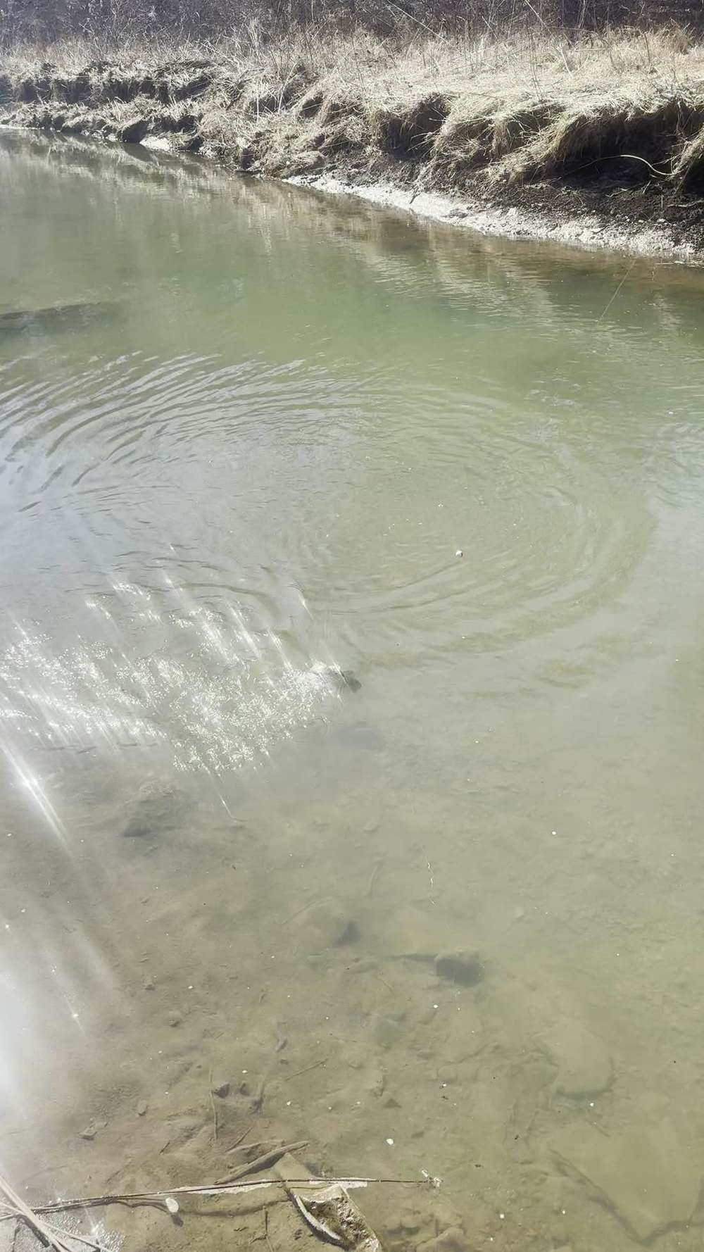
Chautauqua Creek is two fisheries in one creek. Below Westfield it is a classic low, clear lake-run steelhead creek: fish come in from Lake Erie, stack in the lower pools around the railroad and I-90 bridges, and the gauge at Hawley Road tells you whether they are spread out or bottled up. Above the Westfield Water Works Dam it is a deep, forested gorge — ten miles of water the fish could not reach before the 2012 fish-passage project, now open, with a special catch-and-release reach right below the dam. The gauge is the decision, the gorge is the adventure, and the special-reach rule is the thing that will get you a ticket if you do not know it.
02 — Section
2. How to use this guide
1. Check the live gauge first. §3 is a snapshot from the morning of Sun Nov 8, 2026. In the living edition the
gauge is live at page load, stamped with the time the gauge took the reading. Nothing stale is dressed up as live. 2. Fish the trend, not just the number. A creek at 20 cfs and falling fishes differently from the same 20 cfs
and rising. §4 explains what is verified and what is not. 3. Know which reach you are in. The 1.3-mile catch-and-release, artificial-lures-only reach below the dam
has different rules from the rest of the creek (§5). Know the South Gale Street boundary before you cast. 4. Know where you are allowed to stand. 8.5 miles of PFR sounds like a lot — it is, for a creek this size —
but the rest is private land, and the gorge has steep banks with limited exits. §6 lists only the public water verified in DEC sources.
03 — The Water★ Intel
3. Live gauges — verified snapshot, Sun Nov 8, 2026
USGS gauge: 04213319 — Chautauqua Creek below Westfield NY Chautauqua County, NY. Drainage area 35 sq mi. Gage datum 611.62 ft above NAVD88 (prior to Oct 1, 2023, datum was 2.00 ft higher — old gage-height numbers are not directly comparable). Period of record August 2017 to current. Funded by NYSDEC. Managed by the USGS NY Water Science Center, Buffalo. All USGS data provisional, subject to revision.
Gauge extremes for the period of record: maximum discharge 6,760 cfs, Nov 5, 2017 (gage height 7.74 ft, present datum); minimum discharge 1.64 cfs, July 15, 2023. That range is the point: this is a small creek that can go from a trickle to a flood. Reading
Value
Time / source
---
---
---
Discharge
20 cfs, falling
Nov 8, 2026, 9:00 AM EST — Steelhead Almanac, reading USGS 04213319
Gage height
2.08 ft
Nov 8, 2026, 9:00 AM EST — Steelhead Almanac
Discharge (second source, concordant)
20 cfs, down 20% in 12 h
Updated Nov 8, 2026, 9:53 AM ET — Lake Erie Pulse, reading USGS 04213319
Normal for this date
47 cfs
Lake Erie Pulse, Nov 8, 2026 — creek running well below normal
Earlier same-morning reads
23 cfs, falling over ~6 h (observed 3:00 AM EST, BlueStreamFly, reading USGS 04213319); 21 cfs, 2.10 ft, falling (Alley Angler, past-24-h panel)
Nov 8, 2026 — consistent picture: low 20s and easing down through the morning
Typical range for this date
17–77 cfs (middle range, 2018–2026)
BlueStreamFly, Nov 8, 2026 — today's 20–23 cfs sits at the low end of normal for the date
Water temperature
No sensor / unavailable
All sources Nov 8 — this gauge reports discharge and gage height only, not continuous water temperature. Carry a stream thermometer.
Clarity
Clear (flow-estimated, unverified)
Almanac + Pulse Nov 8 — estimated from flow, not a visual check. Do not treat as a confirmed on-the-water clarity call.
Air / wind at gauge
47°F, wind S 6 mph, cloudy
Steelhead Almanac, Nov 8, 9:00 AM EST
Rain forecast at gauge
0.1 in
Lake Erie Pulse, Nov 8, 2026
Gauge location note: USGS 04213319 sits at Hawley Road, lower Chautauqua Creek below Westfield — about 1,400 feet upstream of I-90 and 1.3 miles from the Lake Erie mouth. It measures the lower creek only. It does not measure the South Gale Street special reach or the upper gorge — use it as lower-creek flow context, then confirm the reach you are actually fishing on site.
What this snapshot says, plainly: on the morning of Nov 8, Chautauqua was low, clear, and falling — 20 cfs against a normal of 47, down 20% in 12 hours, at the low end of the typical range for the date. The Almanac rated it Fair / Storm Watch. That is fishable low water: fish holding in the deeper pools, clear-water stealth tactics, and the best water is the pools, not the riffles. The 24-hour picture (Alley Angler: up 72% over 24 hours, now falling) says the creek rose on the recent rain and was already easing off it — the classic day-after-a-rise
window, with the fish likely still spread a little wider than they will be by tomorrow.
Weather today, Westfield area (Sun Nov 8, 2026): increasing clouds, high near 53°F, low 43°F. Wind SW 15–18 mph, gusts to 34 mph (NWS Westfield). Showers tonight, 80% chance, less than a tenth of an inch possible. Monday: chance of showers, high near 52°F. Fredonia/Dunkirk, just east, was 49°F late morning with a 54°F high and gusts to 39 mph. Sunrise ~7:00 AM EST, sunset ~5:03 PM EST. Rain was expected to be light — a nudge to the creek, not a blowout — but re-read the gauge before driving.
3A. Recent pushes / fresh runs — Nov 6–8, 2026 This section uses only dated, sourced reports. No run is claimed unless a source says it. Chautauqua is one of the "all other NY Erie tribs" in the DEC hotline note below — at a trickle and practically void of fish in that window. Today's gauge (20 cfs, falling after a rise) is a small rain bump easing off, not a documented fresh push into this creek.
- Nov 6–7 rain refill (PA Erie tribs): Walnut Creek peaked ~94.7 cfs on Nov 7, easing to ~16.5–18 cfs by
Nov 8, 9:30 AM. Elk and Conneaut also rose on the rain, then eased. The refill was real, but it was a PA-trib refill — it does not by itself prove a fresh push into the NY tribs.
BirdTrout, Nov 6
Peak run for Walnut, Elk, and Conneaut (PA); Tail-off for Cattaraugus (NY). The documented peak was on the PA side; the NY side's biggest creek was already tailing off.
NY DEC hotline, Oct 30–Nov 13
Cattaraugus was the only viable NY Lake Erie tributary — low and clear, with a limited steelhead spread. All other NY Erie tribs were at a trickle, practically void of fish. (Lake Ontario side, same window: Eighteenmile Creek and Oak Orchard had plentiful browns and kings, with some steelhead and coho — not this creek, and not this lake shore.)
Nov 8, 9:00 AM EST, Steelhead Almanac: Cattaraugus Good, 160 cfs, stable; Walnut Fair, 18 cfs, falling;
Elk Fair, ~16 cfs, falling; Twenty Mile Poor, ~28 cfs, falling. The PA creeks were already falling off their Nov 7 peak by Sunday morning.
The honest summary
there is no confirmed widespread fresh push from the Nov 6 forecast alone. The rain lifted the PA creeks and gave the NY creeks a small bump, but no source documents a fresh run into Chautauqua Creek. What is documented is a PA peak, a Cattaraugus tail-off, and NY tribs (other than Cattaraugus) at a trickle in the DEC window.
Next chance — forecast, not fact
the next rain chance, late Sun Nov 8 into Mon, could pull a fresh push in
Ohio/PA. That is a forecast, not a fact, and it is aimed at the Ohio/PA shore, not a promise for this creek.
Re-read the gauge after that rain before driving.
04 — The Water
4. Flow bands — go / wait / stay home
No verified fishing flow band has been established for Chautauqua Creek yet, so this guide prints none.
Until one is, read the gauge this way: use the reading, the trend (rising or falling), and the normal for the date — the pieces laid out below. What is published — and what it is not:
Float band (not a fishing band)
GoFloatThatRiver, estimated from long-term USGS flow percentiles for the below-Westfield gauge — kayak/canoe roughly 75–110 cfs, tubing roughly 50–75 cfs. That is a paddling estimate, explicitly to be verified with local outfitters. It is not a steelhead fishing band and must not be presented as one. At 20 cfs the creek is far below any float band; it is a wading creek at this level.
What "normal" means here
the Pulse normal for the date is 47 cfs and the typical middle range is 17–77 cfs. Today at 20 cfs is low-normal, not extreme low. The creek's recorded extremes (1.64 cfs to 6,760 cfs) show how fast it can move — do not anchor a plan on a single morning number.
No Keystoned band is printed for Chautauqua. No go / wait / stay-home cfs lines are published for this creek, so this guide gives the gauge, the trend, and the normal — not a band. One structural note: the lower creek and the upper gorge hold water differently — the gorge fishes on a slower clock than the lower creek at the same gauge reading, so judge the two reaches separately.
05 — Section
5. The run, the fish, and the rules
Where
Chautauqua County, NY, at Westfield. Flows northerly for over 15 miles before entering Lake Erie near Westfield.
What runs
Lake Erie steelhead each October through April — DEC calls it one of the top Lake Erie steelhead runs in western New York. Lake-run brown trout in fall, smallmouth bass in spring. The lower section has long been a steelhead hot spot.
The dam that changed it
the Westfield Water Works Dam fish-passage project, completed in 2012, now gives steelhead access to an additional 10 miles of stream winding through a deep, forested gorge.
Before 2012 the fish stopped at the dam; now they do not. That is why the upper gorge is in this guide at all.
Public water
8.5 miles of Public Fishing Rights easements in total (DEC). The rest is private land — landowner permission required.
The special reach
a 1.3-mile catch-and-release only, artificial lures only section directly below the
Westfield Water Works Dam (see Regulations below). This is the single most important rule on this creek.
Regulations — as published by NYSDEC (verify current before you fish)
- General Lake Erie tributary rule: brown trout, rainbow trout (including steelhead), coho and chinook salmon — all year, 12-inch minimum, daily limit 3 in any combination.
- South Gale Street special reach — CATCH AND RELEASE: from the bridge on South Gale Street upstream 1.3 miles to the upper Village of Westfield water intake dam: trout and salmon, open all year, catch and release only, artificial lures only. All trout and salmon caught must be returned to the water immediately without unnecessary injury. (NYSDEC Great Lakes and Tributaries Special Regulations;
NY Codes, Rules and Regulations Part 10 §10.2.)
License
a NY fishing license is required. Your license is not a permit to trespass — outside PFR you need landowner permission.
Source
NYSDEC Public Fishing Information for Chautauqua Creek (Ver. 10/12) and NYSDEC Great
Lakes and Tributaries Special Regulations. Verified Nov 11, 2026 against the current NYSDEC Great Lakes and Tributaries Special Regulations page (regulations in effect April 1, 2026): every regulation claim
in this section — the general Lake Erie tributary rule, the South Gale Street catch-and-release / artificial-lures-only reach, and the Sep 1–Mar 31 seasonal hours and 1/2-inch hook-gap rules — matches current DEC. Still confirm in the current NYSDEC guide before you fish; the DEC Region 9 Fisheries office (716) 372-0645 is the contact printed on the PFR map.
06 — Access
6. Access, pool by pool — area-level only
No street address for any parking lot is stated here, because none was verified except as noted. Access below is area-level (town / bridge area / DEC site) from DEC and county sources. Lot details, signage, fees, and seasonal closures can change — check the posted signs on site before you rely on any of them.
Lower creek — mouth to Westfield (steelhead hot spot)
- Mouth / Lake Erie, Westfield area: the creek meets the lake near Westfield, about 1.3 miles below the
Hawley Road gauge. The lower section has long been the hot spot — fish fresh in from the lake stack here first. Mouth access and parking are not confirmed — do not assume a lot exists at the mouth.
Hawley Road bridge / gauge area
the USGS gauge sits here, about 1,400 feet upstream of I-90. This is lower-creek water and the reference point for the whole guide's flow call. The bridge and gauge do not establish legal parking, bank entry, or safe wading — confirm the signed access on site. Fish from the bank where the water is deep or the footing is uncertain, and keep the plan short in this reach.
Railroad Bridge and I-90 Bridge zones
Tour Chautauqua names the water above and below the
Railroad Bridge and the Interstate 90 Bridge as hotspot fishing zones. These are the lower-creek pools where fresh fish hold. Access to each bridge zone is via the PFR easements — which bank, which side of each bridge, and where to park are shown on the current DEC PFR map; check it before you go.
- Pools: lower-creek pools and tailouts — dead-drift eggs and nymphs through the pools, swing soft-hackles and small streamers through the tailouts. At 20 cfs and clear, the fish are in the pools; work each one thoroughly.
South Gale Street special reach — Westfield (catch and release, artificials only)
Access (map-indicated, verify on site)
the DEC PFR map marks an angler lot on Sherman Road and a footpath toward the South Gale / Fort Street bridge, the lower boundary of the special reach. That lot and path are reported from the map, not confirmed on the ground — check the current map and the posted signs on site before relying on that lot or path. No street address is stated for the lot, because none was verified. Verification note (Nov 11, 2026): the PFR map DEC currently serves for Chautauqua Creek — still Ver. 10/12 — carries "Angler Parking" and "Angler Footpath" symbols in its Map 1 legend for this reach, so the lot and path are verified at map level per the current DEC PFR map; that is still a map, not an on-the-ground confirmation.
Pools
the reach below the dam — deep, cold, clear water. Artificials only means no bait, no egg sacs, no scented soft plastics: flies and lures only. Fish it the way the rule intends — small, natural, and released cleanly.
Upper creek — the gorge (above the dam)
- Westfield Water Works Dam upstream, the deep forested gorge: ten miles of gorge water opened by the
2012 passage project, with PFR easements through it. This is the wild half of the creek — steep, wooded, and remote-feeling a few miles from Westfield. Fish move up here once they pass the dam, and the gorge spreads them out, so it fishes less crowded than the lower creek.
Access
via the PFR easements in the gorge. Specific entry points, trails, and parking for the gorge are the least-documented access in this guide, and the banks are steep with limited exits. Do not enter the gorge without a confirmed entry and exit — work from the DEC PFR map and posted trailheads. One DEC-documented gorge-area entry exists outside the PFR map: DEC's Chautauqua Gorge State Forest page lists the Hannum Road day-use parking area and a nearby trailhead (Fred J. Cusimano Westside Overland Trail) — DEC publishes those as state-forest parking/trail access, not as confirmed creek fishing access, so they do not by themselves open a fishing entry to the creek.
Pools
gorge pocket water and deep slots — nymphs and small streamers in the seams, eggs dead-drifted through the slots. The gorge holds fish longer after a rise than the lower creek does, because the water stays cooler and the pools are deeper.
07 — Tactics
7. Flies, tactics, and seasonal playbook
Tackle
| Fly rod | DEC's Lake Erie-wide guidance applies here — 6–8 weight, 8–11 ft, with a 7-weight 10-footer as the all-around steelhead rod; weight-forward floating line, large-arbor reel with smooth disc drag and at least 100 yards of 20-lb backing. Chautauqua's gorge water rewards the longer rod for reach and line control. |
| Leaders | 6–12 lb monofilament leaders (about 9 ft), stepping down to 4–12 lb fluorocarbon tippets on clear-water days. At 20 cfs and clear, go light — the fish can see you, especially in the special reach. |
| Spinning (outside the special reach only) | 7–12 ft medium rod, 6–12 lb monofilament with a fluorocarbon leader; egg sacs under a small bobber, or the same flies floated under an indicator. Inside the 1.3-mile special reach, artificial lures only — no bait, no egg sacs. |
Flies — published Chautauqua / Steelhead Alley patterns
| Egg patterns (first choice) | #8–12 Egg Pattern or #10–14 Sucker Spawn, dead-drifted near the bottom (BlueStreamFly, Chautauqua Creek report, Nov 8, 2026). Glo Bugs (#8–16) and Nuclear Roe (#10–16) are the same family and fish the same way. |
| The local staple | Crystal Meth — described as "a Chautauqua Creek staple that glows like candy in the current" (Fly Fishing and Tying Journal, Steelhead Alley). If you fish one fly on this creek, it is this one or a Sucker Spawn. |
| Swung flies | #10–14 Partridge and Orange swung through a reachable tailout (BlueStreamFly); soft-hackles and small wet flies in the tailouts generally. |
| Streamers | #6–10 Woolly Bugger, or a modest 1.5–2.5 inch Intruder where the legal reach and observed water support it (BlueStreamFly). Egg-Sucking Leeches and black Woolly Buggers are noted top flies on these Chautauqua County creeks. |
| Nymphs | Hare's Ear, Prince Nymph, Pheasant Tail — dead-drifted through pocket water and gorge seams. |
| In low clear water (today's condition) | smaller eggs, lighter tippet, longer leader, and a low profile. If the fish are holding tight in the pools and not chasing, dead-drift beats swing — except in the tailouts, where a swung soft-hackle still moves fish. |
Seasonal playbook
Fall (now — Oct to Dec)
the main run. Fresh steelhead plus lake-run browns, entering from the mouth and stacking in the lower pools, then pushing up through the dam passage into the gorge. Best water is the day after a rise, falling and still carrying a little colour — which is close to today's condition (20 cfs, falling after a rise). Low clear water fishes, but the fish are concentrated and wary.
Winter (Jan–Feb)
fish are in the creek and holding in the deep slow pools — lower creek and gorge slots alike. Slow presentations, dead-drifted eggs and nymphs, midday when the water is warmest. The special reach fishes all year under catch-and-release, which makes it the winter option when other water is iced or crowded. Watch ice at the access points and on the gorge banks.
Spring (Mar–Apr)
the run continues; drop-backs and late fish, plus smallmouth bass moving into the lower creek as waters warm. The gorge stays cooler longer and holds fish later into the spring.
Summer
not a steelhead season on Chautauqua. The creek is a warm-water and gorge-hiking stream in summer — do not sell it as summer steelhead water.
08 — Section
8. Techniques in depth — fishing Chautauqua Creek
Chautauqua forces you to fish two techniques, because it is two fisheries: a bait-and-float creek below Westfield, and an artificials-only, catch-and-release special reach from South Gale Street up 1.3 miles to the water intake dam — with ten miles of gorge water above that. The primary method below the special reach is the float rig in the lower-creek pools around the Railroad Bridge and I-90; inside the special reach, the primary method is fly indicator nymphing, because the rule leaves you nothing else — and the water suits it.
The rig, set for this creek. No fishing band is printed for Chautauqua; §4 gives you the gauge at Hawley Road, the normal, and the range instead: 20 cfs and falling on Nov 8 against a normal of 47, inside a typical range for the date of 17–77 cfs. At low-20s flows, rig light on both reaches: a small float and a compact cluster of shot below the bridges, so a dime-size sac ticks bottom in short pools without dragging; and in the special reach, a long leader, a small indicator, and two small nymphs or a single egg pattern fished at exact pool depth. Check the drift constantly — Chautauqua's lower pools are short, and a drift that starts at the wrong depth is over before it starts working. In the gorge, add a step of depth and shot: the gorge pools are deeper and hold water longer than the lower creek at the same gauge reading, as §4 notes, so judge the two reaches separately.
Bait and flies by clarity. Low Chautauqua water is clear water — the Nov 8 snapshot said so outright — and special-reach fish in deep, cold, clear pools below the dam are the most inspected presentations in this guide set: #12–16 nymphs and small, pale egg patterns, fine tippets, nothing bright. Below Westfield, the same clear-water rule applies at 20 cfs; only on a lift, when the creek rises toward and past its 47 cfs normal and takes on color, do standard-size brighter sacs and beads earn their place — and only outside the special reach, where bait is legal.
Forage notes — Chautauqua Creek in mid-November Chautauqua is two fisheries — the lower creek below Westfield and the gorge water above the water-intake dam — and the forage read has to respect both, plus the 1.3-mile South Gale Street special reach, which is catch-and-release, artificials only. Everywhere on this creek, egg sacs, beads (6–10 mm), and single eggs stay in the lead group year-round, sized to clarity: smallest and palest in the deep, cold, clear pools below the dam, a size and a shade up on the falling limb below Westfield. In the special reach, read every item below as an
imitation only — egg patterns, beads, and nymphs, never natural bait.
Mouth and lower creek only for shiners
emerald shiners matter at the Westfield mouth and the lowest pools, where lake-run browns and steelhead first stack. Where legal below the special reach, a live shiner on a bobber never rotates fully out at mouth and lower-reach water; shiners are not an up-creek lead in the gorge.
Secondary, not lead
sculpin streamers are secondary only in gorge tailouts at low light. Stonefly and other nymphs from §7 are the year-round secondary anchor in the pocket water and seams.
Off the menu
crayfish are tucked and inactive in mid-November cold water, in the gorge as on the lower creek, so do not lead with a crayfish pattern now.
Where they hold. Low and falling: the lower-creek pools above and below the Railroad and I-90 bridges, and the deep slots in the special reach. Prime water — rising toward normal, then falling with a little color: tailouts and seams through the lower creek, and fish spread through the gorge pocket water. High: the soft edges and the deep gorge pools, where fish sit out a flood that makes the lower creek unfishable — the gorge fishes on a slower clock. The secondary method. Swung soft-hackles and small streamers through the tailouts beat dead-drifting at low light and on the falling limb, in the gorge especially, where a streamer in a deep slot is the one aggressive presentation pressured fish still answer.
Seasonal adjustment. The gorge is a cold-water refuge — it stays cooler and holds fish longer after a rise — so as spring warms the lower creek and the run thins down low, move up: late-season effort belongs in the gorge and the special reach, not the bridge pools.
09 — Section
9. Safety
1. The gorge is the hazard. The upper creek runs through a deep, forested gorge with steep banks and
limited exits. Once you drop in, getting out somewhere else is not always possible. Know your entry and your exit before you go down, carry a wading staff, and do not fish the gorge alone. 2. Small creek, fast rise. Chautauqua is a 35-sq-mi watershed with a recorded range of 1.64 to 6,760 cfs. It
rises fast on rain and drops fast after. A creek at 20 cfs in the morning can be a different creek by evening if the rain hits the basin. Check the gauge when you arrive, not just before you leave home. 3. Low clear water is not safe water. The pools are deep, the gorge rock is slick, and the lower-creek banks
are undercut clay and shale. A wading staff and felt or studded soles are worth it even at 20 cfs. Fish from the bank where the water is deep or the footing is uncertain. 4. The dam is a dam. Do not wade or climb around the Westfield Water Works Dam or the water-intake
structures. The special reach ends at the upper intake dam — that is a boundary, not a fishing spot. 5. Private land is the biggest hazard to your day, not the water. Outside the 8.5 miles of PFR, the creek is
private. Stay inside the signed PFR, stay on the 33-foot strip, do not cut across lawns, yards, or posted fields to reach the water, and do not park where you are not invited.
10 — The Water
6. Cold water, November. The gauge has no temperature sensor — assume the water is cold
(steelhead-active range is roughly 42–55°F per DEC-region guidance; below 40°F the fish hold tight in slow deep water). Waders with a belt, layers, and a fishing partner in November are not optional extras. 7. Night fishing is prohibited Sep 1–Mar 31 on the tributary reach (1/2 hour before sunrise to 1/2 hour after
sunset). Plan to be off the water and out of the access by sunset — sunset Nov 8 is ~5:03 PM EST.
8. Regulations are your responsibility — especially here. The special reach is catch-and-release, artificial
lures only, and it is the reach most likely to be checked. This guide quotes DEC as published; the angler is responsible for the regulation on the water they are standing in. Check the DEC summary before you fish — and confirm the PFR map version, which is dated Oct 2012.
11 — Section
10. What is inside the living edition
Same promise as every Keystoned guide:
- Live USGS gauge 04213319 — real readings, stamped with the time the gauge took them; where the gauge has no temperature sensor, the guide says so plainly instead of faking one.
- Live weather & radar built right into the guide.
- Verified access where it exists — and where access is unverified, the guide says so plainly instead of faking a parking lot.
- Gauge reading, not a band — no verified fishing flow band has been established for this creek, so §4 prints none; it gives the gauge, the trend, and the normal for the date, with separate consideration for the lower creek and the gorge.
- Buy once — updates to the guides you bought are free. A living edition that stays current all season.
Sources (Nov 8, 2026 build)
- USGS gauge 04213319, Chautauqua Creek below Westfield NY — site data: Chautauqua County, drainage
35 sq mi, gage datum 611.62 ft NAVD88 (2.00 ft higher before Oct 1, 2023), period of record Aug 2017–current, funded by NYSDEC; extremes max 6,760 cfs Nov 5, 2017, min 1.64 cfs July 15, 2023 (waterdata.usgs.gov).
- Live readings Nov 8, 2026: Steelhead Almanac, assessment Nov 8 9:00 AM EST — 20 cfs falling, 2.08 ft, air 47°F, wind S 6 mph, Fair / Storm Watch, water unavailable, clarity flow-estimated; Lake Erie Pulse, updated Nov 8 9:53 AM ET — 20 cfs / normal 47, down 20% in 12 h, no sensor, Clear estimated, 0.1 in rain forecast; Alley Angler river conditions — 21 cfs, 2.10 ft, up 72% in 24 h, falling; BlueStreamFly Chautauqua Creek report — 23 cfs falling over ~6 h, observed Nov 8 3:00 AM EST, typical middle range 17–77 cfs for the date (2018–2026), gauge at Hawley Road ~1,400 ft upstream of I-90, 1.3 mi from the mouth. All USGS data provisional, subject to revision.
- NYSDEC, Public Fishing Information for Chautauqua Creek (Ver. 10/12) — 15+ miles to Lake Erie, steelhead Oct–Apr, 2012 Westfield Water Works Dam fish passage opening 10 additional miles of gorge, 8.5 mi PFR, 1.3-mi C&R artificials-only section below the dam, Region 9 Fisheries (716) 372-0645.
- NYSDEC, Great Lakes and Tributaries Special Regulations — Chautauqua Creek S. Gale St bridge upstream 1.3 mi to upper Village water intake dam, C&R artificial lures only; Lake Erie tributary seasons/limits (12 in, 3/day); Sep 1–Mar 31 night-fishing prohibition and hook-gap limit.
- NY Codes, Rules and Regulations, Part 10 §10.2 — Chautauqua Creek S. Gale St to upper dam, catch and release only, all trout and salmon returned immediately.
- Tour Chautauqua, Steelhead Alley Begins in Chautauqua County — 5-star steelhead stream, ample parking and easy access, Railroad Bridge and I-90 Bridge hotspot zones, gorge, special-reach rules.
- Tour Chautauqua, Lake Erie Tributaries in Chautauqua County — Westfield Water Works Dam passage, additional miles of PFR above the dam, 1.3-mi C&R section below the dam, gear guidance.
- BlueStreamFly, Chautauqua Creek Fishing Report (Nov 8, 2026) — flies: #8–12 Egg Pattern / #10–14
Sucker Spawn dead-drifted, #10–14 Partridge and Orange swung in tailouts, #6–10 Woolly Bugger, 1.5–2.5 in Intruder; Sherman Road angler lot / footpath to S. Gale / Fort St bridge as marked on the DEC PFR map (verify on site); gauge reports discharge and gage height only, no water temperature.
- Fly Fishing and Tying Journal (ftjangler.com), Steelhead Alley — Crystal Meth as a Chautauqua Creek staple; Sucker Spawn, Woolly Bugger, Egg-Sucking Leech, Intruder, Prince Nymph, Hare's Ear, Pheasant Tail.
- NYSDEC, Steelhead Fishing in Lake Erie Tributaries — Washington strain, bulk run mid-Oct through
April, tackle guidance (7-wt 10-ft all-around rod, WF floating line, 100 yd 20-lb backing).
- GoFloatThatRiver, New York rivers — Chautauqua Creek float band 75–110 cfs kayak/canoe, 50–75 cfs tubing, estimated from USGS percentiles, verify with outfitters. Used here as a float band only, not a fishing band.
- Weather Nov 8, 2026: NWS Westfield / weatherforyou.com — high ~53°F, SW 15–18 mph gusts to 34 mph, showers tonight 80%; weather.com Fredonia hourly and NWS Fredonia — high 54°F, gusts to 39 mph, sunrise ~7:00 AM / sunset ~5:03 PM EST.
- Keystoned Steel Deep Dive format notes (Nov 7, 2026) — Deep Dive $12.99, living-edition format; Erie
Trenches & Tributaries Pack $99.99.
Lore, Legends & History Chautauqua Creek is a short walk with a long memory. Its mouth at Barcelona, on Lake Erie, was the lake end of one of the most important portages in early North America — the carry from Lake Erie up and over the ridge to Chautauqua Lake, and from there down the Conewango and the Allegheny to the Ohio River. Native travelers used that trail long before any European saw it. Étienne Brûlé is believed to have been the first European to use it, in 1615. In July 1749 a French expedition under Pierre Joseph Céloron de Blainville landed at the mouth of Chautauqua Creek, bound for the Ohio country to assert France's claim to it, burying lead plates along the way. His men hacked a road out of the old trail toward Chautauqua Lake. The portage took days — the climb is real, from a lake at roughly 570 feet to a crest near 1,500 feet — and in 1753 a larger French force turned it into a military road to supply forts on the Allegheny. Settlers still called it the Old French Road. Today Portage Street and Old Portage Road remember it, running beside the creek gorge through Westfield.
The name itself is Seneca, and honest sources will tell you it was never settled to one meaning. Applied first to the lake, and then to the creek and the portage, it was pronounced something like Jah-dah-gwah. The most often heard interpretation is "a bag tied in the middle," or "a pack tied in the middle" — a picture of Chautauqua Lake itself, long and narrow, pinched near its middle. A historical marker on the subject says plainly that legends about the meaning are unsubstantiated, and that "bag tied in the middle" is simply the most common reading.
That candor is worth keeping. There is another telling, with a name attached. Dr. Peter Wilson, an educated Cayuga chief, shared a Seneca tradition printed in county histories: Senecas returning from the Ohio paddled through Chautauqua Lake, and one caught a strange fish and tossed it into his canoe. After the portage to Lake Erie, they found it still alive and threw it in, and from then on, the story says, that fish became abundant in Lake Erie where none had been known before. From Ga-jah, "fish," and ga-dah-gwah, "taken out," came Jah-dah-gwah — "fish taken out."
Other meanings have been offered too — "foggy place," "two moccasins fastened together," "high up" — and a
good telling lists them rather than picking a winner the record does not pick.
The creek's best-known town is Westfield, and its gorge is the village's defining feature, cutting north to south just west of the main intersection on its way to the lake. Westfield's documented moment in national history came on February 16, 1861, when President-elect Abraham Lincoln stopped there on his inaugural journey. The year before, an eleven-year-old Westfield girl named Grace Bedell had written to him suggesting he grow whiskers, since his face was so thin. Lincoln answered her letter, grew the beard, and at Westfield he asked for her by name and met her before the crowd. Statues in the village commemorate that meeting today. It did not happen on the creek bank, and no honest telling should move it there — but it happened in the town the creek runs through, and every angler who crosses the gorge at Westfield is crossing the same ground.
No documented ghost story attaches to this creek in the sources consulted, so none is invented here. The portage and a girl who changed a president's face are story enough.
Night fishing — working the holes after dark First, the law on this water. This guide's own rules chapter states it, and it governs everything below: "Great Lakes tributary seasonal rules (Sep 1 – Mar 31): fishing 1/2 hour before sunrise to 1/2 hour after sunset only — night fishing is prohibited — from the bridge closest to the mouth upstream to the first barrier impassable by fish. Hook gap (shaft to point) must not exceed 1/2 inch in that window." "7. Night fishing is prohibited Sep 1–Mar 31 on the tributary reach (1/2 hour before sunrise to 1/2 hour after sunset). Plan to be off the water and out of the access by sunset — sunset Nov 8 is ~5:03 PM EST." Fish the night only where and when that leaves it open. Read that plainly before anything below: from September 1 through March 31 there is NO legal after-dark fishing on the tributary reach this guide covers — the legal day ends 1/2 hour after sunset. Everything below therefore belongs to two places: the open months (April through August), and the lake shore and open mouth water outside the tributary reach, where night fishing stays legal. In season, the night game on this creek is the first and last legal light — fish the §7/§8 program hard at dawn and dusk — not the dark itself.
After dark, the run changes address on Chautauqua Creek, NY. Steelhead that held in the riffles and pocket water by day slide into the deepest holes in the reach — the slow, dark water at the head of the pool, along the undercut and the shale ledge, and the tail where the pool shallows into the next riffle — and they feed there with a confidence they never show at noon. On a small creek the night fishery is a handful of holes; learn which ones they are. Working a hole in the dark is a memory exercise before it is a fishing exercise. Fish the hole in daylight first: learn where it deepens, where the wood and the ledges sit, where you will stand, and where a hooked fish can be landed. At night, work it top to bottom in short steps — a cast or two across the head, down the seam, into the tail — slow, deep and close to the bottom, with long pauses; a steelhead at night does not chase, it intercepts.
Two profiles speak at night: glow — a glow bead, glow egg or chartreuse presentation where a little light helps the fish find it — and dark — a black or black-olive streamer or nymph silhouetted against the night sky. The dark profile works because it reads to a night-feeding fish as a bottom forage fish on the move — big, slow, and tight to the substrate. Light discipline is not optional: a headlamp shone into a hole ends the fishing in it — keep the light on the bank and on your feet, red or dim when you have it, and rest a lit-up hole before fishing it again.
Sound carries the same way. Safety doubles after dark: never wade at night water you have not waded by day, belt cinched and staff in hand, tell someone the reach and the return time — a fall in cold water at night is a survival event, not a soaking.
Tonight's night pick — kept live with this guide's bait rotation. The rotation updates the night pick for this water on the same cycle as the day picks, off the forage calendar and the current clarity and flow.
Current-season default: where night fishing is open: a glow spawn sac under a float at the head of the hole; dark second, a black streamer swung at a crawl along the seam. On the lake shore and open mouth water, a glow spoon or stickbait covers the dark water below the reach.
12 — Posted & Access
Posted Land & Access Trails
Chautauqua Creek carries the deepest public fishing rights coverage of any creek in this set: 8.5 miles of DEC easements on a creek whose steelhead water runs 15 miles from the Lake Erie mouth at Westfield upstream — more than half the run is signed public water. It also holds one of only two catch-and-release, artificial-lures-only sections on New York's Lake Erie tributaries, in the village water at Westfield. The easements are the story here: where the yellow Public Fishing Area signs run, you have the right to fish and walk the bank; where they stop, you are on private land. Checked November 2026.
The public water — access areas & easements
The lower creek and the village of Westfield
PFR easements begin on the lower creek and run through the village water. DEC's PFR map (Ver. 10/12) marks angler parking and an angler footpath in the Sherman Road / Fort Street area at the downstream end of the catch-and-release section.
The catch-and-release section — South Gale Street bridge upstream 1.3 miles
DEC's regulations page defines it: from the South Gale Street bridge upstream 1.3 miles to the upper Village of Westfield water intake dam (DEC's PFR map sheet calls the same structure the Westfield Water Works Dam). Within this reach: catch and release only for trout and salmon, artificial lures only, and the seasonal hook rules apply. This is public, easement-backed village water — the most heavily structured access on the creek.
The middle creek
PFR segments continue upstream of the village. DEC's map sheets (Maps 1–3) draw the easement sections reach by reach; DEC's own warning applies: the maps are not survey quality and the drawn width of PFR "may be wider than reality." Fish the signed water.
Chautauqua Gorge State Forest reach (Hannum Road)
DEC's table credits the creek's access to "PFR and State Forest lands." The state forest is 538 acres; DEC publishes a day-use area on Hannum Road with a parking area (picnic pavilion, hiking trail, seasonal portable toilet, a 0.25-mile loop) and a second parking area and trailhead for the Fred J. Cusimano Westside Overland Trail at the end of Hannum Road. DEC publishes those as state-forest parking and trail access — this guide does not print them as confirmed creek fishing access beyond the PFR easements themselves.
Coordinates — Chautauqua Gorge State Forest — Hannum Road Day Use Area parking: 42.239986, -79.587203 — Source: NYSDEC, "Chautauqua Gorge State Forest" — "Parking area for day use area (42.239986°N, 79.587203°W)", NAD83/WGS84. (DEC publishes this as state-forest parking/trail access; the chapter does not claim it as confirmed creek fishing access beyond the PFR easements)
Coordinates — Chautauqua Gorge State Forest — parking area and trailhead for Fred J. Cusimano Westside Overland Trail, end of Hannum Road: 42.239951, -79.585262 — Source: NYSDEC, "Chautauqua Gorge State Forest" — "Parking area and trailhead for Fred J. Cusimano Westside Overland Trail (42.239951°N, 79.585262°W)", NAD83/WGS84
Above the Westfield dam — opened water
DEC's PFR sheet records the 2012 fish passage project at the Westfield Water Works Dam, which opened an additional 10 miles of stream to fish passage. Opened to fish is not the same as opened to anglers: upstream of the easement water, access is reach-by-reach and landowner-by-landowner.
Posted & private — stay out
8.5 miles of easements on a 15-mile creek means roughly 6.5 miles are not public
DEC's table lists no parks on Chautauqua Creek. Where the easements end, permission is required — the gaps between PFR segments are private banks, including through the gorge country away from the state forest parcels.
The C&R section's rules are the access condition
Fishing it with bait, or keeping a trout or salmon there, is a violation regardless of the easement under your feet.
Do not treat the state forest as blanket creek access
DEC publishes parking and trails at Hannum Road; it does not publish the gorge's creek frontage as a fishing access site. The easements govern where you may fish.
Seasonal & changing access
Open all year for trout and salmon creek-wide: 12-inch minimum, 3 per day in any combination (outside the C&R section, where nothing is kept).
Night rule: September 1 through March 31, the reach from the bridge closest to the mouth upstream to the first impassable barrier fishes daylight-only (one-half hour before sunrise to one-half hour after sunset), hook gap no more than ½ inch, hooks free-swinging. Night fishing is prohibited on that reach in that window.
The 2012 passage project changed what "first impassable barrier" means here. The Westfield dam passes fish since 2012, and DEC's publications do not name the next barrier upstream as the seasonal reach's top end. This guide prints DEC's rule as written and flags the barrier question as unresolved in DEC's own pages — when in doubt on the upper creek in the September–March window, fish the daylight hours.
Hannum Road is not plowed in winter per DEC's state forest information — gorge access narrows to foot travel in snow season.
Sources for this section: NYSDEC, "Steelhead Streams in Western New York" (Region 9 table); NYSDEC, Chautauqua Creek Public Fishing Rights map (Ver. 10/12); NYSDEC, "Great Lakes and Tributaries Special Regulations"; NYSDEC, Chautauqua Gorge State Forest page (dec.ny.gov). Checked November 2026.
The Bottom Line
Chautauqua Creek is two fisheries in one creek. Below Westfield it is a classic low, clear lake-run steelhead creek: fish come in from Lake Erie, stack in the lower pools around the railroad and I-90 bridges, and the gauge at Hawley Road tells you whether…
Legal · Read last
LEGAL DISCLOSURE — Keystoned Steel Guides
What Keystoned Steel warrants. Keystoned Steel warrants only that, as of the edition date stated in this guide, the access, gauge, and regulation information in this guide that is attributed to a cited official source accurately reflects that source as published on that date. If a material error in that information is confirmed, Keystoned Steel will issue a corrected edition to the original buyer at no charge or, if it does not do so within 30 days after confirming the error, refund the price you paid. That is the sole express warranty provided with this guide.
This guide does not warrant or guarantee:
- (a) Stream conditions, water levels, clarity, or weather — conditions change daily and can change after any
reading printed here;
- (b) Fishing success — no representation is made that fish are present, in any number, size, or location, at any
time;
- (c) Access — access status, parking, and Public Fishing Rights can change, be posted, or be withdrawn at any
time; inclusion of a reach in this guide is not permission to fish it, and is not a representation that access is currently open;
- (d) Third-party data — Gauge readings, including USGS data, agency publications, and maps, originate from
third-party sources. Keystoned Steel does not control those sources and cannot guarantee their accuracy, completeness, availability, or continued accessibility. Third-party information may be provisional, delayed, revised, or incorrect. Its inclusion does not constitute an independent guarantee by Keystoned Steel of the underlying data;
- (e) Regulations — seasons, creel and size limits, and special-reach rules change; the regulations summarized
here are a convenience summary only and are not the law.
Your responsibilities. Before you fish: confirm the current regulations in the current NYSDEC Freshwater Fishing Regulations Guide; hold the required license; verify access is open and lawful for the reach you fish; respect posted signs and private land — a fishing license is not a permit to trespass. Wading and stream fishing involve inherent risks, including fast or rising water, slippery rock, and remote terrain; you fish at your own risk and are responsible for your own safety decisions. This safety warning and assumption of risk do not waive or limit any liability, warranty, or remedy that cannot lawfully be waived or limited under applicable law.
Corrections and refunds. If you believe this guide contains a material error, email keystonedsteel@gmail.com or message our Facebook Page with the guide name and the error. Keystoned Steel will review it against the cited sources within 30 days. If the error is confirmed, you will receive a corrected edition or, at Keystoned Steel's election, a refund of the price you paid. That remedy is your sole and exclusive remedy for errors in this guide. Limitation of liability. TO THE FULLEST EXTENT PERMITTED BY APPLICABLE LAW, KEYSTONED STEEL'S TOTAL LIABILITY ARISING OUT OF THIS GUIDE WILL NOT EXCEED THE PRICE YOU PAID FOR IT, AND KEYSTONED STEEL WILL NOT BE LIABLE FOR INDIRECT, INCIDENTAL, OR
CONSEQUENTIAL DAMAGES, INCLUDING TRIP COSTS, CITATIONS OR FINES, OR PERSONAL INJURY ARISING FROM YOUR USE OF THIS GUIDE. NOTHING HERE LIMITS LIABILITY FOR GROSS NEGLIGENCE OR WILLFUL MISCONDUCT. License. This guide is licensed to the original buyer for personal use only. It is nontransferable and may not be shared, resold, or redistributed without the prior written consent of Keystoned Steel. Living-edition updates are delivered only to the original buyer's purchase email.
TO THE FULLEST EXTENT PERMITTED BY APPLICABLE LAW, THE WARRANTY SET FORTH ABOVE IS THE SOLE EXPRESS WARRANTY PROVIDED BY KEYSTONED STEEL FOR THIS GUIDE, AND KEYSTONED STEEL DISCLAIMS ALL OTHER WARRANTIES, EXPRESS OR IMPLIED, INCLUDING ANY IMPLIED WARRANTY OF MERCHANTABILITY AND ANY IMPLIED WARRANTY OF FITNESS FOR A PARTICULAR PURPOSE. NOTHING IN THIS DISCLOSURE SHALL EXCLUDE OR LIMIT ANY WARRANTY, RIGHT, OR REMEDY THAT CANNOT LAWFULLY BE EXCLUDED OR LIMITED UNDER APPLICABLE LAW.