
Keystoned Steel // Field Guide
Cattaraugus Creek
GAUGE — USGS 04213500
The brief
class="v-brief">What this guide covers: the lake-run steelhead water of Cattaraugus Creek — the roughly 34 miles NYSDEC describes between Lake Erie and Springville Dam, the first barrier fish cannot pass. The creek above the dam is a separate inland trout fishery with different rules, and it is not part of this guide.
01 — Section
SENECA NATION LICENSE — READ THIS FIRST
Cattaraugus Creek is Seneca Nation / Indian-owned water on its lower 14 miles. You need a Seneca Nation fishing license to fish it — a New York State license alone does not cover you there.
Which reaches require it
downstream of Gowanda, virtually all of the lower 14 miles of the creek (mouth to Gowanda) runs through the Seneca Nation's Cattaraugus Territory, and a Seneca Nation license is required there. Upstream of Gowanda — Springville Dam, Zoar Valley, and the water above the Aldrich Street Extension Bridge — is state-regulated water: a New York State fishing license covers you there, and no Seneca license is needed. The boundary is Gowanda.
The license
the Seneca Nation Fishing License (non-member). Only the Nation issues fishing licenses for its lands. Anyone 16 or older needs one to fish on Seneca Territory. Fishing on the Territory is governed by the Nation's Comprehensive Conservation Law, adopted April 14, 2026 (CN S-04-14-26-19). This guide does not print the Nation's fees. The Clerk's Office sets the fees and can change them, and the Nation does not publish its fee schedule on its website — so confirm the current fees, the license types available (including any short-term license), and how long the license is valid directly with the Seneca Nation Clerk's Office before you go. The Clerk's Office addresses and phone numbers are in the next bullet; the Nation's own site (sni.org) confirms the Clerk's Office sells SNI fishing licenses to non-members.
Where to buy it — in person
Seneca Nation Clerk's Office, Irving — Cattaraugus Territory, 12837 Route
438, Irving, NY 14081, 716-532-4900; Seneca Nation Clerk's Office, Salamanca — Allegany Territory, 90 Ohi:yo Way, Salamanca, NY 14779, 716-945-1790. Both offices and phone numbers are listed on the Nation's site (sni.org). The Nation's Conservation Department also names Highbanks Campground and Seneca One Stops as license and permit outlets. The Nation lists no online purchase route — buy in person, and call ahead to confirm current fees and availability before you drive.
- A license does NOT open the whole lower creek. The 2026 law bars licensed non-members from the restricted waters shown on the Nation's Cattaraugus Territory fishing-restrictions map unless a Nation member accompanies them — and that map marks most of the main stem on the Territory and its tributaries as restricted. Per Cattaraugus Creek Outfitters' Sep 26, 2026 summary of the map, the stretches open to licensed non-members without a member alongside are from Versailles upstream to Gowanda, and from the Thruway downstream. One angler's Oct 4, 2026 report put it bluntly: his license gave him access to only about 30% of the Cattaraugus stretch. A Nation license does not buy the whole river.
- Do you also need a NY license on the Territory? Older Seneca Nation guidance says you need a Seneca license but do not need a New York State license on Seneca Territory. DEC's own Cattaraugus steelhead map (Ver. 12/09) states the same point directly: anglers do not need a New York State license on Seneca Nation lands. Above Gowanda, a NY license is required.
The safe rule: NY license above Gowanda; Seneca license below Gowanda; and before you fish the Territory, confirm the Nation's current rules with the Clerk's Office before you fish there — the Nation's 2026 law governs on the ground.
- Other Nation rules that apply on the Territory: lead sinkers are prohibited; non-native bait is prohibited; no discarding fish carcasses within 100 feet of shore; set lines, snagging, and spearing are prohibited; 3 poles maximum; tournaments and guides require permits. Any enrolled Seneca may ask to see your license; only a Seneca Conservation Officer or Marshal may impound equipment or issue a citation.
- Full detail: see §5 (rules) and §6 (lower creek access). If any of this is unclear, call the Clerk's Office in
Irving (716-532-4900) before you fish — do not guess, and do not fish the Territory without the license in hand.
02 — Section
1. The idea in one paragraph
Cattaraugus Creek — "the Cat" — is the biggest Lake Erie tributary in New York and, in NYSDEC's words, one of the premier steelhead streams in the state. It is also the most complicated water in Steelhead Alley to fish legally and safely: the top of the run is a dam, the middle is a 400-foot gorge with exactly two safe ways down to the water, and the bottom 14 miles run through Seneca Nation territory where a different license applies. The fish are Washington-strain steelhead, stocked as yearlings, running October through April with the peak in October and November. The creek itself is a clay-bank river that stays murky long after a rise and clears slowly — a big rise takes a median six days to clear back to the seasonal median. This guide is built around that one fact: read the Gowanda gauge, read the clarity, know whose land you are standing on, then decide. A rising gauge here usually means dirtier water, not just more water.
03 — Section
2. How to use this guide
1. Check the live gauge at Gowanda first. §3 is a snapshot from Nov 8, 2026. In the living edition, the
gauge is live at page load. A stable gauge after days without rain is a different creek from a rising gauge after rain. 2. Fish the band, not the number. §4 gives the fall and spring flow bands from a published Western New
York source (WNY Fly Fishing, Nov 2, 2026). On Nov 8 the creek was at 160 cfs — low water, in the bottom band. 3. Know which jurisdiction you are in before you cast. Above Gowanda, a New York State license covers
you on public water. Below Gowanda, virtually all of the lower 14 miles is Seneca Nation Cattaraugus Territory and needs a Seneca Nation license. See §5 and §6. 4. Check the special-regulation reach. From the Aldrich Street Extension Bridge in Gowanda upstream to
Springville Dam, seasonal rules apply September 1 through March 31 — daylight only, hook gap 1/2 inch or less. See §5. 5. Respect the gorge. Zoar Valley's cliffs are over 400 feet high, of erodible shale. The only safe creek access
is from the Valentine Flats trail and the Forty Road parking lot, both in the Town of Persia. There is no safe gorge or creek access from the Erie County side or from the Town of Otto. See §9, Safety.
04 — The Water★ Intel
3. Live gauges — verified snapshot, Sun Nov 8, 2026
All readings below are USGS provisional data, subject to revision, as reported by the sources cited. Times are the gauge reading times as reported. These are a dated snapshot, not a live reading — in the living edition this cell is live at page load.
Gauge
Reading (as reported)
Water temp
Clarity
Call on the day
---
---
---
---
---
USGS 04213500 — Cattaraugus Creek at Gowanda, NY — right bank, 15 ft upstream from the State Highways 39 and 62 bridge at Gowanda, 4.2 mi downstream from South Branch, 17.8 mi upstream from mouth. Drainage area 436 mi². Period of record Nov 1939 to current year.
160 cfs, 1.30 ft gauge height, Nov 8 ~08:15–09:15 AM EST — steady, stable for 53 hours (trend +2.4 cfs/hr). Normal for this date: 433 cfs. So the creek was running at roughly 37% of normal.
48.7–48.9°F (9.4°C) — USGS water-temperature sensor, updated Nov
05 — Section
8, 9:15 AM EST
Clear — 4 FNU measured (turbidity sensor at the gauge). Lake Erie Pulse rated it "Low & clear" on Nov 8, 9:53 AM ET.
Fishable but low and clear. Fish are spooky, hold in the deeper pools, and few new fish move in from the lake at this flow. Fish the deep water, go small and natural, and expect the best window midday (outfish.in scored 11 AM–1 PM best today). Rain is coming — about 0.2″ in the next 36 hours, with showers expected overnight Nov 8–9 — which may lift the creek into its good band.
Weather at the creek, Nov 8, 2026: air ~48–50°F, cloudy, wind SW 12–20 mph with gusts to ~30 mph, pressure falling (29.08 inHg at Gowanda per outfish.in; Silver Creek, NY nearby reported 50°F, feels like 43°F, wind SW 19 mph gusts 28 mph, pressure falling). Sunrise 6:59 AM EST, sunset 5:01 PM EST. Small Craft Advisory on Lake Erie until Mon 4:00 PM EST.
Regional context, Nov 8: New York rivers were running at 56% of normal across 193 USGS gauges (Snoflo statewide report, Nov 7, 2026). Nearby Steelhead Alley creeks were also low: Chautauqua Creek 20 cfs (normal 47), Canadaway Creek 15 cfs (normal 37), Eighteenmile Creek 12 cfs (normal 49). The whole western New York Alley was in a low, clear, post-rain window — not a blowout, not a fresh push.
What the gauge history says: median discharge peaks in March near 1,010 cfs and April near 980 cfs, sinks to about 170 cfs in August and 160 cfs in September; October's median is about 230 cfs, climbing to about 520 cfs in November and 710 cfs in December. Today's 160 cfs is a normal September number showing up in November — low for the date. Turbidity climbs steeply with flow: on October–April days since 2011, median turbidity was about 11 FNU when the creek ran under 430 cfs, about 38 FNU between 730 and 1,170 cfs, and about 147 FNU above 1,170 cfs. That is why the flow band in §4 matters more than the flow number alone.
Sources for the table: USGS site 04213500 station description (location, drainage area, period of record, extremes — max 34,600 cfs Mar 7, 1956); outfish.in Cattaraugus Creek Fishing Report, Nov 8, 2026 (160.0 cfs, 9.4°C / 48.9°F, updated 9:15 AM; air 48.4°F, wind 20 km/h, cloud 100%, pressure 29.08 inHg falling; stable 53h); Steelhead Almanac, Nov 8, 2026 9:00 AM EST assessment (160 cfs, water 48.7°F, gauge 1.30 ft, observed 8:15 AM EST; air 48°F, wind SW 12 mph; rain expected in ~12h); Lake Erie Pulse, updated Nov 8, 9:53 AM ET (160 / normal 433, steady, 49°F, Clear 4 FNU measured, 0.2″ rain next 36h; "Low & clear" definition).
3A. Recent pushes / fresh runs — Nov 6–8, 2026 Dated, sourced reports only. This section is a dated snapshot — in the app it is replaced by the latest reports at page load. Nothing here claims a run that is not sourced.
- Nov 6–7 rain refill (USGS gauges, via Lake Erie Pulse / Steelhead Almanac): the Nov 6–7 rain lifted the
Pennsylvania tribs and then eased fast. Walnut Creek (PA) peaked at ~94.7 cfs on Nov 7, easing to ~16.5–18 cfs by Nov 8, 9:30 AM. Elk Creek and Conneaut Creek (PA) also rose on the rain and then eased.
Cattaraugus did not spike the same way — it held steady at 160 cfs for 53 hours (§3).
- BirdTrout, Nov 6, 2026: peak run for Walnut, Elk, and Conneaut (PA); tail-off for Cattaraugus (NY).
In other words, the PA creeks were at their best on the back of the rain while the Cat was past its push and settling into low, clear water.
- NY DEC hotline, Oct 30–Nov 13, 2026: Cattaraugus was the only viable NY Lake Erie tributary — low and clear, with a limited spread of steelhead. All other NY Lake Erie tribs were at a trickle, practically void of fish. On the Lake Ontario side, Eighteenmile Creek and Oak Orchard had plentiful browns and kings, with some steelhead and coho.
- Nov 7 Erie, PA angler report (Donny Angler): murky but fishy — fish caught on spoons, eggs and egg sacks working; on Elk Creek, eggs and minnows were effective despite the leaves.
- Steelhead Almanac, Nov 8, 2026, 9:00 AM EST assessment: Cattaraugus Good — 160 cfs, stable.
Walnut Fair — 18 cfs, falling. Elk Fair — ~16 cfs, falling. Twenty Mile Poor — ~28 cfs, falling. The PA creeks are on the falling limb after the Nov 6–7 refill; the Cat is steady and low.
- Honest summary — no confirmed widespread fresh push: the Nov 6 forecast alone did not produce a confirmed widespread fresh push. What the reports show is a localised PA refill on Nov 6–7 that peaked and is now falling, a tailing-off Cat at low, clear water with limited fish spread, and NY's smaller Erie tribs practically void of fish. Do not read a big new run into this weekend.
- Next chance — forecast, not fact: the next rain chance, late Sun Nov 8 into Mon Nov 9 (showers overnight, ~0.07″ at Silver Creek, ~0.2″ in the next 36 hours at the Cattaraugus gauge), could pull a fresh push into the Ohio and Pennsylvania tribs. That is a forecast, not a fact — check the gauges Monday morning before you drive.
06 — The Water
4. Flow bands — go / wait / stay home
Source: WNY Fly Fishing, "WNY Fly Fishing Stream Report 11/2/2026" (wnyflyfishing.blogspot.com, Nov 2, 2026) — the published fall and spring bands for Cattaraugus Creek at the Gowanda gauge. These are a local fly-shop source, not a NYSDEC publication — they are the best published bands for this gauge, printed with their source. Read them together with the gauge trend, not as a guarantee.
Fall (the run that matters now) Flow at Gowanda (USGS 04213500)
Call
---
---
100–250 cfs
Low water flow. Fishable, but tough — clear water, spooky fish, deep pools only. This is where the creek sat on Nov 8 (160 cfs).
250–400 cfs
Good fishing flow. The window to plan around — enough water to move fish and give you cover, not so much it blows out.
Flow at Gowanda (USGS 04213500)
Call
400–650 cfs
Fishable flow. Higher, likely stained. Fish the edges, the soft water, and the bigger, brighter patterns.
650–800 cfs
High water flow. Hard wading, dirty water, fish pushed to the banks.
Experienced anglers only, and only where you have safe footing.
800–1,000 cfs
Very high water flow. Do not wade. Bank-fish the soft edges or stay home.
1,000–1,200 cfs
Stay home, tie flies.
Spring Flow at Gowanda
Call
---
---
100–250 cfs
Low water flow
250–400 cfs
Good fishing flow
400–650 cfs
Normal fishing flow
650–800 cfs
High water flow
800–1,000 cfs
Very high water flow
1,000–1,200 cfs+
Stay home, tie flies
How to read the band in practice: steelhead push upstream on rising or falling water and stay put in low water or floods (NYSDEC tributary guide, via outfish.in). The best day is usually the falling limb 2–4 days after a rain, as the creek drops back through 400 toward 250 cfs and the color turns from chocolate to steelhead green.
At 160 cfs and clear, do not expect fresh fish to move in — fish the residents holding in the deep pools. A big rise takes a median six days to clear back to the seasonal median on this creek, so a blowout here costs you a week, not a day. One caution on the bands: the gorge in Zoar Valley fishes differently from the open water above Gowanda at the same cfs — the same flow that is comfortable above town can be pushy in the gorge. When in doubt, fish the band one step more conservative in the gorge.
07 — Section
5. The run, the fish, and the rules
- Strain and timing: Washington-strain steelhead. First fish reach the Lake Erie tributaries from mid-September as creek temperatures fall; the bulk of the run is mid-October through April. NYSDEC's 2006 review put the Cattaraugus fishery's peak in October and November, usually on the lower creek within Seneca Nation land. Spawning runs mid-March to late April. Best migration water temperature is 45–58°F (DEC Lake Ontario guidance, cited for the tributaries generally); runs slow once water reaches the 30s °F.
At Gowanda in 2011–2025, the daily mean first dipped to 58°F or below between September 17 and October 17, and first fell below 40°F between November 2 and 29. On Nov 8, 2026 the water was 48.7–48.9°F — squarely inside the migration band.
- How good is it: NYSDEC's 2026–2035 Lake Erie steelhead plan reported 0.41 fish per hour here in
2024–25, with yearly swings tied most likely to flow and temperature. New York stocks Washington-strain
yearlings across its nine major Lake Erie tributaries (Cattaraugus, Canadaway, Chautauqua, Eighteenmile, Buffalo, Cayuga, Cazenovia, Silver, Walnut); DEC figures put recent plants at about 230,000 yearlings a year, while the Lake Erie tributaries page cites a current target of 142,500 yearlings annually across 8 major tributaries — the two DEC numbers count different things (recent plants across nine streams vs. the plan target across eight), so check DEC's current stocking list for the year you fish. The plan also notes it is studying how Pennsylvania's 2024 and 2025 stocking cuts affect New York streams, where Pennsylvania fish make up about 80% of adult returns in some.
Size
Lake Erie steelhead generally average 5–8 pounds; fish up to 10–12 pounds are common (NYSDEC).
Regulations — verify before you fish
on New York-regulated water, under the regulations in effect from
April 1, 2026, brown trout, rainbow trout including steelhead, coho, and Chinook share one rule on Cattaraugus Creek: open all year, 12-inch minimum, three fish a day in any combination (outfish.in summary of NYSDEC rules). Special reach: from the Aldrich Street Extension Bridge upstream to Springville Dam, seasonal rules apply September 1 through March 31 — fish only from 1/2 hour before sunrise to 1/2 hour after sunset, and keep hook gaps at 1/2 inch or less. A New York State fishing license is required on state-regulated water. Regulations change yearly — confirm the current creel, size, and special-reach rules in the current NYSDEC Freshwater Fishing Regulations Guide before you fish.
- Seneca Nation territory — the rule that catches visitors out: downstream of Gowanda, virtually all of the lower 14 miles is on the Seneca Nation's Cattaraugus Territory. A Seneca Nation Fishing License is required there — only the Nation issues fishing licenses for its lands; if you are not an enrolled Seneca member you need a Nation license from the Clerk's Office (also sold through Seneca One Stops and Highbanks Campground). The Nation does not publish its fee schedule on its website — confirm the current fees and license types with the Clerk's Office before you go; the full license box is at the top of this guide.
But a license alone does not open the whole lower creek: the law bars licensed non-members from the restricted waters on the Nation's Cattaraugus Territory map unless a Nation member accompanies them, and most of the main stem on the Territory is marked restricted — open stretches for licensed non-members are reported as Versailles upstream to Gowanda, and from the Thruway downstream. Older sources say a New York license is not needed on the Territory; DEC's Cattaraugus steelhead map (Ver. 12/09) states directly that anglers do not need a New York State license on Seneca Nation lands; the Nation's 2026 law governs on the ground — confirm the Nation's current rules before you fish there. Before you fish the Territory, confirm the restricted-area boundaries against the Nation's current Cattaraugus Territory fishing-restrictions map, and follow posted signs.
08 — Access
6. Access, pool by pool — area-level only
No street addresses are given in this guide — area-level access (town, park, bridge area) only, per the Keystoned rule. Where a specific lot is named, it is a well-known public access; confirm signage, fees, and seasonal closures on arrival. No parking-lot address is stated here that was not verified in a source.
Springville Dam — the top of the run (Springville area)
The water
Springville Dam is the first barrier fish cannot pass — the top of the steelhead water. There is an undeveloped county park below the dam with some fishing opportunities, and a short stretch of water below Scoby Bridge. The dam's powerhouse shut down in 1998, so there is no power-generation release to watch — but the creek above the dam is a separate inland trout fishery, not steelhead water.
Pools
the deep pool directly below the dam, then the short run down to Scoby Bridge. Fish hold tight below the barrier.
Note
plans have been discussed to modify Springville Dam to allow steelhead into an additional 75 river miles, where 34 miles of public fishing access is already in place. That has not happened as of this edition — check NYSDEC news for the Springville Dam project before counting on any new water.
Hammond Hill Road bridge to Zoar Valley — the upper valley (above Gowanda)
- The water: the Zoar Valley begins below Hammond Hill Road bridge. The upper part of the canyon is a broad valley with limited public access except for 3.8 miles of NYSDEC Public Fishing Rights (PFR) lands.
PFRs are permanent easements purchased from landowners — they give anglers the right to fish and walk along the bank, usually a 33-foot strip on one or both banks. Yellow "Public Fishing Area" signs mark PFR sections.
Access
via Hammond Hill Road (south bank only). One PFR section is landlocked and requires permission from a private landowner to reach — do not trespass to get to it.
Pools
broad-valley runs and pools above the gorge proper; steelhead push through the gorge quickly because there is limited gravel in the gorge streambed, but there is fishable pocket water and many shale ledges in the upper valley where fish pause.
Note
this is the stretch a New York State fishing license covers, upstream of Gowanda — public access through the Zoar Valley Multiple Use Area and DEC PFR holdings — DEC's own figures: 3.8 miles of PFR, 6 miles in the Zoar Valley MUA on the main stem, and 0.5 mile of Erie County park land at the dam.
Zoar Valley gorge — Valentine Flats and Forty Road (Town of Persia)
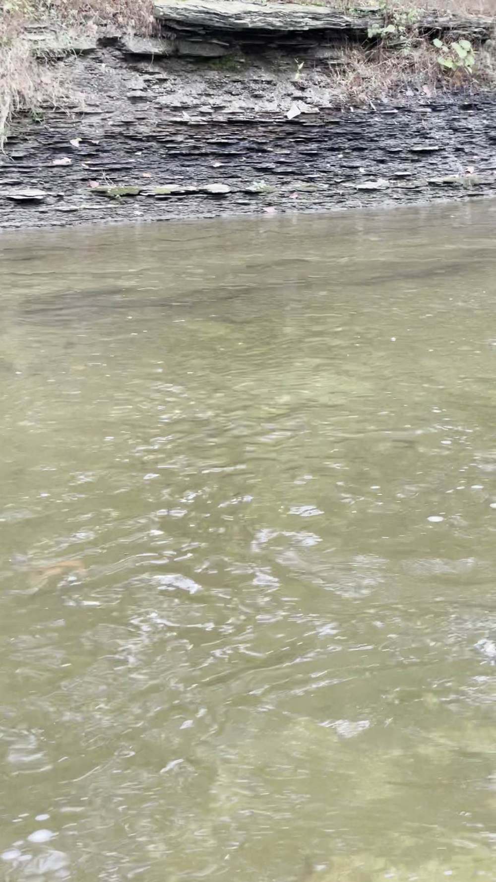
- The water: below the upper valley, the Cat and its South Branch flow through the wild, remote, 14-mile narrow Zoar Valley gorge. Half the valley lies within the ~3,000-acre state-owned Zoar Valley Multiple Use Area. The gorge is boulder-strewn, with pocket water and shale ledges where steelhead pause temporarily on their upstream journey — they do not hold here the way they hold over gravel.
- Access — the only two safe ways down: hike in and out from Valentine Flats (approximately 1-mile trail descending the gorge to the confluence of the main branch and South Branch) or the Forty Road parking area (Town of Persia; easy access to the South Branch and a short accessible trail to a scenic overlook).
Together they give access to about 7 miles of fishable water in the gorge section. DEC's detailed steelhead map is at dec.ny.gov/docs/fish_marine_pdf/cattcreeksteelhead.pdf. Sign in and out at the trail registers. The MUA is closed between sunset and sunrise; no camping, fires, alcoholic beverages, or glass containers.
Pools
the confluence pool at Valentine Flats (main branch meets South Branch — a natural holding spot), the pocket water and shale ledges through the gorge, and the South Branch pools off Forty Road. At fishable flows the gorge is difficult to float due to shallow water between the deeper pools and runs.
Note
DEC was carrying out Phase II safety improvements in fall 2026 (trail upgrades on the Valentine
Flats Trail, selective tree removal after Nov 1) — check the current Zoar Valley MUA webpage for trail closures before you go.
Gowanda — Aldrich Street Extension Bridge and NY 39 bridge (Village of Gowanda)
The water
the gauge sits here (USGS 04213500, at the State Highways 39 and 62 bridge). This is the boundary between the two jurisdictions: upstream is state-regulated water, downstream is Seneca Nation territory.
Access
there is no formal public fishing access in or near the town of Gowanda, but there are opportunities above the Aldrich Street bridge, and above the New York 39 bridge 1½ miles upstream of Gowanda. Be aware of posted private land downstream, closer to Gowanda.
Pools
the runs and pools above the Aldrich Street Extension Bridge are in the special-regulation reach (daylight only, hook gap 1/2 inch or less, Sep 1–Mar 31). Fish the seams and the deeper slots; at 160 cfs this is low, clear, spooky-fish water.
Note
the village sits on the creek, and bridge-area parking on Main Street is the usual walk-in point for the water above and below the bridge — confirm parking is public and permitted when you arrive, and obey posted signs; this guide does not guarantee a lot there.
Lower creek — Seneca Nation Cattaraugus Territory (Gowanda to Lake Erie, ~14 miles)
The water
the lower creek, where the fall peak concentrates — NYSDEC's 2006 review put the fishery's peak in October and November, usually on the lower creek within Seneca Nation land. Early in the fall, steelhead congregate on the lower reservation, providing there is adequate water; fish start moving through Gowanda and into the Zoar Valley by mid-October.
Access
Seneca Nation license required (see §5). The creek mouth area gives shore and boat access —
NYSDEC boat launches at Cattaraugus Creek (Town of Hanover Launch, off Routes 5 and 20, 2 miles west of the Silver Creek thruway interchange, hard-surface ramp, 75 cars and trailers) and Sunset Bay Marina (off Routes 5 and 20, marina at end of Allegany Road, 50 cars and trailers) serve the mouth, not the creek itself.
Pools
the lower-river holding water, the mouth, and the tidal/brackish water near the mouth where steelhead and the occasional Atlantic salmon move in during their runs. When the main stem is unfishable, feeders such as the lower South Branch in Zoar Valley, Clear Creek on the reservation, and Connoisarauley Creek are worth trying.
Note
this is the most productive water and the most commonly misunderstood. Confirm the current license, guide, and access rules with the Nation before you fish here — do not rely on a New York license alone.
09 — Tactics
7. Flies, tactics, and seasonal playbook
Tackle and fly categories below are from NYSDEC's "Steelhead Fishing in Lake Erie Tributaries" page and the I FISH NY Guide to Steelhead Fishing in Great Lakes Tributaries — the state's own advice, not a shop list.
Tackle
| Fly rod | 6–8 weight, 8–11 feet; a 7-weight, 10-foot rod is the DEC-recommended all-around steelhead rod for the Lake Erie tributaries — long enough to dead-drift egg patterns or swing streamers. Fly reels need a smooth adjustable disc drag and capacity for the floating fly line plus at least 100 yards of 20-pound dacron backing; large arbor is ideal. Weight-forward floating line is the versatile choice (dead-drift with a strike indicator, or cast large streamers). |
| Spinning | the most widely used setup — spinning combo for drifting egg sacs or casting spinners, spoons, and stickbaits. |
| Float / centerpin | very effective and increasingly popular — better drift control and much longer drifts than a spinning combo. |
| Leaders | 6–12 lb monofilament leaders (about 9 feet), with 4–12 lb fluorocarbon tippets on clear water days. |
Flies and baits
| Three fly types (DEC) | egg imitators, nymphs, and wet flies/streamers — different patterns and sizes by season, water temperature, clarity, and flow. |
| Egg patterns | the workhorse. Single eggs, sucker spawn, scrambled-egg sacks. In clear water, natural colors (steelhead-orange, peach, pink-pearl), small (6mm) and light tippet (6 lb); in stained water, hot pink, chartreuse, or blacker patterns, hook size #8–10 (vs #14–16 in clear). |
| Natural bait | salmon eggs tied in dime-sized sacks in nylon mesh — blue mesh is often very effective. |
Earthworms can also be good at times. Artificial eggs, small plastic worms, and beads have become popular.
| Nymphs | stonefly nymphs, hare's ear, caddis pupae — dead-drifted just off the bottom, moving at the exact speed of the current. In winter, dredge the bottom with stoneflies or eggs on long drifts. |
| Streamers | woolly buggers, egg-sucking leeches, zonkers, sculpin patterns — swing them in stained water and in pre-spawn aggression windows; the Cat's width and gradient suit spey rods and streamers, and stained water allows heavier tippet (10–12 lb). |
| Spinners/spoons/stickbaits | effective on the spinning rod, especially for fresh-run fish in the lower creek. |
How to fish it
| Drift fishing | present the bait just off the stream bottom, with the least weight needed to keep it near bottom without constantly hanging up. |
| Float fishing | long, snag-free drifts with the bait in the strike zone — the method of choice in the deep pools at low water. |
| Swinging | streamers through the pocket water and shale ledges of the gorge; steelhead prefer to hold over gravel, and the gorge has little of it, so cover water and fish the ledges where fish pause. |
| Clear-water rule (today's condition) | downsize everything — small egg patterns, light tippet, long leaders, and fish the deep slow runs, not the skinny riffles. |
Seasonal playbook
- Fall — now (Oct–Nov, peak): the main event. Fish push in with the first good fall rains; the peak is
October and November, usually on the lower creek (Seneca land) first, then through Gowanda into Zoar Valley by mid-October. Late September through mid-November is the best window. Fish the falling limb after rain, 250–400 cfs at Gowanda.
| Winter (Dec–Feb) | holdover fish in deep slow pools. Slow but rewarding if you can stand the cold. Egg patterns and stoneflies on long drifts. A mild winter means high, unfishable flows from rain and snowmelt — check the gauge, not the calendar. |
| Spring (Mar–Apr, spawning) | spawning mid-March to late April. Spring fishing is best in May and June, when flow levels and water conditions are most favorable, though April can also be good. The creek is still cold with flow to spare through late April and May, so it can take stocked fish when other New York Lake Erie tributaries usually cannot. Spring band: 250–400 cfs good, 400–650 cfs normal. |
| Summer | not a steelhead season on the Cat. The creek above the dam holds wild brook trout and stocked browns in smaller pools and runs — a different fishery, outside this guide. |
10 — Section
8. Techniques in depth — fishing Cattaraugus Creek
The Cat is the one creek in this set where size changes the technique, not just the scenery. It is a big, clay-banked river with a published band, a 400-foot gorge, and a dam at the top of the run — and the primary method at prime flows is the float rig fished long, because the pools are long, the drifts are long, and fish hold spread out instead of stacked in one slot.
The rig, set for this creek. Fish the band in §4, not a guess: 250–400 cfs at Gowanda is the good-fishing window to plan around, 100–250 cfs is low and tough, and 400–650 cfs is fishable but higher and likely stained.
At 250–400 cfs, set a full-size float rig — enough shot in a tapering pattern to hold a dime-size egg sac or a pegged bead down through a long drift without it planing up, and a leader long enough to fish the deep dam pool below Springville and the confluence pool at Valentine Flats at full depth. Check the drift relentlessly: on drifts this long, drag creeps in halfway down, so mend early and often, and treat depth as a dial — tick bottom every couple of seconds in the riffle heads, then ride just off it through the pool.
Bait by clarity. Clay is the whole clarity story here. The Cat colors from chocolate to steelhead green on the falling limb, and a blowout takes a median six days to clear back — so you will fish stained water here more than on any other creek in this guide set. In green water, standard-size sacs and beads in orange and chartreuse are right. In the brief low, clear windows at 100–250 cfs, go small and pale like a small-creek angler. In chocolate, go big, bright, and close to the bank — or do not go.
Forage notes — Cattaraugus Creek in mid-November On a big, clay-banked river like the Cat — roughly 34 miles from Lake Erie to Springville Dam, with the Zoar Valley gorge and its shale ledges in the middle — do not demote eggs just because the fall salmon pulse is winding down. Egg sacs, beads (6–10 mm), and single eggs stay in the lead group year-round here, sized to clarity: small and pale in the green, standard and brighter in the stain this creek carries longer than any other in the set. That is the drift the lake-run steelhead and coho named in §5 are still keyed to in the slots below gravel and in the long Gowanda pools.
Mouth and lower river only for shiners
emerald shiners matter at the mouth and in the lowest river, not as an up-creek lead in the gorge. Where legal and properly licensed — remember the lower 14 miles are Seneca Nation water — a live shiner on a bobber never rotates fully out at mouth and lower-reach water; up-creek, fish shiner profiles only as an imitation, not as the plan.
Secondary, not lead
sculpin streamers are secondary only, swung through shale-ledge pocket water after the egg drift has had first pass. Stonefly nymphs are the year-round secondary anchor, dead-drifted just off bottom as §7 already fishes them.
Off the menu
crayfish are tucked under rock and inactive in mid-November cold water on this clay-and-shale bottom, so crayfish patterns are not a November lead here.
Where they hold. Low at 100–250 cfs: the deep pools only — below Springville Dam, the Gowanda runs, the confluence pool. Prime at 250–400 cfs: seams, tailouts, and the shale ledges and pocket water in the Zoar Valley gorge where fish pause on the way up. High at 650–800 cfs and above: soft seams tight to the banks and the slowest inside edges, experienced anglers only — and past 800 cfs, do not wade at all.
The secondary method. Swung streamers beat the float rig on the falling limb at 400–650 cfs, when the water is stained, fresh fish are moving, and the broad runs above Gowanda and in the upper valley give a fly room to swing. That is the Cat's best fly water, and it barely exists on the smaller creeks.
Seasonal adjustment. Spring runs big here — March and April medians near 1,010 and 980 cfs — so spring technique means planning around the band's upper half: fish the drops through 400 cfs between floods instead of expecting the low, clear water fall anglers get at 160 cfs.
Winter adjustment. When the water falls into the 30s, the Cat's fish stop traveling and stack in the flat, deep pools — the dam pool, the Gowanda runs, the long pools in the valley — and they will not move far for a bait: below about 36 °F, expect to put repeated drifts through the same seam instead of covering water. Fish the day's warmest hours, roughly 11 AM to 2 PM, and downsize — pale, washed-out egg tones and small patterns
out-fish bright ones in cold, clear winter water. Spring spawning movement also starts a week or two later here than on the smaller southern-shore creeks, because the big river warms last.
11 — Section
9. Safety
1. The gorge kills people. Zoar Valley's cliffs are over 400 feet high, very steep, and composed of erodible,
unstable shale. Stay on designated and marked trails, stay at least 15 feet from cliff edges (a property-specific regulation, except on designated trails), and never scale or climb cliff walls including waterfalls (except ice climbing/rappelling by rope). There is no safe gorge or creek access from any location in Erie County or from the Town of Otto — only Valentine Flats and Forty Road, both in the Town of Persia. Do not walk along the top of the gorge. 2. The creek rises fast and stays dirty. Water levels rise quickly after rain or snowmelt, making the creek
unfishable for a day or two — and a big rise takes a median six days to clear. Clay soils and unstable, erodible banks keep the lower creek murky for much of the September–May steelhead season. Check the gauge before you drive, and again when you arrive. DEC's Zoar Valley paddling notes read the gorge by gauge height: mostly floatable above 2.0 feet, a few sticky drops near 2.5, extensive whitewater-kayak experience strongly advised above 3.0, only very experienced paddlers above 4.0 — and strainers are the most common hazard. 3. Cold water kills. The water was 48.7–48.9°F on Nov 8. A fall in November water is a real emergency.
Waders with a belt, a wading staff on the bouldery gorge water, and a fishing partner are not optional extras — and on the gorge's wet shale, wear studded rubber soles; felt soles skate on shale ledges. 4. Know whose land you are on. Fishing without the right license — New York State above Gowanda,
Seneca Nation below it — is not a paperwork problem, it is trespassing on sovereign land. In sections without PFR, you must obtain the landowner's permission. Your fishing license is not a permit to trespass.
Respect private property or you risk losing public access for everyone. 5. The special reach has its own rules. Aldrich Street Extension Bridge to Springville Dam, Sep 1–Mar 31:
daylight only (1/2 hour before sunrise to 1/2 hour after sunset), hook gap 1/2 inch or less. Fish it by those rules or do not fish it. 6. Trail rules in the MUA: sign in and out at trail registers, stay on marked trails, MUA closed sunset to
sunrise, no camping, fires, alcohol, or glass. Check the Zoar Valley MUA webpage for trail closures —
Phase II safety work was under way in fall 2026.
12 — Section
10. What is inside the living edition
Same promise as every Keystoned guide:
- Live USGS gauge at Gowanda (04213500) — real readings, stamped with the time the gauge took them: flow, gauge height, water temperature, and turbidity where the sensor is working.
- Live weather & radar built right into the guide.
- Verified access where it exists — and where access is unverified, the guide says so plainly instead of faking a parking lot.
- Flow windows — the exact bands that say go, wait, or stay home (§4).
- Buy once — updates to the guides you bought are free. A living edition that stays current all season.
Sources (Nov 8, 2026 build)
- USGS 04213500 Cattaraugus Creek at Gowanda NY — station description (location, 436 mi² drainage, period of record Nov 1939–current, extremes, water-quality sonde since June 2011), waterdata.usgs.gov.
- outfish.in, Cattaraugus Creek Fishing Report, Nov 8, 2026 (crawled 15:14 UTC): 160.0 cfs, 9.4°C / 48.9°F,
USGS updated Nov 8 9:15 AM; air 48.4°F, wind 20 km/h, cloud 100%, pressure 29.08 inHg falling; stable 53h; seasonal-hours and hook-gap rules above Aldrich Street Extension Bridge; DEC run timing, peak Oct–Nov, spawning mid-Mar–late Apr; turbidity vs flow; 0.41 fish/hr 2024–25; DEC 2026–2035 steelhead plan.
- Steelhead Almanac, Nov 8, 2026 9:00 AM EST assessment: Cattaraugus 160 cfs, water 48.7°F, gauge 1.30 ft, observed 8:15 AM EST; air 48°F, wind SW 12 mph; rain expected in ~12h.
- Lake Erie Pulse, updated Nov 8, 9:53 AM ET: Cattaraugus 160 / normal 433, steady, 49°F, Clear 4 FNU measured, 0.2″ rain next 36h; status-word definitions; NY stocking ~230,000 across nine tributaries.
- WNY Fly Fishing, Stream Report 11/2/2026 (wnyflyfishing.blogspot.com): Cattaraugus fall/spring flow bands, 100–250 / 250–400 / 400–650 / 650–800 / 800–1,000 / 1,000–1,200 cfs.
- NYSDEC, Steelhead Streams in Western New York (dec.ny.gov): PFR definition; Cattaraugus Creek PFR
3.8 mi + 6 mi Zoar Valley MUA (Cattaraugus Co.), 6 mi Zoar Valley MUA + 0.5 mi Erie County Park at dam (Erie Co.), Seneca license on lower 14 mi; Silver Creek entry (see Silver Creek guide).
- NYSDEC, Steelhead Fishing in Lake Erie Tributaries (dec.ny.gov): Washington strain, 142,500 yearling target across 8 tributaries, bulk run mid-Oct–Apr, 5–8 lb average (10–12 lb common), tackle (7-wt 10-ft fly rod, 100 yd 20-lb backing, WF floating line; spinning; float/centerpin), HuntFishNY / DEC InfoLocator for parking and access.
- I FISH NY Guide to Steelhead Fishing in Great Lakes Tributaries (DEC): fly types (egg imitators, nymphs, wet flies/streamers), artificial/natural baits (salmon eggs in dime-sized sacks, blue mesh; earthworms), drift and float techniques.
- Fly Fisherman, "The Cat's Meow: Lake Erie Steelhead" (Sep 25, 2025): 34 miles Springville Dam to Lake
Erie, Zoar Valley gorge, Hammond Hill Road PFR (south bank only, one landlocked section), Valentine Flats / Forty Road access to 7 miles of gorge water, no formal access in Gowanda, Seneca license (William Seneca Administration Building 716-532-4900; Seneca One Stop, US 20 & NY 5), fall peak late Sep–mid-Nov, spring best May–June.
- Ellicottville Outside, "Fly Fishing Ellicottville: The Fall Basecamp Guide": largest NY Lake Erie tributary,
~230,000 yearlings across nine tributaries, 10+ miles public access above Gowanda (Zoar Valley MUA + PFR), Seneca license below Gowanda.
- Tour Chautauqua, Lake Erie Tributaries in Chautauqua County: Silver Creek / Walnut Creek entries; regulations (trout open all year, 12-inch minimum, 3/day; 1/2 hour before sunrise to 1/2 hour after sunset).
- NYSDEC, Zoar Valley Multiple Use Area & Unique Area FAQ (dec.ny.gov): cliffs over 400 ft, only safe creek access Valentine Flats trail and Forty Road lot (Town of Persia), no safe access Erie County side or Town of Otto, 15-ft cliff-edge setback, trail registers, MUA closed sunset–sunrise, no camping/fires/alcohol/glass; Phase II safety improvements fall 2026.
- Snoflo New York flow report, Nov 7, 2026: NY rivers 56% of normal across 193 USGS gauges.
- Weather: weather.com, Silver Creek NY hourly, Nov 8, 2026 (50°F, wind SW 19 mph gusts 28 mph, pressure falling; showers overnight, 0.07″); Small Craft Advisory until Mon 4:00 PM EST.
- Seneca Nation license — Seneca Nation of Indians Comprehensive Conservation Law (adopted Apr 14,
2026, CN S-04-14-26-19), as reproduced by Cattaraugus Creek Outfitters (Facebook / Instagram, Sep 26,
2026): restricted areas — licensed non-members barred unless accompanied by a Member; open stretches reported as Versailles upstream to Gowanda and from the Thruway downstream; lead-sinker and non-native-bait prohibitions. Seneca Nation Clerk's Office page (sni.org, checked Nov 9, 2026): the Clerk's Office sells SNI fishing licenses to non-members; offices at 12837 Route 438, Irving, NY 14081, 716-532-4900, and 90 Ohi:yo Way, Salamanca, NY 14779, 716-945-1790. Seneca Nation Conservation Department page (sni.org): license/permit outlets include the Clerk's Office, Highbanks Campground, and Seneca One Stops; restricted-area and lead-sinker rules. The Nation does not publish its fishing-license fee schedule on its site, so this guide does not print fees — confirm them with the Clerk's Office.
- Recent pushes / fresh runs (§3A) — Nov 6–7 rain refill: Walnut Creek (PA) peaked ~94.7 cfs Nov 7, easing to ~16.5–18 cfs Nov 8, 9:30 AM; Elk/Conneaut also rose then eased (USGS gauges via Lake Erie Pulse / Steelhead Almanac). BirdTrout, Nov 6, 2026: peak run Walnut/Elk/Conneaut (PA), tail-off Cattaraugus (NY). NY DEC hotline, Oct 30–Nov 13, 2026: Cattaraugus only viable NY Erie trib, low/clear, limited steelhead spread; all other NY Erie tribs at a trickle, practically void of fish; Eighteenmile / Oak Orchard (Lake Ontario) plentiful browns/kings, some steelhead/coho. Nov 7 Erie, PA angler report (Donny Angler): murky/fishy, fish on spoons, eggs/sacks working; Elk eggs/minnows effective despite leaves. Steelhead Almanac, Nov 8, 2026 9:00 AM EST: Cattaraugus Good 160 cfs stable, Walnut Fair 18 falling, Elk Fair ~16 falling, Twenty Mile Poor ~28 falling. Next rain chance late Sun Nov 8 into Mon Nov 9 — forecast only.
- Keystoned context: Pennsylvania Outflows & Tailwaters guide (format model); Erie Trenches & Tributaries
Pack $99.99.
Lore, Legends & History Start with the name, because the name is a warning and a description at once. Cattaraugus comes from a Seneca word recorded in older spellings as Gah-ta-ra-ke-ras. William Beauchamp, in the New York State Museum's study of Aboriginal place names, translated it as "stinking shore" or "foul-smelling river bank." In modern Seneca it is rendered Ga'dä:gë́sgë:ö', "the clay used to stink." Honest tellings keep both halves together — clay banks, and a strong smell rising off them.
That smell was real. Natural gas seeped from cracks in the rock and from the mud along the creek, and petroleum showed on the water. A traveler in 1809 noted oily scum on the creek that sometimes caught fire.
French maps marked this water Rivière puante — the smelly river. Local retellings have also called Cattaraugus a word for "burning springs," tying the name to gas-rich banks that could burn. The spellings and translations vary, as Seneca names passed through French, English, and Seneca speakers often do, but every version points back to the same ground truth: this creek announced itself by scent before you ever saw it.
For most of its lower course, the creek runs through the Cattaraugus Territory of the Seneca Nation, and it ran through Seneca country long before there was a reservation line to draw. Seneca villages stood along its banks, including a settlement a few miles from the mouth, above the high banks. After the Sullivan campaign of the Revolutionary War drove Seneca families from their towns in the Genesee country, some fled west toward Zoar Valley and toward the British post at Niagara. The valley has been a refuge as well as a home.
Zoar Valley, the deep gorge east of Gowanda, carries the oldest lore on this water. A published Cattaraugus County history records that Seneca folklore placed a troupe of fairies — the little people — in Zoar, and said some ceremonies were learned from them. Marks in the hardened sand along the creek, like tiny footprints, were taken as their sign, and sounds echoing in the valley, like distant drumbeats, were said to be theirs, and a signal for ritual. That is how the county history tells it, and it should be left as it was told: Seneca tradition, not a claim to prove. The same history passes on a darker settler legend from Zoar, of a traveling peddler who took
lodging in the valley, was struck down and thrown into a cellar, and with his last words pronounced a curse that locals blamed for strange happenings afterward. It is presented in that book as legend, and that is how it belongs here. The settler towns grew up on mill power and creek crossings. Gowanda, split by the creek between Erie and Cattaraugus counties, takes its name from a Seneca phrase meaning "a valley among the hills" or "under the cliffs" — a plain description of its place below the Zoar gorge. Turner Aldrich settled there in 1810, the place was called Aldrich's Mills, then Lodi, and it incorporated as Gowanda in 1848, with the Cattaraugus Reservation bordering it to the northwest. Upstream, Springville in the town of Concord was first settled in 1807 by Christopher Stone and John Albro, took its name from its many freshwater springs, and grew with the factories and trade that Cattaraugus Creek and its tributaries made possible.
Stand at the mouth, or down in Zoar when the gorge holds the mist, and the old name makes sense. Clay, gas, deep hills, and a people who named what they smelled and saw — that is the Cattaraugus.
Night fishing — working the holes after dark First, the law on this water. This guide's own rules chapter states it, and it governs everything below: "5. The special reach has its own rules. Aldrich Street Extension Bridge to Springville Dam, Sep 1–Mar 31: daylight only (1/2 hour before sunrise to 1/2 hour after sunset), hook gap 1/2 inch or less. Fish it by those rules or do not fish it." "6. Trail rules in the MUA: sign in and out at trail registers, stay on marked trails, MUA closed sunset to sunrise, no camping, fires, alcohol, or glass. Check the Zoar Valley MUA webpage for trail closures — Phase II safety work was under way in fall 2026." Fish the night only where and when that leaves it open. The general tributary rule travels with those reach rules: Sep 1–Mar 31, the tributary reach from the bridge closest to the mouth to the first barrier impassable by fish is daylight-hours water (1/2 hour before sunrise to 1/2 hour after sunset). The lower 14 miles are Seneca Nation water — Seneca licensing and Seneca rules govern there.
Read that plainly before anything below: from September 1 through March 31 there is NO legal after-dark fishing on the tributary reach this guide covers — the legal day ends 1/2 hour after sunset. Everything below therefore belongs to two places: the open months (April through August), and the lake shore and open mouth water outside the tributary reach, where night fishing stays legal. In season, the night game on this creek is the first and last legal light — fish the §7/§8 program hard at dawn and dusk — not the dark itself.
After dark, the run changes address on Cattaraugus Creek, NY. Steelhead that travelled and held in the fast water by day settle into the deep holes — the slow, dark water at the head of the pool, along the ledge and the undercut bank, and the soft seam beside the fast tongue — and they feed there with a confidence they never show at noon. The deep holes are the night fishery: fewer fish moving, more fish eating.
Working a hole in the dark is a memory exercise before it is a fishing exercise. Fish the hole in daylight first: learn where it deepens, where the wood and the ledges sit, where you will stand, and where a hooked fish can be landed. At night, work it top to bottom in short steps — a cast or two across the head, down the seam, into the tail — slow, deep and close to the bottom, with long pauses; a steelhead at night does not chase, it intercepts.
Two profiles speak at night: glow — a glow bead, glow egg or chartreuse presentation where a little light helps the fish find it — and dark — a black or black-olive streamer or nymph silhouetted against the night sky. The dark profile works because it reads to a night-feeding fish as a bottom forage fish on the move — big, slow, and tight to the substrate. Light discipline is not optional: a headlamp shone into a hole ends the fishing in it — keep the light on the bank and on your feet, red or dim when you have it, and rest a lit-up hole before fishing it again.
Sound carries the same way. Safety doubles after dark: never wade at night water you have not waded by day, belt cinched and staff in hand, tell someone the reach and the return time — a fall in cold water at night is a
survival event, not a soaking. Tonight's night pick — kept live with this guide's bait rotation. The rotation updates the night pick for this water on the same cycle as the day picks, off the forage calendar and the current clarity and flow.
Current-season default: where night fishing is open: a glow spawn sac under a float at the head of the hole; dark second, a black streamer swung at a crawl along the seam. On the lake shore and open mouth water, a glow spoon or stickbait covers the dark water below the reach.
13 — Posted & Access
Posted Land & Access Trails
Cattaraugus Creek is 34 miles of steelhead water from the Lake Erie mouth at Irving to the Springville Dam, and no other creek in this set splits into as many different kinds of ground. The lower 14 miles are Seneca Nation Territory, fished on the Nation's license under the Nation's law. Above Gowanda the creek runs through the Zoar Valley Multiple Use Area and DEC public fishing rights easements, with a half-mile of Erie County park land at the dam. DEC's own totals for the run: 3.8 miles of PFR easements, 6 miles in the Zoar Valley MUA, and permission-required private land everywhere else. This chapter walks the creek mouth to dam and names whose ground each reach is. Checked November 2026.
The public water — access areas & easements
The mouth at Irving
DEC's steelhead map is blunt: "Very limited public access to the creek can be found at the mouth in Irving." DEC names no parcel, park, or lot at the mouth. The two DEC-listed boat launches here — the Town of Hanover Launch on Routes 5/20 and Sunset Bay Marina — serve the creek mouth and the lake, not bank fishing on the creek. Treat the mouth as effectively closed to bank anglers.
Coordinates — Town of Hanover Launch on Routes 5/20: 42.563791, -79.128297 — Source: NYSDEC, "Boat Launch Sites for Chautauqua County" — Lake Erie/Cattaraugus Creek, Town of Hanover, municipal hard-surface launch row prints "42.563791°N, 79.128297°W" (the DEC table leaves this row's site name blank; Erie County's Shore Fishing Sites list supplies the name "Cattaraugus Creek - Town of Hanover Launch Ramp")
Coordinates — Sunset Bay Marina (DEC/OPRHP: Sunset Bay State Marine Park): 42.567104, -79.135328 — Source: NYSDEC, "Boat Launch Sites for Chautauqua County" — "Sunset Bay State Marine Park. 42.567104°N, 79.135328°W", Town of Hanover, OPRHP
The Seneca Nation reach — the lower ~14 miles
DEC's steelhead table: "Virtually the entire lower 14 miles in Erie County are located on the Seneca Indian Reservation. A Seneca license is required to fish on reservation lands." DEC's Cattaraugus map adds: anglers fishing on the Reservation "must purchase a license from the Seneca Nation; however anglers do not need a New York State license on Seneca Nation lands." This is the Nation's water under the Nation's own conservation law — the license outlets, the restricted-waters map, and the stretches the Nation opens to licensed non-member anglers are detailed in this guide's Seneca Nation box, and the Nation's rules govern on the ground.
Zoar Valley Multiple Use Area — DEC state land, Gowanda upstream
DEC's table credits the main stem with 6 miles in the MUA; DEC's map says "over seven miles of the Cattaraugus main stream and South Branch flow through public land" in the area, and the property regulation (6 NYCRR §190.25) takes in a five-mile segment of the main creek and a two-mile segment of the South Branch. DEC's Zoar Valley FAQ names the only safe access to the creek: the Valentine Flats trail (about a one-mile trail descending to the confluence of the main branch and the South Branch) and the Forty Road parking lot (easy access to the South Branch, with a short accessible trail to a scenic overlook), both in the Town of Persia. Designated parking is on Valentine Flats Road and Forty Road (Persia) and Vail Road (Town of Collins, Erie County). DEC states there is no safe access to the gorge or the creek from Erie County or from the Town of Otto.
Coordinates — Forty Road parking lot, Zoar Valley Multiple Use Area, Town of Persia: 42.425211, -78.897056 — Source: NYSDEC, "Zoar Valley Multiple Use Area and Unique Area" — "Forty Road Parking Area is located on Forty Road near Point Peter Road (42.425211°N, 78.897056°W)", NAD83/WGS84
Coordinates — Designated parking on Vail Road, Town of Collins (DEC: Ross Parking Area): 42.451078, -78.879255 — Source: NYSDEC, "Zoar Valley Multiple Use Area and Unique Area" — "Ross Parking Area is off Vail Road near Unger Road (42.451078°N, 78.879255°W)", NAD83/WGS84
Coordinates — Designated parking on Vail Road, Town of Collins (DEC: Holcomb Pond Parking Area): 42.451906, -78.862755 — Source: NYSDEC, "Zoar Valley Multiple Use Area and Unique Area" — "Holcomb Pond Parking Area is off of Vail Road between Unger Road and Button Road (42.451906°N, 78.862755°W)", NAD83/WGS84
South Branch Cattaraugus Creek
DEC's table: fishable from the mouth up to the falls 3.5 miles upstream, with 1 mile of that in the Zoar Valley MUA. The rest is permission water.
PFR easements — 3.8 miles, Cattaraugus County bank
DEC's map: the easements are "all on the Cattaraugus County bank, above and below Hammond Hill Road." These are permanent DEC easements — the right to fish and walk the bank (usually a 33-foot strip) for fishing only — marked on the ground by yellow Public Fishing Area signs. Angler parking is marked on the map at North Otto Road as well.
Coordinates — Angler parking at North Otto Road (DEC: Cattaraugus Creek Waterway Access): 42.455777, -78.812004 — Source: NYSDEC, "Zoar Valley Multiple Use Area and Unique Area" — "Cattaraugus Creek Waterway Access is located outside of the property to the east, on North Otto Road (42.455777°N, 78.812004°W)", NAD83/WGS84. DEC's Cattaraugus County boat launch table prints the same Otto hand-launch site as 42.455775°N, 78.812020°W — a ~2 m variant between DEC's own pages
Springville Dam — Erie County park land
DEC's table credits 0.5 mile of Erie County Park land at the dam; DEC's map: "Anglers can also fish a short section just below the Springville Dam on the Erie County side of the stream." The dam is the upstream barrier — the run ends here.
Posted & private — stay out
Everything outside the doors above is permission water
DEC's table says it for reach after reach of this creek: "Anglers must obtain permission from landowners to fish other sections." A New York license is not a permit to trespass.
The Seneca reach is not public water
It is open to non-member anglers only where and as the Nation allows, on a Seneca license. Unlicensed fishing on the Territory is a violation of the Nation's law, not a gray area.
Zoar Valley's cliffs are closed ground
DEC is explicit that there is no safe gorge or creek access from the Erie County side or the Town of Otto, and the MUA regulation prohibits proceeding beyond the designated trails' safe routes in the restricted South Branch area except as the regulation allows (see Seasonal). Do not improvise a descent.
Gowanda itself
DEC prints no public access in the village. The Aldrich Street Extension Bridge matters to this creek as a regulation boundary (below), not as an access point.
Seasonal & changing access
The creek is open all year for trout and salmon under the Lake Erie tributary rules: 12-inch minimum, 3 per day in any combination.
New York's night rule applies to a defined reach of this creek only. From September 1 through March 31, fishing is daylight-only (one-half hour before sunrise to one-half hour after sunset), with a hook gap of no more than ½ inch and free-swinging hooks — on Cattaraugus Creek, DEC defines that reach as the Aldrich Street Extension Bridge in Gowanda upstream to the Springville Dam. DEC does not extend the seasonal reach below Aldrich Street; the Seneca water below Gowanda fishes under the Nation's law in any case.
Zoar Valley closes at night all year. The MUA is open sunrise to sunset and "closed to any and all public use of any kind between the hours of sunset and sunrise" (6 NYCRR §190.25(b)) — that closure is a property rule, not a fishing rule, and it runs twelve months a year. Camping, structures, and fires are prohibited.
South Branch restricted area: from the abandoned Forty Road bridge abutments upstream to the state land boundary, no one may proceed by land or water except licensed anglers for the purpose of fishing, or by permit (§190.25(r)).
A printed closure that no longer stands: DEC's 2009 Cattaraugus map prints April 1–December 31 seasons with a January 1–March 31 fishing prohibition for Spooner Creek and the North Branch of Clear Creek. DEC's 2026–2035 Lake Erie steelhead management plan records those tributary restrictions as removed, and DEC's current regulations page lists no such closure. This guide treats the closure as superseded — and flags it here so an angler holding the old map is not confused.
Sources for this section: NYSDEC, "Steelhead Streams in Western New York" (Region 9 table); NYSDEC, Cattaraugus Creek steelhead-section map (Ver. 12/09); NYSDEC, Zoar Valley Multiple Use Area FAQ; 6 NYCRR §190.25; NYSDEC, "Great Lakes and Tributaries Special Regulations" and "Steelhead Fishing in Lake Erie Tributaries" (dec.ny.gov). Checked November 2026.
The Bottom Line
Cattaraugus Creek — "the Cat" — is the biggest Lake Erie tributary in New York and, in NYSDEC's words, one of the premier steelhead streams in the state. It is also the most complicated water in Steelhead Alley to fish legally and safely: the top of the run…
Legal · Read last
LEGAL DISCLOSURE — Keystoned Steel Guides
What Keystoned Steel warrants. Keystoned Steel warrants only that, as of the edition date stated in this guide, the access, gauge, and regulation information in this guide that is attributed to a cited official source accurately reflects that source as published on that date. If a material error in that information is confirmed, Keystoned Steel will issue a corrected edition to the original buyer at no charge or, if it does not do so within 30 days after confirming the error, refund the price you paid. That is the sole express warranty provided with this guide.
This guide does not warrant or guarantee:
- (a) Stream conditions, water levels, clarity, or weather — conditions change daily and can change after any
reading printed here;
- (b) Fishing success — no representation is made that fish are present, in any number, size, or location, at any
time;
- (c) Access — access status, parking, and Public Fishing Rights can change, be posted, or be withdrawn at any
time; inclusion of a reach in this guide is not permission to fish it, and is not a representation that access is currently open;
- (d) Third-party data — Gauge readings, including USGS data, agency publications, and maps, originate from
third-party sources. Keystoned Steel does not control those sources and cannot guarantee their accuracy, completeness, availability, or continued accessibility. Third-party information may be provisional, delayed, revised, or incorrect. Its inclusion does not constitute an independent guarantee by Keystoned Steel of the underlying data;
- (e) Regulations — seasons, creel and size limits, and special-reach rules change; the regulations summarized
here are a convenience summary only and are not the law.
Your responsibilities. Before you fish: confirm the current regulations in the current NYSDEC Freshwater Fishing Regulations Guide; hold the required license; verify access is open and lawful for the reach you fish; respect posted signs and private land — a fishing license is not a permit to trespass. Wading and stream fishing involve inherent risks, including fast or rising water, slippery rock, and remote terrain; you fish at your own risk and are responsible for your own safety decisions. This safety warning and assumption of risk do not waive or limit any liability, warranty, or remedy that cannot lawfully be waived or limited under applicable law.
Corrections and refunds. If you believe this guide contains a material error, email keystonedsteel@gmail.com or message our Facebook Page with the guide name and the error. Keystoned Steel will review it against the cited sources within 30 days. If the error is confirmed, you will receive a corrected edition or, at Keystoned Steel's election, a refund of the price you paid. That remedy is your sole and exclusive remedy for errors in this guide. Limitation of liability. TO THE FULLEST EXTENT PERMITTED BY APPLICABLE LAW, KEYSTONED STEEL'S TOTAL LIABILITY ARISING OUT OF THIS GUIDE WILL NOT EXCEED THE PRICE YOU
PAID FOR IT, AND KEYSTONED STEEL WILL NOT BE LIABLE FOR INDIRECT, INCIDENTAL, OR CONSEQUENTIAL DAMAGES, INCLUDING TRIP COSTS, CITATIONS OR FINES, OR PERSONAL INJURY ARISING FROM YOUR USE OF THIS GUIDE. NOTHING HERE LIMITS LIABILITY FOR GROSS NEGLIGENCE OR WILLFUL MISCONDUCT. License. This guide is licensed to the original buyer for personal use only. It is nontransferable and may not be shared, resold, or redistributed without the prior written consent of Keystoned Steel. Living-edition updates are delivered only to the original buyer's purchase email.
TO THE FULLEST EXTENT PERMITTED BY APPLICABLE LAW, THE WARRANTY SET FORTH ABOVE IS THE SOLE EXPRESS WARRANTY PROVIDED BY KEYSTONED STEEL FOR THIS GUIDE, AND KEYSTONED STEEL DISCLAIMS ALL OTHER WARRANTIES, EXPRESS OR IMPLIED, INCLUDING ANY IMPLIED WARRANTY OF MERCHANTABILITY AND ANY IMPLIED WARRANTY OF FITNESS FOR A PARTICULAR PURPOSE. NOTHING IN THIS DISCLOSURE SHALL EXCLUDE OR LIMIT ANY WARRANTY, RIGHT, OR REMEDY THAT CANNOT LAWFULLY BE EXCLUDED OR LIMITED UNDER APPLICABLE LAW.