
Keystoned Steel // Field Guide
Buffalo Creek
GAUGE — USGS 04214222
The brief
class="v-brief">What this creek is: Buffalo Creek is the city creek of the NY Lake Erie steelhead set — a DEC-stocked tributary (5,000 steelhead yearlings a year, Table 1, 2025 targets, no domestic rainbow allotment) that runs through the Buffalo suburbs and into the Buffalo River / Lake Erie. DEC's steelhead section is mouth to Blossom Dam, 14 miles — and the whole of it is need owner permission: DEC lists no Public Fishing Rights and no park mileage for this creek. It is a permission creek with a live gauge at Gardenville, and on November 8 it was one of the better-looking small NY tribs: 32.9 cfs and rising.
01 — Section
1. The idea in one paragraph
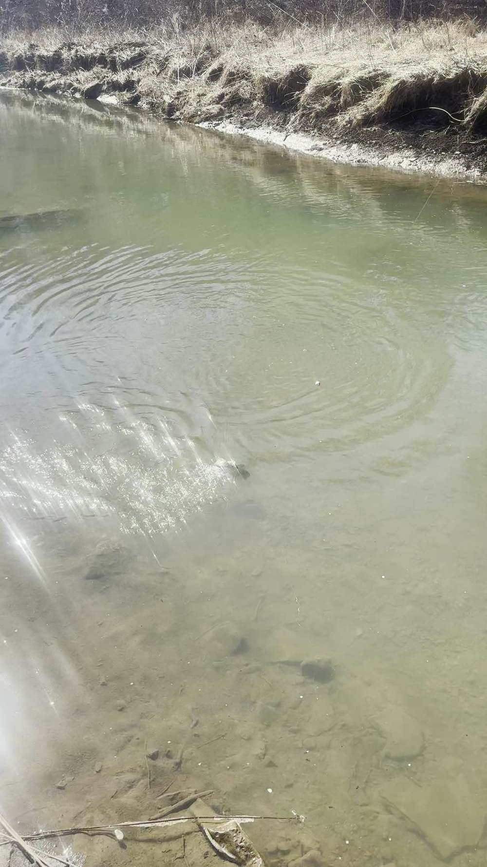
Buffalo Creek fishes like an urban steelhead creek: easy to reach, hard to access legally, and surprisingly good when it has water. It is bigger than the Chautauqua County small creeks — the Gardenville gauge read 32.9 cfs on Nov 8, an order of magnitude more than Walnut or Silver Creek that morning — and it rises with rain in the Buffalo metro watershed. The fish are stocked steelhead that run up from the lake through the Buffalo River, and the limiting factor is not fish, it is permission: the creek runs through private land, suburban yards, and parkland whose fishing rules need checking reach by reach. Get permission, read the Gardenville gauge, and fish the falling water.
02 — Section
2. How to use this guide
1. Check the Gardenville gauge first (§3). If it is rising, fish are moving in; fish the falling water a day past
the peak. 2. Assume private land until proven otherwise. DEC lists no PFR on Buffalo Creek. Do not walk in where
you have no permission. 3. Fish the trend, not the number (§4). No published flow band exists for this creek — §4 gives a working
method for reading the gauge instead of a band. 4. Bring a thermometer. The Gardenville gauge has no water-temperature sensor.
03 — The Water★ Intel
3. Live gauges — verified snapshot, Sun Nov 8, 2026
All readings below are USGS provisional data, subject to revision, pulled direct from USGS Water Services on Nov 8, 2026. Times are the gauge reading times. These are a dated snapshot, not a live reading — in the living edition these cells are live at page load.
Gauge
USGS site
Live read (as reported)
Water temp
Call on the day
---
---
---
---
---
Gauge
USGS site
Live read (as reported)
Water temp
Call on the day
Buffalo Creek at Gardenville, NY
04214500
32.9 cfs, 0.69 ft, Nov 8 09:15 EST, rising
No sensor — not reported
Fishable and rising. Steelhead Almanac rated it Poor at 33 cfs on Nov 8, 09:15 EST (air 50°F, wind N 16 mph) — its rating reflects low flow for the creek's size, but a rising gauge is the right direction: fish the water as it comes up and then drops. The best window is the falling limb, not the rising limb.
Regional context, Nov 8, 2026, ~09:00–10:00 EST (USGS direct): Cattaraugus Creek at Gowanda 160 cfs / 48.9°F (the only NY Lake Erie trib gauge with a live temperature sensor that morning); Eighteen Mile Creek at Hamburg 12.2 cfs; Big Sister Creek 3.66 cfs; Cazenovia Creek 20.6 cfs; Cayuga Creek 9.71 cfs; Canadaway Creek 15.0 cfs and rising; Chautauqua Creek 20.0 cfs and falling; Silver Creek 3.70 cfs; Walnut Creek (NY) 1.95 cfs. Lake Erie surface temperature was 56.8°F (NOAA stations, via Steelhead Almanac, Nov 8, 10:00 EST). Rain expected in the region in ~11 hours per Steelhead Almanac's Nov 8, 10:00 EST assessment.
Weather on the day (Steelhead Almanac, Nov 8, 09:15 EST): clouds, air 50°F, wind N 16 mph at the Gardenville gauge. In the app, the live NWS Buffalo forecast is embedded at page load.
3A. Recent pushes / fresh runs — Nov 6–8, 2026 Dated, sourced reports only. This section is a dated snapshot — in the app it is replaced by the latest reports at page load. Nothing here claims a run that is not sourced.
How this applies to this creek: the DEC hotline line — 'all other NY Lake Erie tribs at a trickle, practically void of fish' — covers this creek directly, even though Buffalo Creek was the highest of the small Erie County tribs on Nov 8 at 32.9 cfs and rising.
- Nov 6–7 rain refill (USGS gauges, via Lake Erie Pulse / Steelhead Almanac): the Nov 6–7 rain lifted the
Pennsylvania tribs and then eased fast. Walnut Creek (PA) peaked at ~94.7 cfs on Nov 7, easing to ~16.5–18 cfs by Nov 8, 9:30 AM. Elk Creek and Conneaut Creek (PA) also rose on the rain and then eased.
BirdTrout, Nov 6, 2026
peak run for Walnut, Elk, and Conneaut (PA); tail-off for Cattaraugus (NY).
NY DEC hotline, Oct 30–Nov 13, 2026
Cattaraugus was the only viable NY Lake Erie tributary — low and clear, with a limited spread of steelhead. All other NY Lake Erie tribs were at a trickle, practically void of fish. On the Lake Ontario side, Eighteenmile Creek and Oak Orchard had plentiful browns and kings, with some steelhead and coho.
Walnut Fair — 18 cfs, falling. Elk Fair — ~16 cfs, falling. Twenty Mile Poor — ~28 cfs, falling.
(Walnut / Elk / Twenty Mile here are the PA creeks.)
- Honest summary — no confirmed widespread fresh push: the Nov 6 forecast alone did not produce a confirmed widespread fresh push. What the reports show is a localized PA refill on Nov 6–7 that peaked and is now falling, a tailing-off Cat at low, clear water with limited fish spread, and NY's smaller Erie tribs practically void of fish. Do not read a big new run into this weekend.
- Next chance — forecast, not fact: the next rain chance, late Sun Nov 8 into Mon Nov 9, could pull a fresh push into the Ohio and Pennsylvania tribs. That is a forecast, not a fact — check the gauges Monday morning before you drive.
04 — The Water
4. Flow bands — go / wait / stay home
No published, verified flow band exists for this creek. What follows is a working method, not a band — qualitative guidance for reading the gauge, with no invented cfs lines.
Working method:
- Around the Nov 8 reading (~33 cfs at Gardenville, rising): fishable, improving. Fish the pools and the deeper runs; expect fish to be moving in on the rise and holding as it drops.
- A fresh lift (rising gauge after rain, then falling): the creek's best water. Fish the falling water while it still carries a little color.
- Blown out (gauge several times the Nov 8 reading and still rising): stay home, or — only where you already have the landowner's permission — bank-fish the mouth area. Do not wade an urban creek you cannot see the bottom of — strainers, concrete, and debris are real hazards here.
- Low and stable (well below 33 cfs): fishable, but fish pod up in the deep pools. Stealth and small flies matter more.
- General rule: stability beats the number, and on an urban creek the trend is the tell — rising means fish coming in, falling-and-clearing means fish holding and catchable.
No cfs band is printed for this creek — none is published, and this guide does not invent one. Use the method above, and keep notes on what the gauge read on your good and bad days; that log is worth more than a guessed band.
05 — Section
5. The run, the fish, and the rules
Run timing
the bulk of the run is mid-October through April; mature steelhead enter as early as mid-September. Steelhead are most active roughly 42–55°F; Cattaraugus read 48.9°F that morning (Nov 8), in range.
Stocking note
DEC stocks this creek with 5,000 steelhead yearlings a year (2025 targets). No domestic rainbow allotment. Stocked steelhead typically spend two years in the lake and return as three-year-olds.
Regulations — check before you fish
NY fishing license required, age 16+. DEC's Lake Erie tributary summary (secondary source) gives trout/salmon open all year, 12-inch minimum, 3 fish in combination — verify against the current NYSDEC Freshwater Fishing Regulations Guide. No special-regulation reach for Buffalo Creek is listed in DEC's tributary summary — confirm in the current NYSDEC guide before you fish.
06 — Access
6. Access, pool by pool — area-level only
No street address is stated here that was not verified. Access below is area-level (town / area), from the NYSDEC steelhead-streams public-access table. No parking-lot address is invented.
READ THIS FIRST: the entire DEC steelhead section of Buffalo Creek — mouth to Blossom Dam, all 14 miles — is listed by DEC as "need owner permission," not "posted." Per DEC, you need the landowner's permission to fish any part of it. There is no public access point anywhere in that stretch, and nothing in this section should be read as one.
Mouth to Blossom Dam (14 miles)
DEC's steelhead section, and DEC lists it as "need owner permission" — landowner permission required to fish any of it. No exceptions in the DEC table: no PFR mileage, no park mileage, no public access point in these 14 miles. That is the whole access story in the DEC table.
Gardenville (gauge area)
the gauge sits at Gardenville. This is a gauge location, not a confirmed public access point. Do not treat the gauge as a parking lot.
Buffalo River / mouth area
Buffalo Creek joins the Buffalo River, which carries DEC's net-pen steelhead program (7,500 steelhead in net pens, Table 1) — that is a pen program in the river, not a wadeable tributary, and it is not part of this guide. The creek's own mouth sits inside the permission-only mouth-to-Blossom stretch above — it is not a public access point, and you need the landowner's permission to fish the creek there, same as everywhere else in the section. The mouth area is urban, industrial in places — obey posted signs there, and do not treat the mouth as an access point.
What is NOT public here
everything outside a confirmed park or a permission is private. Suburban creek access is the hardest kind to get right — yards, posted land, and town park rules all apply, and a fishing license is not a permit to trespass. The standing rule for this creek: DEC lists no park or public access anywhere on the steelhead section, inside or outside the mouth-to-Blossom Dam stretch — so treat the whole creek as permission-only. Blossom Dam and the mouth area are private, permission-only water. If a county or town park ever opens posted fishing access here, the living edition will add it in an update; until then, this is a gauge + conditions + permission guide, not an access guide.
07 — Tactics
7. Flies, tactics, and seasonal playbook
Flies and tactics General Steelhead Alley practice for this creek (not stream-specific hatch data):
| Nymphs (#10–14) | pheasant tail, hare's ear, caddis pupa in the seams and tailouts when the water is low and clear. Go small and natural in clear water. |
| Streamers (#6–10 woolly bugger, small sculpin) | the deep pools and the slower runs, especially at first and last light. |
| Centerpin / float fishing | egg sacs and beads under a float in the deep pools — the standard NY trib method when fish are podded up. |
| Spin | small spoons and spinners in the deeper runs and the mouth area; check the reach rules before you tie on bait. |
| Urban-creek note | watch for strainers, shopping carts, concrete, and debris — fish the clean water, wade only where you can see the bottom, and do not wade a rising urban creek. |
Seasonal playbook From NYSDEC (Lake Erie tributary steelhead):
| Fall (now — Nov) | On Nov 8 Buffalo Creek was 32.9 cfs and rising — fish moving in on the rise. |
| Winter | fish the deep, slow pools; fish slow, drift the fly right to them. Below ~40°F they hold tight. |
| Spring (late Feb–Apr) | the second half of the run. Urban creeks warm fast in spring — the window can be short. |
| Summer | no steelhead. Warmwater species. |
08 — Section
8. Techniques in depth — fishing Buffalo Creek
Buffalo Creek is permission water from the mouth to Blossom Dam — all 14 miles of the DEC steelhead section — so the technique question only starts once you have the landowner's yes. Where you have it, this is a deep-pool float creek running through an urban corridor, and the rig has to cope with slow, deep, sometimes murky water rather than clean riffles. The rig, set for this creek. No published band exists here; §4 works from the gauge at Gardenville instead — around the Nov 8 reading of ~33 cfs and rising was fishable and improving, and a fresh lift followed by falling water is the creek's best window. Set the float rig deeper and heavier than you would on a small clear trib: a larger float to carry extra shot, shot spread in a tapering pattern down the leader so the bait sweeps the bottom of a long pool without hanging up on the concrete and debris this creek holds, and a dime-size egg sac with floaters so it drifts just off bottom instead of dragging through it. Check the drift by watching the float tip — in slow urban pools the take is often just the float slowing, not dunking. Depth discipline means working the pool in layers: fish the head, the middle, and the tail at full depth before you move, because podded fish here do not chase. Bait by clarity. Buffalo stains up after rain and clears slowly for a creek its size, and the urban runoff can leave it a dull green-brown even at fishable flows. In that color, brighter and bigger wins: a full-size sac in orange or chartreuse, or a white jig under the float at first light. When it does run clear at low, stable flows well below 33 cfs, drop straight back to small, natural-toned beads and sacs — the fish have seen everything in this corridor.
Forage notes — Buffalo Creek in mid-November Buffalo Creek is 14 miles of permission-only water from the mouth to Blossom Dam, running slow, deep, and often dull green-brown through an urban corridor — once you have the landowner's yes, forage sizing follows that colour. Egg sacs, beads (6–10 mm), and single eggs stay in the lead group year-round, sized to clarity: full-size sacs in orange or chartreuse in the usual stained water, small and pale only when it finally runs clear at low, stable flows. Eggs lead in both colours here; November does not demote them.
Mouth and lower creek only for shiners
emerald shiners matter at the mouth, where Buffalo Creek joins the Buffalo River, and in the lowest runs — not as an up-creek lead toward Blossom Dam. Where legal and with permission, a live shiner on a bobber never rotates fully out at mouth and lower-reach water.
Secondary, not lead
sculpin streamers — the small sculpins in §7 — are secondary only in the deep pools and slower runs at first and last light. Stonefly-type nymphs and caddis pupae from §7 are the year-round secondary anchor.
Off the menu
crayfish are tucked and inactive in mid-November cold water, under the urban corridor's rock and debris as everywhere else, so crayfish patterns are not a November lead.
Where they hold. Low and stable, they pod in the deep pools and the slower runs, exactly as §7 puts it. On the prime falling water after a lift, they spread into the deeper runs and the seams below obstructions. Blown out — the gauge several times the Nov 8 reading and still rising — §4's answer is bank-fish the mouth area only where you already have permission, and do not wade water you cannot see the bottom of: strainers, concrete, and debris are real hazards here, not boilerplate.
The secondary method. Casting small spoons and spinners beats the float in the deeper runs and toward the mouth, where the water is too wide and slow for a clean drift and fish sit scattered rather than podded. Work them slow and deep, across and down, and let the blade tick bottom occasionally.
Seasonal adjustment. Urban creeks warm fast in spring, and Buffalo is no exception — the second half of the run compresses here. Fish the spring lift on the first falling day, not the third, because by the third this creek can already be warm, low, and clear again.
09 — Section
9. Safety
1. Urban creek hazards. Strainers, concrete, debris, and sudden rises from metro runoff. Do not wade water
you cannot see the bottom of, and do not wade a rising creek. 2. This creek rises fast. Metro watershed, lots of pavement — rain in Buffalo is flow in Buffalo Creek, fast.
Check the gauge before you drive and again when you arrive. 3. Cold water kills. November water in the high 40s °F is a real emergency if you fall in with waders.
Waders with a belt and a fishing partner are not optional extras. 4. Private land is private. No PFR is listed on this creek. Do not cross a posted boundary, a yard, or a fence
to reach a pool. 5. Mouth / Buffalo River area: industrial water — check access and safety rules before you go, and do not
assume the riverbank is open.
10 — Section
10. What is inside the living edition
- Live USGS gauge at Gardenville (04214500) — real readings, stamped with the time the gauge took them; where a water has no temperature sensor, the guide says so plainly instead of faking one.
- Live weather & radar built right into the guide.
- Verified access where it exists — and where access is unverified, the guide says so plainly instead of faking a parking lot.
- Flow method (§4) — a qualitative gauge-reading method for judging go, wait, or stay home from the gauge trend and level; no cfs band is published for this creek.
- Buy once — updates to the guides you bought are free.
The NY Lake Erie roster — verified / excluded Same table as in the Eighteen Mile Creek guide. DEC's authoritative list (Management Plan for Lake Erie Tributary Steelhead 2026–2035): ~142,500 steelhead yearlings stocked annually in 8 tributaries — Cayuga, Buffalo, Eighteenmile, Cattaraugus, Silver, Walnut, Canadaway, Chautauqua — plus ~50,000 domestic rainbow trout in 4 of them. DEC also names Big Sister and Smokes Creek as smaller, non-stocked tribs that still support healthy steelhead runs.
Stream
Verdict
Why
---
---
---
Eighteen Mile Creek, Erie Co.
GUIDE — separate file
DEC-stocked, 20,000 steelhead + 15,000 rainbow; USGS 0421422210
Big Sister Creek
GUIDE — separate file
DEC-named non-stocked run; USGS 04214060; no DEC stocking
Cattaraugus Creek
GUIDE — separate file
DEC-stocked, 60,000 + 15,000; USGS 04213500
Canadaway Creek
GUIDE — separate file
DEC-stocked, 10,000 + 10,000; USGS 04213376
Chautauqua Creek
GUIDE — separate file
DEC-stocked, 25,000 + 10,000; USGS 04213319
Walnut Creek, NY
GUIDE — separate file
DEC-stocked, 5,000; USGS 04213401 — not PA Walnut Creek
Silver Creek, NY
GUIDE — separate file
DEC-stocked, 5,000; USGS 04213394
Buffalo Creek, NY
GUIDE — this file
DEC-stocked, 5,000; USGS 04214500
Cayuga Creek, NY
GUIDE — separate file
DEC-stocked, 5,000; USGS 04215000
Cazenovia Creek (+ E/W Branches)
GUIDE — separate file
DEC steelhead-stream table, 25 mi; not DEC-stocked; USGS 04215500
Little Sister Creek
NO standalone guide
Runs per secondary sources, but not DEC-stocked, not in DEC's access table, no USGS gauge, almost entirely private
Smokes / Smoke Creek
NO standalone guide
DEC plan names it as a non-stocked trib with a healthy run, but no USGS gauge, no DEC PFR/access table entry, no verified public access
Ellicott Creek
11 — Section
EXCLUDED
Flows to Tonawanda Creek / Niagara River, not directly to Lake Erie; not in DEC's Lake Erie steelhead-stream table
Murder Creek
12 — Section
EXCLUDED
Tributary of Tonawanda Creek, not a Lake Erie trib; not in DEC's Lake Erie steelhead-stream table
Buffalo River net pens
EXCLUDED as a stream guide
DEC stocks 7,500 steelhead in net pens — a pen program, not a wadeable tributary
Sources (Nov 8, 2026 build)
- NYSDEC, Management Plan for Lake Erie Tributary Steelhead 2026–2035, Table 1: Buffalo Creek 5,000 steelhead, no domestic rainbow; Buffalo River net pens 7,500 steelhead; 8 stocked tribs; run timing mid-Sep entry / bulk mid-Oct–Apr.
- NYSDEC, Steelhead Streams in Western New York: Buffalo Creek mouth to Blossom Dam, need owner permission, 14 mi.
- USGS Water Services, direct IV pull Nov 8, 2026: 04214500 Buffalo Creek at Gardenville 32.9 cfs / 0.69 ft,
09:15 EST. All USGS data provisional, subject to revision.
- Steelhead Almanac, Nov 8, 2026 10:00 EST assessment: Buffalo Creek Poor, 33 cfs rising, air 50°F wind N
16 mph, gauge 0.69 ft, flow observed 09:15 EST; Lake Erie 56.8°F; rain expected in ~11 h.
- No street addresses, parking-lot addresses, or flow bands were invented for this guide; where a detail could not be confirmed from an official source, the guide says so and points you to that source.
Lore, Legends & History Of all the waters in this guide, Buffalo Creek carries the heaviest history, because for half a century this creek was a capital. What is now called the Buffalo River — Buffalo Creek in its day — was the center of Seneca life in western New York, and the ground along it decided the fate of a nation.
Begin honestly: nobody knows exactly how Buffalo Creek got its name. The Buffalo History Museum has catalogued seven competing theories, documented back to the 1820s. The name was in common use by 1764, when John Montresor wrote it in his journal. The museum rates two theories most plausible. In one, the Seneca called the place by names rendered Te-osah-way or Do-sho-we, "place of the basswoods," for the dense basswood lining the creek — and the name was mistranslated as Buffalo along the way. In the other, a Seneca man of the Wolf clan named De-gi-yah-go — "Buffalo," a large, stoop-shouldered man who resembled his namesake — lived and fished on the creek, and settlers called it Buffalo's Creek after him. Older county histories tell both together, as one story. Bison at a salt lick, a stolen horse passed off as buffalo meat, a French phrase misheard — the theories pile up, and the verdict stands: the city took its name from the creek, and the creek's name remains disputed. What is not disputed is what happened here. After the Sullivan campaign of 1779 destroyed Seneca towns in the Genesee country, Seneca families reoccupied the Buffalo Creek country — where an older Wenro village and burial ground had stood before them — encouraged by the British to settle permanently at a place they had long used for hunting and fishing. The Buffalo Creek Reservation grew to some 83,000 acres, with villages along the creek, a council house, and, from 1828, a mission church the Seneca built themselves near what is now Indian Church Road. Its most famous resident was the Seneca orator Red Jacket — Sagoyewatha, "he keeps them awake." Red Jacket made Buffalo Creek his home community and its council fire his stage. When commissioners and the Ogden Land Company's agents came, again and again, to buy the reservation out from under its people, it was Red Jacket whose eloquence answered that the Senecas would not sell a single foot of their land. He signed treaties he opposed rather than let his name be missing from his people's record, and when he died on January 20, 1830, he was buried, as he had wished, in the Seneca burial ground at Buffalo Creek — the ground remembered today at the Buffam Street site in South Buffalo. Mary Jemison, the White Woman of the Genesee, was buried in that same ground. The end came by paper. The Second Treaty of Buffalo Creek, in 1838 — procured, as even President Van Buren's message suggested, by improper means — signed away all the Seneca reservations for removal to Kansas. Quaker allies and the Senecas themselves fought it, and the compromise Third Treaty of Buffalo Creek, in 1842, restored the Allegany, Cattaraugus, and Oil Springs reservations. But Buffalo Creek and Tonawanda
were lost. Most Seneca families removed to Cattaraugus and Allegany; a handful stayed on, working their fields and orchards on land that was no longer theirs. Red Jacket's remains were later moved by the Buffalo Historical Society to Forest Lawn Cemetery, where his statue stands.
Fish this water knowing what ran here: basswood banks, a council fire, the greatest orator the Seneca produced, and a reservation erased by treaty in 1842. The creek is quiet now. It was not always.
Night fishing — working the holes after dark First, the law on this water. New York's Great Lakes tributary rules close this creek to night fishing in season: in the Sep 1–Mar 31 window the tributary reach — from the bridge closest to the mouth up to the first barrier impassable by fish — is open only from 1/2 hour before sunrise to 1/2 hour after sunset. In that window, be off the tributary water by sunset; the tactics below are for the water and the hours where night fishing is open — the lake shore and open mouth water this guide identifies, and the creek outside the seasonal window where no other rule closes it. Read that plainly before anything below: from September 1 through March 31 there is NO legal after-dark fishing on the tributary reach this guide covers — the legal day ends 1/2 hour after sunset. Everything below therefore belongs to two places: the open months (April through August), and the lake shore and open mouth water outside the tributary reach, where night fishing stays legal. In season, the night game on this creek is the first and last legal light — fish the §7/§8 program hard at dawn and dusk — not the dark itself.
After dark, the run changes address on Buffalo Creek, NY. Steelhead that held in the riffles and pocket water by day slide into the deepest holes in the reach — the slow, dark water at the head of the pool, along the undercut and the shale ledge, and the tail where the pool shallows into the next riffle — and they feed there with a confidence they never show at noon. On a small creek the night fishery is a handful of holes; learn which ones they are. Working a hole in the dark is a memory exercise before it is a fishing exercise. Fish the hole in daylight first: learn where it deepens, where the wood and the ledges sit, where you will stand, and where a hooked fish can be landed. At night, work it top to bottom in short steps — a cast or two across the head, down the seam, into the tail — slow, deep and close to the bottom, with long pauses; a steelhead at night does not chase, it intercepts.
Two profiles speak at night: glow — a glow bead, glow egg or chartreuse presentation where a little light helps the fish find it — and dark — a black or black-olive streamer or nymph silhouetted against the night sky. The dark profile works because it reads to a night-feeding fish as a bottom forage fish on the move — big, slow, and tight to the substrate. Light discipline is not optional: a headlamp shone into a hole ends the fishing in it — keep the light on the bank and on your feet, red or dim when you have it, and rest a lit-up hole before fishing it again.
Sound carries the same way. Safety doubles after dark: never wade at night water you have not waded by day, belt cinched and staff in hand, tell someone the reach and the return time — a fall in cold water at night is a survival event, not a soaking. Tonight's night pick — kept live with this guide's bait rotation. The rotation updates the night pick for this water on the same cycle as the day picks, off the forage calendar and the current clarity and flow.
Current-season default: where night fishing is open: a glow spawn sac under a float at the head of the hole; dark second, a black streamer swung at a crawl along the seam. On the lake shore and open mouth water, a glow spoon or stickbait covers the dark water below the reach.
13 — Posted & Access
Posted Land & Access Trails
Buffalo Creek is the longest permission-only creek in this set: 14 miles of DEC-listed steelhead water, from the Buffalo River confluence up to Blossom Dam, and DEC's steelhead table gives its access type as "need owner permission" — for the whole creek. No public fishing rights easements, no DEC access site, no park on its banks in DEC's listing. DEC's Lake Erie tributaries page says the same thing from the other side: Buffalo Creek receives good runs of steelhead, "however, public access is limited on these streams." Fourteen miles of fishable water that opens one landowner at a time. Checked November 2026.
The public water — access areas & easements
There is no DEC-listed public water on Buffalo Creek. The section, mouth to upstream:
The mouth and lower creek, up through the I-90 (Thruway) corridor
private banks. The USGS gauge in the Gardenville reach reads the creek's flow for the region; a gauge is a measurement point, not an access point, and DEC lists no public parcel anywhere along the lower creek.
The middle creek
DEC's table covers it with the same access type as the rest: owner permission required. No easement segments interrupt it.
Blossom Dam
the top of DEC's listed section and the first impassable barrier. DEC lists no access at the dam; it is the run's ceiling, not a door.
Posted & private — stay out
DEC's wording matters here: "need owner permission" is not the same as "posted," and this chapter does not upgrade it. DEC does not say Buffalo Creek's banks are posted; it says permission is required to fish them. The practical rule is identical — no permission, no fishing — but the chapter prints DEC's claim, not a stronger one.
Suburban creek, working landscape
Much of this creek runs behind houses, farms, and businesses in the Buffalo suburbs. Every bank has an owner, and the creek's steelhead run does not dilute that. Ask at the door, fish only the yes.
Do not borrow the neighbors' doors
Cayuga Creek's county parks and Cazenovia Creek's city park are on different creeks. Buffalo Creek has no equivalent, and pretending otherwise is how permission creeks get closed entirely.
Seasonal & changing access
Open all year for trout and salmon under the Lake Erie tributary rules: 12-inch minimum, 3 per day in any combination — on water you have permission to fish.
Night rule — Buffalo Creek's reach is defined differently from the other creeks in this set. DEC's seasonal regulations for the Buffalo River and its tributaries run from the I-90 (Thruway) bridge upstream to the first impassable barrier — Blossom Dam. From September 1 through March 31, that reach fishes daylight-only (one-half hour before sunrise to one-half hour after sunset), hook gap no more than ½ inch, hooks free-swinging. Note the difference: on most Lake Erie tributaries the seasonal reach starts at the bridge closest to the mouth; on the Buffalo River system, DEC starts it at I-90.
Permission is the seasonal variable. On a creek with no public ground, access changes when ownership or goodwill changes. A yes from one season is a courtesy to renew, not a right to assume.
Sources for this section: NYSDEC, "Steelhead Streams in Western New York" (Region 9 table); NYSDEC, "Steelhead Fishing in Lake Erie Tributaries"; NYSDEC, "Great Lakes and Tributaries Special Regulations" (dec.ny.gov). Checked November 2026.
The Bottom Line
Buffalo Creek fishes like an urban steelhead creek: easy to reach, hard to access legally, and surprisingly good when it has water. It is bigger than the Chautauqua County small creeks — the Gardenville gauge read 32.9 cfs on Nov 8, an order of magnitude more…
Legal · Read last
LEGAL DISCLOSURE — Keystoned Steel Guides
What Keystoned Steel warrants. Keystoned Steel warrants only that, as of the edition date stated in this guide, the access, gauge, and regulation information in this guide that is attributed to a cited official source accurately reflects that source as published on that date. If a material error in that information is confirmed, Keystoned Steel will issue a corrected edition to the original buyer at no charge or, if it does not do so within 30 days after confirming the error, refund the price you paid. That is the sole express warranty provided with this guide.
This guide does not warrant or guarantee:
- (a) Stream conditions, water levels, clarity, or weather — conditions change daily and can change after any
reading printed here;
- (b) Fishing success — no representation is made that fish are present, in any number, size, or location, at any
time;
- (c) Access — access status, parking, and Public Fishing Rights can change, be posted, or be withdrawn at any
time; inclusion of a reach in this guide is not permission to fish it, and is not a representation that access is currently open;
- (d) Third-party data — Gauge readings, including USGS data, agency publications, and maps, originate from
third-party sources. Keystoned Steel does not control those sources and cannot guarantee their accuracy, completeness, availability, or continued accessibility. Third-party information may be provisional, delayed, revised, or incorrect. Its inclusion does not constitute an independent guarantee by Keystoned Steel of the underlying data;
- (e) Regulations — seasons, creel and size limits, and special-reach rules change; the regulations summarized
here are a convenience summary only and are not the law.
Your responsibilities. Before you fish: confirm the current regulations in the current NYSDEC Freshwater Fishing Regulations Guide; hold the required license; verify access is open and lawful for the reach you fish; respect posted signs and private land — a fishing license is not a permit to trespass. Wading and stream fishing involve inherent risks, including fast or rising water, slippery rock, and remote terrain; you fish at your own risk and are responsible for your own safety decisions. This safety warning and assumption of risk do not waive or limit any liability, warranty, or remedy that cannot lawfully be waived or limited under applicable law.
Corrections and refunds. If you believe this guide contains a material error, email keystonedsteel@gmail.com or message our Facebook Page with the guide name and the error. Keystoned Steel will review it against the cited sources within 30 days. If the error is confirmed, you will receive a corrected edition or, at Keystoned Steel's election, a refund of the price you paid. That remedy is your sole and exclusive remedy for errors in this guide. Limitation of liability. TO THE FULLEST EXTENT PERMITTED BY APPLICABLE LAW, KEYSTONED STEEL'S TOTAL LIABILITY ARISING OUT OF THIS GUIDE WILL NOT EXCEED THE PRICE YOU PAID FOR IT, AND KEYSTONED STEEL WILL NOT BE LIABLE FOR INDIRECT, INCIDENTAL, OR CONSEQUENTIAL DAMAGES, INCLUDING TRIP COSTS, CITATIONS OR FINES, OR PERSONAL INJURY ARISING FROM YOUR USE OF THIS GUIDE. NOTHING HERE LIMITS LIABILITY FOR GROSS NEGLIGENCE OR WILLFUL MISCONDUCT. License. This guide is licensed to the original buyer for personal use only. It is nontransferable and may not be shared, resold, or redistributed without the prior written consent of Keystoned Steel. Living-edition updates are delivered only to the original buyer's purchase email.
TO THE FULLEST EXTENT PERMITTED BY APPLICABLE LAW, THE WARRANTY SET FORTH ABOVE IS THE SOLE EXPRESS WARRANTY PROVIDED BY KEYSTONED STEEL FOR THIS GUIDE, AND KEYSTONED STEEL DISCLAIMS ALL OTHER WARRANTIES, EXPRESS OR IMPLIED, INCLUDING ANY IMPLIED WARRANTY OF MERCHANTABILITY AND ANY IMPLIED WARRANTY OF FITNESS FOR A PARTICULAR PURPOSE. NOTHING IN THIS DISCLOSURE SHALL EXCLUDE OR LIMIT ANY WARRANTY, RIGHT, OR REMEDY THAT CANNOT LAWFULLY BE EXCLUDED OR LIMITED UNDER APPLICABLE LAW.