
Keystoned Steel // Field Guide
Black River (NY)
GAUGE — USGS 04260500 · Black River at Watertown
The brief
class="v-brief">What this guide covers: the lake-run water of the Black River in Jefferson County — the "Salmon Run Section" of DEC's Public Fishing Rights map, from the Mill Street Dam in Watertown downstream to Lake Ontario at Black River Bay, including the ladder-extended water through Glen Park and Dexter. This is the easternmost and biggest river in the Ontario set: a 1,920-square-mile drainage that runs salmon, steelhead, and browns through a working hydro river of dams, ladders, and whitewater.
01 — Section
1. The idea in one paragraph
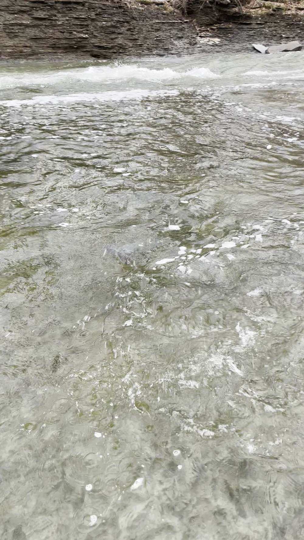
The Black River is the North Country's salmon river: DEC's Jefferson County page names it (with North and South Sandy creeks) as receiving the largest runs of Chinook salmon in the North Country, and its PFR map's Salmon Run Section carries Chinook and coho from September to November, steelhead from October to April, and brown trout year-round. The river is a staircase — Mill Street Dam in Watertown is the historic barrier, and fish ladders at Glen Park and Dexter, built in the 1980s, pass salmon and steelhead up roughly eight additional miles to Water Street in Watertown. The water is big and falling today (3,860 cfs at Watertown, down from 4,870) — this river fishes from boats and banks as much as from waders. Read the Watertown gauge, fish the PFR water, and respect a river that is genuinely dangerous at fall flows.
02 — Section
2. How to use this guide
1. Check the Watertown gauge snapshot in §3 — at this size, the flow is a safety decision before it is a fishing
decision. 2. Read §4: no published band governs this river, and this guide prints none. 3. Plan access from §6: the PFR Salmon Run Section, the Dexter water, and the ladder reaches. 4. Fish it with §7 — boat and bank tactics dominate here — and read §9 before you get anywhere near the
water.
03 — The Water★ Intel
3. Live gauges — verified snapshot, Wed Nov 11, 2026
Gauge: USGS 04260500, Black River at Watertown, NY. Pulled live Nov 11, 2026, ~2:42 PM EST (USGS NWIS Instantaneous Values API). All values provisional. The station returned no water-temperature values today — none is printed. Item
Value
---
---
Reading
3,860 cfs at 1:30 PM EST, Nov 11, 2026 (gage height 4.53 ft)
Water temp
Not reported in today's pull — none printed
Past-day range
3,620–4,870 cfs — big water, falling from the day's high
Item
Value
Clarity on the day
Stained — estimate; a falling hydrograph this size carries color, and no visual report was available
Call on the day
FAIR — 3,860 cfs and falling is workable big-river water for the bank and boat fishery; it is not wading water in the main channel, and it will fish better as it drops
Weather at the river (Watertown, NY, weather.com, Nov 11, 2026): cloudy, 51°F, wind WSW 2 mph, pressure falling; high 51°F, low 36°F; showers tonight, and Thu Nov 12 brings rain turning to snow (~0.37 in rain, ~0.40 in snow) — the North Country's first real winter signal, on a river whose steelhead season runs to April. Sunrise 6:53 AM EST, sunset 4:41 PM EST.
Regional context: the Black is the outlier of the day — every other river in the set ran steady or low on Nov 11 (Salmon River 272 cfs, Oswego 3,150 cfs and rising on canal water, the creeks flat). The Black's fall from 4,870 to 3,860 cfs is a natural river coming down off a rise, and its run fishes best on exactly that shape over the coming days. Gauge history: the Watertown gauge sits in the middle of the Salmon Run Section's upper end — what it reads is what the Dexter and Glen Park ladder reaches are running. A past-day range of 3,620–4,870 cfs with gage height 4.41–5.01 ft is a river at several times the Salmon River's flow: scale your tackle, your boat, and your caution accordingly. Sources for this snapshot: USGS NWIS Instantaneous Values API, site 04260500, queried Nov 11, 2026 ~2:42 PM EST; weather.com, Watertown NY, Nov 11, 2026.
3A. Recent pushes / fresh runs
- No dated, day-specific run report for the Black River was available for Nov 11, 2026. The dated signal is the gauge itself (§3): a river falling from 4,870 to 3,860 cfs is the classic post-rise setup DEC's own run calendar points to — Chinook and coho in the river through November, steelhead building behind them from October onward (DEC PFR map, Salmon Run Section).
- DEC run calendar (Salmon Run Section, PFR map): Chinook and coho salmon September to
November; steelhead October to April; brown trout year-round, with a fall spawning run from the lake.
04 — The Water
4. Flow bands — go / wait / stay home
No published flow band was found for the Black River at Watertown — not from DEC, and not from the published shop/guide flow guides this series checks. Re-checked in the verification pass against DEC's Black River pages, the WNY Fly Fishing flow guide, Snoflo's gauge page for USGS 04260500 (forecast/percentile data and NWS flood stages only — flood stages are not a fishing band), and published Black River fishing guides — still none for this gauge and this reach. (Ratings found for the upper Black River near Boonville and for Ohio's Black River are different reaches and a different river; they do not transfer here.) So this guide prints none. The working read from §3 stands on its own: big, falling water — bank and boat water now, better as it drops. A band will only be added when a credible published source prints one.
05 — Section
5. The run, the fish, and the rules
The fishery (per NYSDEC's Black River PFR map and Jefferson County page): the river drains approximately 1,920 square miles. The section from the Mill Street Dam in Watertown downstream to Lake Ontario supports runs of Chinook and coho salmon (Sept.–Nov.), steelhead (Oct.–April), and brown trout (year-round); browns have a fall spawning run from the lake and are also stocked during the spring. Fish ladders at Dexter and Glen Park open another eight miles of the river to salmon, steelhead, and browns (DEC Jefferson County page) — fish now pass to Water Street in Watertown, above the historic Great Falls barrier at Mill Street. Near the VanDuzee Bridge, large brown trout are stocked annually (DEC).
Rules: seasonal regulations for Great Lakes tributaries apply from September 1 through March 31 on the Salmon Run Section (DEC PFR map). Verify the current rules — seasons, size and creel limits, and tributary tackle/hours provisions — in the current NYSDEC Freshwater Fishing Regulations Guide before you fish. The DEC guide is the law; this summary is not.
Stocking quantities (per DEC's published stocking lists): the PFR map quantifies the runs by season, not by numbers stocked, but DEC's stocking lists do give numbers. Per DEC's 2025 statewide fish stocking list (the 2025 New York Fish Stocking List, fish distribution January 1–December 31, 2025; the most recent actual-year list on DEC's Fish Stocking page), Region 6, Jefferson County: Black River (Hounsfield) — 25,000 Chinook (3.0 in) and 89,881 Chinook (3.5 in), and 32,500 steelhead (5.0 in); Black River (Watertown) — 3,860 brown trout (9.5 in) and 410 brown trout (14.0 in). Per DEC's Spring 2026 Trout Stocking list for Jefferson County (anticipated yearling and older trout for spring 2026): Black River (Watertown) — 3,900 brown trout (9–10 in) and 450 brown trout (12–15 in), May, first week. The spring list covers yearling and older trout only, so it lists no Chinook or steelhead fingerlings — use the 2025 actual list for those.
06 — Access
6. Access, pool by pool — area-level only
Area-level only, from official sources:
- DEC Public Fishing Rights — the Salmon Run Section. DEC's PFR map for the Black River covers the salmon run water from the Mill Street Dam in Watertown downstream to Lake Ontario: permanent easements, usually a 33-foot strip on one or both banks, fishing only, with DEC angler parking mapped on the sheet. Fish the signed PFR segments.
- Dexter — good access at Dexter, with a boat ramp upstream of the dam providing upstream travel to
Brownville (DEC, Fishing and Canoeing the Black River). The ladder at Dexter passes fish upriver; the water below the dam fishes through the season.
- Glen Park — the second ladder reach between Dexter and Watertown; DEC's canoeing/fishing page treats the Watertown-at-Mill-Street-to-Dexter reach (7.4 miles) as the salmon/steelhead water, noting steelhead fishing popular near the VanDuzee Bridge, where large browns are stocked annually.
- Dexter to Lake Ontario (1.5 miles) — the lowest reach: access downstream of Route 12E with a boat ramp (DEC); the mouth water at Black River Bay.
- Everything else is private or restricted. Hydro facilities, dam works, and ladder structures are not fishing platforms — fish the PFR, the ramps, and the public areas, and stay off the works.
DEC Region 6 Fisheries office (Watertown): (315) 785-2263 (per DEC's current statewide offices listing, which lists Region 6 Fisheries at Watertown as (315) 785-2263, and DEC's Region 6 Fisheries page, 317 Washington St, Watertown, NY 13601). The number printed on DEC's PFR sheet for this river appears to belong to a different region, so that sheet number is not used here.
07 — Tactics
7. Flies, tactics, and seasonal playbook
Tackle Big-river gear: 9–10 ft 8-weight fly rod, float rod, or medium-heavy spinning gear from the bank; drift boats are a real part of this fishery (DEC's Jefferson County page names drift fishing from a boat or casting from shore as the popular steelhead methods). At fall flows near 3,860 cfs, the bank and the boat are the games — the main channel is not wading water.
Flies and baits Per DEC's Jefferson County guidance: steelhead on egg sacs drifted along the bottom (a small piece of foam or marshmallow in the sac to lift it slightly), plus spinners, flies, wobbling plugs, and sponge balls. Salmon on the same drift gear in the fall; browns on egg patterns and streamers.
How to fish it Fish the falling river: as the gauge drops from a rise, fish settle into the runs below the dams and ladders and feed. Work the seams below Dexter and Glen Park, the VanDuzee Bridge water for browns, and the lower river toward the mouth as flows allow. From a boat, drift the deeper runs; from the bank, fish the soft water inside the main current — at this size, the fishable water is the edge, not the middle.
Seasonal playbook
| Fall (Sep–Nov) | Chinook and coho — among the largest runs in the North Country (DEC); browns on their fall spawning run; steelhead arriving from October. |
| Winter (Dec–Feb) | steelhead in the deeper runs; a big river in the North Country winter — ice and shelf ice end days early. |
| Spring (Mar–Apr) | steelhead to April per DEC's calendar; spring brown stocking; drop-backs to the lake. |
| Summer | the warmwater river — smallmouth, walleye, northern pike — and the whitewater reaches above the fishery are a paddling game, not this guide's. |
08 — Section
8. Techniques in depth — fishing the Black River
The primary rig: a weighted bottom drift, from boat or bank This is not float water in the small-creek sense. On a river that was running 3,860 cfs and falling at the build, with no published band to lean on (§4), the primary method is the one DEC names for this water: egg sacs drifted along the bottom, from a drift boat or a high bank. Rig heavy and simple. Run enough weight that the rig ticks bottom every couple of seconds as it swings through a seam, and rig the weight on a short dropper — a fuse — so a hang-up in the ledges below the dams costs you the dropper, not the whole rig. In the boat, move a touch slower than the current so the sacs track straight down the seam; from the bank, cast up and across, mend once, and let the drift finish in the soft inside water. Depth discipline here means bottom contact: if you are not ticking, you are over the fish; if you hang up every cast, you are fishing the rocks instead.
Bait selection by clarity The Black's fall pattern is color on a falling hydrograph — §3 called the day stained, on a river dropping from 4,870 cfs. In that stained, falling water, fish a dime-size egg sac with a small piece of foam or a floater built in, exactly as DEC describes, so the sac lifts just off bottom and shows in the color; chartreuse and orange netting earns its keep here. As the river keeps dropping and clears, shrink the sac, go to natural mesh, and rotate in a pegged soft bead set an inch or two above the hook — wary steelhead in clearing water inspect a bead drifted at head height and refuse a big glowing sac. Browns in the VanDuzee Bridge water take the same drift.
Forage notes — Black River in mid-November The Black is a staircase river — fish ladders at Glen Park and Dexter pass salmon and steelhead roughly eight miles above the historic barrier at Mill Street Dam in Watertown — and on the build day it was big and falling, 3,860 cfs at Watertown, down from 4,870. Its Chinook and coho run runs September to November, so the egg pulse is spending itself right now; by mid-November egg presentations still lead for the steelhead that run October to April and the year-round browns, including the large browns stocked near the VanDuzee Bridge.
Shiners and lake forage hold deep in Black River Bay off the mouth, not in the gorge current; crayfish are tucked into the limestone and inactive.
Lead — eggs
egg sacs, beads (6–10 mm) and single eggs, sized to clarity — a dime-size sac with a floater built in, in chartreuse or orange netting, in stained falling water; shrunk, in natural mesh, with a pegged bead rotated in as the river drops and clears (§8).
Secondary — sculpins and stoneflies
sculpin patterns and stonefly nymphs along the ledges and in the ladder-pool seams — second to eggs.
Mouth and bay only — shiners
at the mouth and in the bay's lower-reach water, a live shiner on a bobber is a standing go-to where legal.
Where they hold, by level At low water for this river — the bottom of its fall range, well down from a rise — fish sit deep: the runs below the Dexter and Glen Park ladders, the slots under the dam water, and the bridge water where the big browns are stocked. On the prime shape, a falling river like the build day, they spread into the seams below both ladders and feed actively as the current eases; that falling edge is the best fishing this river offers. At high water, up toward and past that 4,870 cfs mark, forget the middle entirely: fish hold tight to the inside edges, in the soft water behind every bank feature, and down in the lower river toward Black River Bay, where the current finally spreads and slows.
The secondary method Casting spinners and wobbling plugs from the bank beats the drift when the water is at its most colored, early in a fall, and the salmon and browns are aggressive rather than feeding — a plug worked slowly across a seam below Dexter draws a reaction a drifted sac does not, and it covers the wide edge water where a bank angler's drift is too short to be effective.
Seasonal adjustment Winter is this river's honest test. From December on, go small, slow, and deep: smaller sacs and beads, longer, slower drifts through the deepest runs below the ladders, and the middle hours of the day — and accept that shelf ice on a North Country river this size ends days early.
09 — Section
9. Safety
The Black River is whitewater country with dams and hydro works through the fishing reach: at 3,860 cfs the main channel is not wadeable, full stop. Fish the banks and boats, stay off dam and ladder structures, and treat shelf ice and the river's ledges with respect in the cold months. Releases and generation can change the water without local rain. If the gauge is rising, the day is over — this river at 4,870 cfs is a different and more dangerous river than the one at 3,000.
10 — Section
10. What is inside the living edition
Same promise as every Keystoned Steel guide:
- Live USGS gauge at Watertown (04260500) — real readings, stamped with the time the gauge took them; where the gauge is not reporting a parameter, the guide says so plainly instead of faking a number.
- Live weather & radar built right into the guide.
- Verified access where it exists — and where access is unverified or permission-only, the guide says so plainly instead of faking a parking lot.
- Flow windows — the exact bands that say go, wait, or stay home where a published band exists; where none exists, the guide says so plainly instead of inventing one.
- Buy once — updates to the guides you bought are free. A living edition that stays current all season.
Sources (Nov 11, 2026 build)
- USGS NWIS Instantaneous Values API (waterservices.usgs.gov), site 04260500 (Black River at
Watertown, NY), queried live Nov 11, 2026 ~2:42 PM EST: latest discharge 3,860 cfs at 1:30 PM EST Nov 11, 2026 (provisional), gage height 4.53 ft; no water-temperature values returned in today's pull; past-day range 3,620–4,870 cfs.
- NYSDEC, Public Fishing Rights Maps: Black River — Salmon Run Section (DEC PFR map, fr.dec.ny.gov): the Black River drains approximately 1,920 sq mi; the section from the Mill Street Dam in Watertown downstream to Lake Ontario supports runs of Chinook and coho salmon (Sept.–Nov.), steelhead (Oct.–April), and brown trout (year-round, with a fall spawning run; browns also stocked in spring); seasonal Great Lakes tributary regulations apply Sept. 1–Mar. 31; PFR = permanent easements, usually a 33-ft strip on one or both banks, fishing only. (The sheet's printed regional phone appears to belong to a different region — see §6.)
- NYSDEC, Lake Ontario Tributary Fishing in Jefferson County (dec.ny.gov): North and South Sandy creeks and the Black River receive the largest runs of Chinook salmon in the North Country; fish ladders at Dexter and Glen Park open another eight miles of the Black River to salmon, steelhead, and brown trout; steelhead November–April; drift fishing from boat or casting from shore with egg sacs is the most popular method;
DEC PFR maps listed for the Black River (Salmon Run Section).
- NYSDEC, Fishing and Canoeing the Black River (dec.ny.gov): Great Falls at Mill Street is the historic barrier; fish ladders built in the 1980s at Dexter and Glen Park let steelhead and Chinook pass as far as Water Street in Watertown; Watertown at Mill Street to Dexter reach 7.4 mi (salmon, smallmouth, walleye, northern pike, rainbow/steelhead, yellow perch, bullhead) with good access at Dexter and a boat ramp upstream of the dam; steelhead fishing popular near VanDuzee Bridge where large brown trout are stocked annually; Dexter to Lake Ontario 1.5 mi with access downstream of Route 12E and a boat ramp; Bureau of Fisheries, Region 6.
- WNY Fly Fishing, Stream Report 11/2/2026 and Flow Rate Guide (wnyflyfishing.blogspot.com): no published band for the Black River (absence noted in §4).
- NYSDEC, 2025 New York Fish Stocking List (dec.ny.gov, Fish Stocking page, actual stocking lists updated June 23, 2026; fish distribution January 1–December 31, 2025), Region 6, Jefferson County: Black River (Hounsfield) 25,000 Chinook at 3.0 in, 89,881 Chinook at 3.5 in, 32,500 steelhead at 5.0 in; Black River (Watertown) brown trout 3,860 at 9.5 in, 410 at 14.0 in.
- NYSDEC, Spring Trout Stocking (2026), Spring 2026 Trout Stocking for Jefferson County (dec.ny.gov):
Black River (Watertown) anticipated brown trout 3,900 at 9–10 in and 450 at 12–15 in, May, first week.
NYSDEC, DEC Statewide Offices
Contact Information By Location (dec.ny.gov/about/contact-us/statewide-office-information): Region 6 headquarters 317 Washington St., Watertown, NY 13601-3787; Region 6 Fisheries (315) 785-2263, Watertown. Also NYSDEC, Region 6 Fisheries Management and Research page (dec.ny.gov): Bureau of Fisheries, Region 6, 317 Washington St, Watertown, NY 13601, Phone: 315-785-2263.
Weather
weather.com, Watertown NY, Nov 11, 2026 (51°F, cloudy, wind WSW 2 mph, pressure falling; high 51°F, low 36°F; showers tonight, Thu Nov 12 rain to snow ~0.37 in rain / ~0.40 in snow; sunrise 6:53 AM, sunset 4:41 PM EST).
Lore, Legends & History You can see this river's name the first time you look down into it: the water runs the colour of strong tea — amber in the shallows, near black in the deep holes. The honest answer on the name, and the one the references give, is that the origin is not certain, but it may come from the natural tannic acid leaching out of the Adirondack forests and swamps the river drains, darkening the water in places. The river rises at North Lake in the Adirondack foothills, gathers the Moose River at Lyons Falls, and runs about a hundred and twenty-five miles northwest to its bay at Dexter. It earns the colour honestly, all the way down.
Men came to this river early for the oldest of reasons: things floated down it, and power fell out of it. French traders and Native travellers had used these north-country waters — the Black, and the Oswegatchie beyond it — as working routes between Lake Ontario, the St. Lawrence, and the Iroquois country long before there was a town on the banks. In March 1756, in the depths of the French and Indian War, a French and Indigenous force under de Léry marched overland from La Présentation on the St. Lawrence through deep snow, fording or crossing on ice the Oswegatchie, the Black, and the Mohawk on their way to strike the English supply line at Fort Bull — fifteen days, two of them wholly without food, by the Oneida County histories. Armies do not suffer like that for a river that does not matter as a road.
The town that defines the river arrived in 1800, when New England pioneers — Hart Massey, Henry Coffeen, and Zachariah Butterfield among them — settled Watertown with their eyes open. They chose the site as an industrial bet: the Black River falls about forty feet in the centre of town and some hundred and twenty feet within two and a half miles, and they meant to spend that fall on mill wheels. Water power was first used in 1802, a dam and a small gristmill were turning by 1803 at Cowan's, and the first paper mill on the river started in 1808 — Gurdon Caswell's Pioneer Mill, on the south bank opposite Beebee's Island, putting out perhaps a hundred and fifty pounds of paper a day with a crew you could fit in a kitchen. From that seed the valley grew into one of the great paper-making districts of the country. Knowlton's mill, which traces straight back to that 1808 start, still runs at Watertown and is counted the oldest continuously operating paper mill in the nation.
There is a fitting detail in its records: by 1874 the Black River's water had grown too dark and dirty for fine white papers, so Knowlton turned to making coloured cover papers — the river's own colour, turned into the product. The same mill history preserves the Oneida name for this river: Kamargo.
The falls kept drawing industry — cotton and woollen mills at Factory Village from 1813, carriage works, sewing machines, steam engines — and the city that power built gave the wider world an unlikely gift: Frank W. Woolworth, working in a Watertown store, conceived the idea of the five-and-dime there in 1878.
Today the river below Watertown runs through a limestone canyon famous for the opposite of industry — hard whitewater, among the most storied rafting and kayaking water in the East. But the colour has not changed, and neither has the reason people first stopped here: a dark Adirondack river, falling fast toward the lake, with power in every mile.
Night fishing — working the holes after dark First, the law on this water. New York's Great Lakes tributary rules close this water to night fishing in season: in the Sep 1–Mar 31 window the tributary reach — from the bridge closest to the mouth up to the first barrier impassable by fish — is open only from 1/2 hour before sunrise to 1/2 hour after sunset. In that window, be off the tributary water by sunset; the tactics below are for the water and the hours where night fishing is open — the lake shore, pier and open mouth water this guide identifies, and the river outside the seasonal window where no other rule closes it. After dark, the run changes address on Black River, NY. Steelhead that travelled and held in the fast water by day settle into the deep holes — the slow, dark water at the head of the pool, along the ledge and the undercut bank, and the soft seam beside the fast tongue — and they feed there with a confidence they never show at noon. The deep holes are the night fishery: fewer fish moving, more fish eating.
Working a hole in the dark is a memory exercise before it is a fishing exercise. Fish the hole in daylight first: learn where it deepens, where the wood and the ledges sit, where you will stand, and where a hooked fish can be landed. At night, work it top to bottom in short steps — a cast or two across the head, down the seam, into the tail — slow, deep and close to the bottom, with long pauses; a steelhead at night does not chase, it intercepts.
Two profiles speak at night: glow — a glow bead, glow egg or chartreuse presentation where a little light helps the fish find it — and dark — a black or black-olive streamer or nymph silhouetted against the night sky. The dark profile works because it reads to a night-feeding fish as a bottom forage fish on the move — big, slow, and tight to the substrate. Light discipline is not optional: a headlamp shone into a hole ends the fishing in it — keep the light on the bank and on your feet, red or dim when you have it, and rest a lit-up hole before fishing it again.
Sound carries the same way. Safety doubles after dark: never wade at night water you have not waded by day, belt cinched and staff in hand, tell someone the reach and the return time — a fall in cold water at night is a survival event, not a soaking. Tonight's night pick — kept live with this guide's bait rotation. The rotation updates the night pick for this water on the same cycle as the day picks, off the forage calendar and the current clarity and flow.
Current-season default: where night fishing is open: a glow spawn sac or glow bead under a float at the head of the hole; dark second, a black streamer swung slow. Off the piers and open shore, glow spoons and stickbaits are the night hardware.
The Bottom Line
The Black River is the North Country's salmon river: DEC's Jefferson County page names it (with North and South Sandy creeks) as receiving the largest runs of Chinook salmon in the North Country, and its PFR map's Salmon Run Section carries Chinook and coho…
Legal · Read last
LEGAL DISCLOSURE — Keystoned Steel Guides
What Keystoned Steel warrants. Keystoned Steel warrants only that, as of the edition date stated in this guide, the access, gauge, and regulation information in this guide that is attributed to a cited official source accurately reflects that source as published on that date. If a material error in that information is confirmed, Keystoned Steel will issue a corrected edition to the original buyer at no charge or, if it does not do so within 30 days after confirming the error, refund the price you paid. That is the sole express warranty provided with this guide.
This guide does not warrant or guarantee:
- (a) Stream conditions, water levels, clarity, or weather — conditions change daily and can change after any
reading printed here;
- (b) Fishing success — no representation is made that fish are present, in any number, size, or location, at any
time;
- (c) Access — access status, parking, and Public Fishing Rights can change, be posted, or be withdrawn at any
time; inclusion of a reach in this guide is not permission to fish it, and is not a representation that access is currently open;
- (d) Third-party data — Gauge readings, including USGS data, agency publications, and maps, originate from
third-party sources. Keystoned Steel does not control those sources and cannot guarantee their accuracy, completeness, availability, or continued accessibility. Third-party information may be provisional, delayed, revised, or incorrect. Its inclusion does not constitute an independent guarantee by Keystoned Steel of the underlying data;
- (e) Regulations — seasons, creel and size limits, and special-reach rules change; the regulations summarized
here are a convenience summary only and are not the law.
Your responsibilities. Before you fish: confirm the current regulations in the current NYSDEC Freshwater Fishing Regulations Guide; hold the required license; verify access is open and lawful for the reach you fish; respect posted signs and private land — a fishing license is not a permit to trespass. Wading and stream fishing involve inherent risks, including fast or rising water, slippery rock, and remote terrain; you fish at your own risk and are responsible for your own safety decisions. This safety warning and assumption of risk do not waive or limit any liability, warranty, or remedy that cannot lawfully be waived or limited under applicable law.
Corrections and refunds. If you believe this guide contains a material error, email keystonedsteel@gmail.com or message our Facebook Page with the guide name and the error. Keystoned Steel will review it against the cited sources within 30 days. If the error is confirmed, you will receive a corrected edition or, at Keystoned Steel's election, a refund of the price you paid. That remedy is your sole and exclusive remedy for errors in this guide. Limitation of liability. TO THE FULLEST EXTENT PERMITTED BY APPLICABLE LAW, KEYSTONED STEEL'S TOTAL LIABILITY ARISING OUT OF THIS GUIDE WILL NOT EXCEED THE PRICE YOU PAID FOR IT, AND KEYSTONED STEEL WILL NOT BE LIABLE FOR INDIRECT, INCIDENTAL, OR CONSEQUENTIAL DAMAGES, INCLUDING TRIP COSTS, CITATIONS OR FINES, OR PERSONAL INJURY ARISING FROM YOUR USE OF THIS GUIDE. NOTHING HERE LIMITS LIABILITY FOR GROSS NEGLIGENCE OR WILLFUL MISCONDUCT. License. This guide is licensed to the original buyer for personal use only. It is nontransferable and may not be shared, resold, or redistributed without the prior written consent of Keystoned Steel. Living-edition updates are delivered only to the original buyer's purchase email.
TO THE FULLEST EXTENT PERMITTED BY APPLICABLE LAW, THE WARRANTY SET FORTH ABOVE IS THE SOLE EXPRESS WARRANTY PROVIDED BY KEYSTONED STEEL FOR THIS GUIDE, AND KEYSTONED STEEL DISCLAIMS ALL OTHER WARRANTIES, EXPRESS OR IMPLIED, INCLUDING ANY IMPLIED WARRANTY OF MERCHANTABILITY AND ANY IMPLIED WARRANTY OF FITNESS FOR A PARTICULAR PURPOSE. NOTHING IN THIS DISCLOSURE SHALL EXCLUDE OR LIMIT ANY WARRANTY, RIGHT, OR REMEDY THAT CANNOT LAWFULLY BE EXCLUDED OR LIMITED UNDER APPLICABLE LAW.